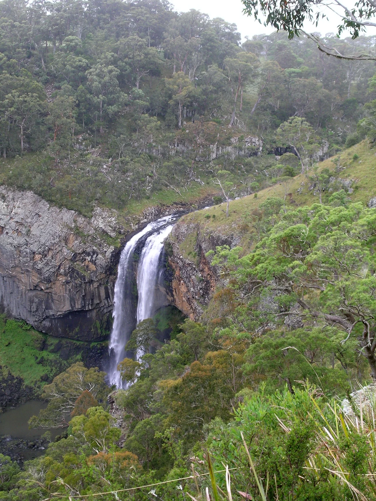

Ebor Falls
The Gumbaynggirr people called this place Martiam, which means simply "the great falls," and standing on the lookout you understand the economy of the name. There is nothing to add. The Guy Fawkes River, gliding quietly across the top of the New England plateau, reaches the edge of the world and falls away from it, dropping over a staircase of columned black rock into a gorge so deep and forested that the bottom seems to belong to a different country. This is the centrepiece of the road they named Waterfall Way, and it earns the billing.
A River Meets the Edge
The drama unfolds in two acts. At the upper falls, the river plunges 115 metres over four distinct layers of columnar basalt, splitting into twin cascades that braid and recombine on the way down. The columns themselves are the giveaway to what happened here: when thick lava cools slowly, it cracks into neat hexagonal pillars, the same geometry that built Ireland's Giant's Causeway. A short walk downstream, the lower falls take a second leap, this time over much older Permian sedimentary rock, before the water vanishes into the steep green throat of the gorge. From the platforms the eye struggles to find the river again once it reaches the shadows below.
The Fire That Made It
Long before the river found this line, there was a volcano. The Ebor Volcano erupted around 19 million years ago, and its lava flows spread across the landscape in sheets, layer upon layer, cooling into the basalt that now forms the lip of the falls. The river has spent the intervening eons sawing back through those flows, exposing their edges like the pages of a closed book. What looks like permanence, a wall of ancient stone, is really a record of slow violence and even slower erosion. Every metre of the drop is a measure of geological time, the river patiently undoing what fire built.
Waterfall Way's Showpiece
Ebor Falls is the kind of place that anchors a whole tourist route. Within Guy Fawkes River National Park, sealed paths lead from the car park to a sequence of lookouts, with picnic tables, barbecues and an information display tucked among the snow gums. By 2008 the falls were drawing as many as 80,000 visitors a year, and they have been protected since 1895, when the surrounding land was set aside as a recreation reserve. Fire is a recurring character in the story: the lookout platforms were destroyed in a 2007 bushfire, then rebuilt and reopened in September 2008. You cannot camp at the falls, but Cathedral Rock National Park nearby keeps a fire ready for those who want to stay the night on the high country.
High Country Weather
At over 1,300 metres, this is genuinely cool tableland, not the subtropical coast that waits an hour's drive east. Mist settles into the gorge on winter mornings and burns off slowly. The river's volume swings with the season, modest and clear in dry months, thunderous and tea-coloured after rain, when the twin upper cascades merge into a single roaring sheet. The light is best in the late afternoon, when the sun angles into the gorge and warms the black basalt to the colour of bronze. Below, the forest goes about its business, indifferent to the crowds at the rail above.
From the Air
Ebor Falls sits at 30.40 degrees south, 152.34 degrees east, on the eastern edge of the New England tablelands at roughly 1,300 m elevation. The two-tiered cascade and the dark gash of the Guy Fawkes River gorge are visible against the open pasture of the plateau in clear weather. Nearest controlled airport is Armidale (YARM) about 80 km to the west; Coffs Harbour (YCFS / CFS) lies roughly 75 km east on the coast, and Port Macquarie (YPMQ / PQQ) further south. Expect rapid cloud build-up and orographic mist over the escarpment edge, especially on summer afternoons; visibility into the gorge is best mid to late afternoon with low westering sun.
Nearby Stories
- Guy Fawkes River National Park 10 km away
- Coffs Harbour 18 km away
- Guyra, New South Wales 24 km away
- South West Rocks Pilot Station Complex 35 km away
- McCrossin's Mill 36 km away
- Glen Innes, New South Wales 37 km away
- Grafton Bridge (New South Wales) 40 km away
- Trial Bay Gaol 72 km away