![Photo: Marco Schmidt[1] | CC BY-SA 3.0](https://commons.wikimedia.org/wiki/File:Loxodonta_africana_MS_10093s.jpg)
Bwabwata National Park
Most national parks draw a hard line: people on one side of the fence, wild animals on the other. Bwabwata erases the line. Some 5,500 people live inside this park, in villages strung along a tarred highway, growing crops and grazing cattle in the same bush where elephant herds pass through on their way between four countries. Stretched thin along Namibia's Caprivi Strip - barely 40 kilometres top to bottom but 190 across - Bwabwata is less a fortress for wildlife than a negotiated truce between the people who farm here and the animals who have always migrated through.
A Finger of Land Between Two Rivers
Look at a map of Namibia and the Caprivi Strip leaps out: a long, thin panhandle reaching east toward the Zambezi, a colonial-era oddity that left Namibia bordering four neighbours at once. Bwabwata fills much of it. The Okavango River marks the western edge, the Kwando the eastern, with Angola to the north and Botswana to the south. The Trans-Caprivi Highway runs straight through the middle, carrying trucks between Rundu and Katima Mulilo on their way to Zambia and Zimbabwe. Established in 2007 from the old Caprivi and Mahango game reserves, the park covers 6,274 square kilometres of woodland savanna, low vegetated dunes, and the seasonal drainage lines that locals call omiramba.
The Elephant Road
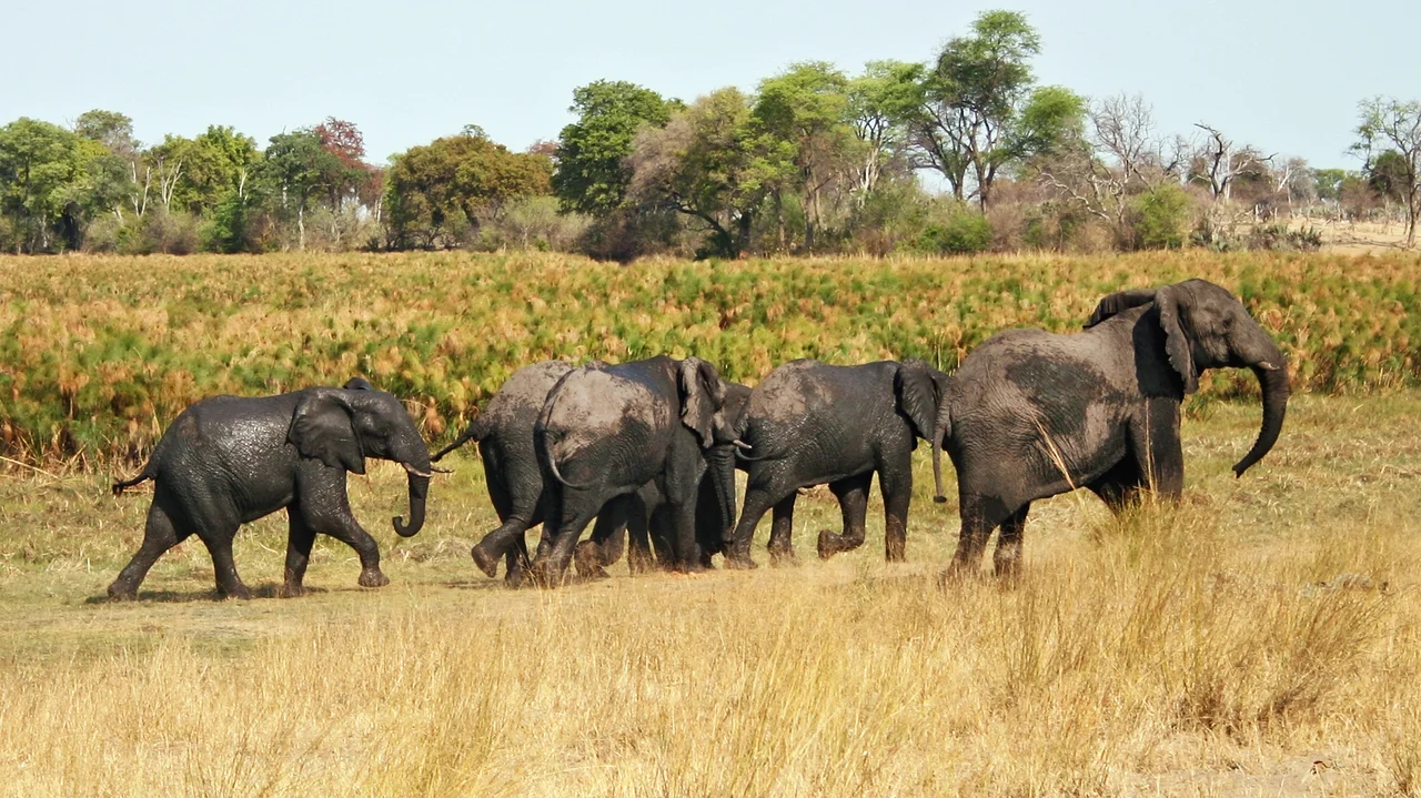
Bwabwata's real importance is as a corridor. It sits at the heart of the Kavango-Zambezi Transfrontier Conservation Area, a vast cross-border park shared by Namibia, Angola, Botswana, Zambia, and Zimbabwe - one of the largest conservation zones on the planet. Through this gap, African elephants move between Botswana's crowded Okavango and the recovering wilds of Angola, following routes their ancestors walked long before any of these borders existed. They are not alone. Cape buffalo, hippo, sable and roan antelope, red lechwe, sitatunga, and Nile crocodile share the rivers and floodplains, hunted by lion, leopard, cheetah, and spotted hyena. The Mahango wetlands in the west are a birding hotspot, home to wattled cranes, slaty egrets, African skimmers, and the booming call of the southern ground hornbill.
A Park Its People Help Run
Most of Bwabwata's residents are Khwe San, one of southern Africa's most marginalized communities, whose ancestors lived in this country for millennia before the parks and highways arrived. Rather than evict them, Namibia chose a different model. The land is zoned - core areas at Kwando, Buffalo, and Mahango are protected for wildlife and tourism, while a large Multiple Use Area is set aside for settlement, farming, and community enterprise. Residents formed the Kyaramacan Association to represent themselves and to earn income from tourism, regulated hunting, and the harvest of devil's claw, a wild tuber sold internationally as a remedy for pain and fever. Local game guards patrol against poaching alongside government staff. It is an imperfect, evolving arrangement - but it treats the people of the park as partners rather than obstacles.
Fire, Bush, and Balance
The land here is restless. Fire sweeps through almost every year, sparked by lightning or by people, and while these savannas evolved to burn, the timing and frequency matter enormously - too much fire or too little can both push the ecosystem out of balance. Long-term studies between 1996 and 2019 documented a creeping problem of woody encroachment, thickets crowding out the open grassland that grazing animals need. Managers experiment with controlled burns, with mixed success. The woodland itself is worth knowing: Zambezi teak, false mopane, the nut-bearing manketti, towering camelthorn, and the fan-leaved makalani palm all grow here, shaping the texture of the bush. For the visitor, all of this stays in the background. What you see are three community-run campsites near the rivers - Nǁgoabaca, Nambwa, and Bum Hill - sandy tracks that demand four-wheel drive, and the chance, at dusk by the Kwando, to watch elephants come down to drink against a sky going copper and rose.
From the Air
Bwabwata spans the Caprivi Strip in northeastern Namibia, centered near 17.92°S, 22.50°E. From the air it reads as a green ribbon between two rivers - the Okavango bending in from the northwest, the Kwando along the east - with the thin grey line of the Trans-Caprivi Highway (B8) bisecting it. Angola lies just north, Botswana just south. The nearest airfields are Rundu Airport (ICAO FYRU) at the western end near Divundu, and Katima Mulilo / Mpacha to the east near Kongola. Best viewing is the dry season (May-October), when game concentrates along the shrinking rivers; the wet season brings dramatic storms and flooded floodplains. Watch for elephants and large herds near the watercourses.
Nearby Stories
- LAM Mozambique Airlines Flight 470 49 km away
- Tsodilo 74 km away
- Okavango Delta 144 km away
- Chobe National Park 187 km away
- Mavinga National Park 227 km away
- Tsumkwe 238 km away
- Barotse Floodplain 283 km away
- Liuwa Plain National Park 324 km away