.jpg)
Cadiz Dunes Wilderness
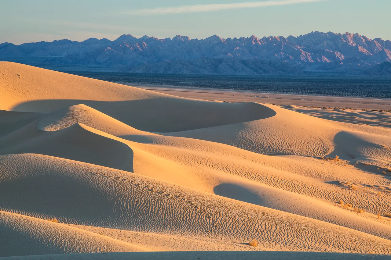
The Cadiz Dunes exist because a dry lake keeps losing its surface. The Cadiz dry lake — playa — sits in the Cadiz Valley between the Calumet Mountains and the Old Woman Mountains, and the prevailing winds pick up the fine sediment from its surface and carry it northeast, where it accumulates into dunes. The process has been running long enough to produce dunes worth protecting.
A Wilderness Established
Congress established the Cadiz Dunes Wilderness in 1994, designating the area for management by the Bureau of Land Management under wilderness protection. The designation removed the area from consideration for development or mechanized use, preserving the dune system and the surrounding Mojave Desert terrain in something close to its undisturbed condition.
In 2016, the Cadiz Dunes Wilderness was incorporated into the Mojave Trails National Monument, which President Obama established by proclamation. The monument designation added another layer of protection to a region that encompasses several wilderness areas across the desert corridor between Joshua Tree National Park and the Colorado River. The BLM continues to administer the wilderness as part of this broader protected landscape.
How the Dunes Form
The Cadiz Valley occupies a closed basin between mountain ranges — a typical Mojave geography where drainage has no outlet to the sea. Water that flows into the valley from surrounding slopes eventually evaporates or sinks into the alluvium, leaving behind the mineral residues that form playas. The Cadiz dry lake is one of these features: a flat, reflective, nearly lifeless surface that was once much larger during Pleistocene wet periods and has been shrinking since.
The sand and fine sediment that make up the playa surface are mobile. Wind picks them up and transports them until terrain or vegetation slows the air enough to drop the load. The dunes that have built up in the Cadiz Dunes Wilderness are the result of this transport — a sand body shaped by the consistent prevailing winds, growing and migrating at the pace that desert wind systems allow.
What Grows on Sand
The Borrego milkvetch — a flowering plant in the pea family — establishes on the dune margins and in the sandy flats associated with the dune system. The plant's blooms appear in spring, when adequate winter rainfall has primed the desert. Wildflower years in the Mojave depend on the timing and quantity of winter precipitation; in good years, the dune margins and surrounding flats support displays that draw visitors from the highway and beyond.
The surrounding wilderness terrain holds the characteristic Mojave Desert community — creosote bush, desert holly, brittlebush, and scattered cacti at the lower elevations. The dunes themselves support different plants: species adapted to the instability of wind-shifted sand, capable of establishing and re-establishing as the surface moves. The wilderness designation protects this system from the kinds of disturbance — off-road vehicles, mining, development — that have altered similar dune systems elsewhere in the Mojave.
From the Air
The Cadiz Dunes Wilderness lies in the Cadiz Valley of San Bernardino County, centered approximately 34.15°N, 115.55°W, north of the historic Route 66 corridor. The dune system is identifiable from altitude as a lighter-colored sand feature against the desert floor, between the Calumet Mountains to the west and the Old Woman Mountains to the east. The Mojave Trails National Monument surrounds the area. Nearest airports: Twentynine Palms (TNP) ~30 miles west, Needles Airport (EED) ~70 miles east.
Nearby Stories
- Trilobite Wilderness 5.8 km away
- Desert Queen Mine 10 km away
- Ragtown, California 13 km away
- Condor Field 15 km away
- Coxcomb Mountains 25 km away
- Poston War Relocation Center 53 km away
- London Bridge (Lake Havasu City) 58 km away
- Boulder City and Hoover Dam 151 km away