Desert Queen Mine
The Desert Queen Mine was established in blood. In the early 1890s, a man named Frank L. James operated a gold claim in what is now Joshua Tree National Park until an outlaw named Jim McHaney arranged to have him killed. McHaney had his associate Charles Martin force James at gunpoint to sign over his property rights, then had Martin shoot James. Martin was acquitted on self-defense grounds. The mine changed hands several more times before it finally settled into its longest and most productive period of operation.
Murder and Acquisition
Jim McHaney ran a gang in the Mojave Desert in the 1890s, and his operations combined cattle theft, rustling, and a general willingness to use violence to acquire property. His takeover of the Desert Queen Mine was typical of how lawless the desert remained in that era. Frank James had established the claim and was working it when McHaney decided he wanted it. After James was forced to sign over his rights and then killed, McHaney operated the mine — but he held it for only a short time before losing it to a bank, the kind of institutional creditor that outlaws found more difficult to intimidate than individual prospectors. The mine then passed through several other owners before William F. Keys arrived.
Keys and the Long Tenure
William F. Keys began operating the Desert Queen Mine in 1917 and continued working it until 1961 — nearly 45 years of continuous operation by one man. Including the mine's earlier history, total active operation stretched close to 75 years. Keys was the defining figure of the early Joshua Tree desert, a man who ran cattle, mined gold, operated a ranch, built infrastructure, and engaged in the legal and personal disputes that characterized frontier life in the California desert. He operated the mine using the practical knowledge of someone who had spent decades learning the Mojave's conditions. When the National Park Service eventually took control of the area, Keys's long tenure at the Desert Queen meant that his name and story were inseparable from its history.
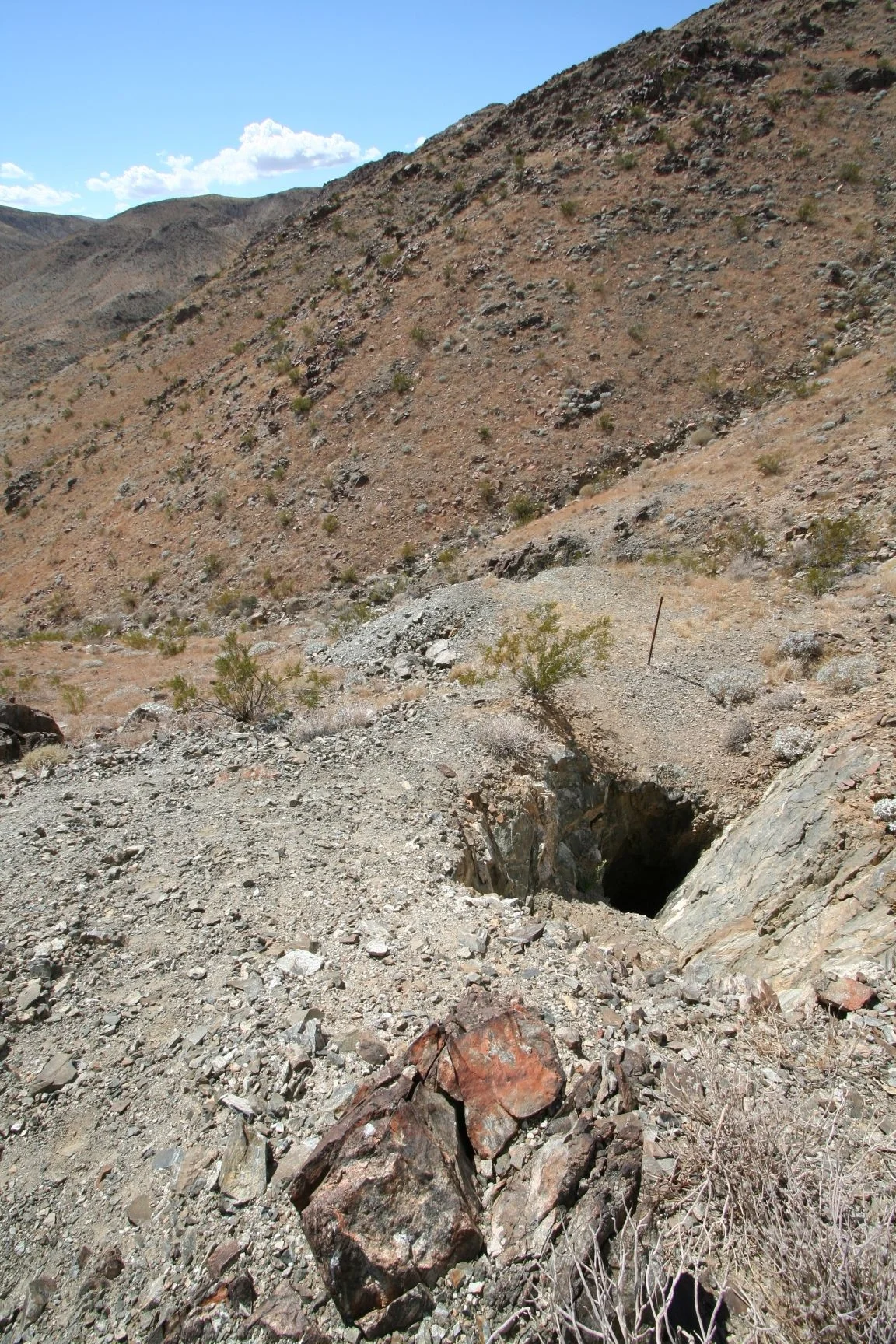
What the Shafts Tell
The ruins of the Desert Queen Mine are now part of the national park's interpretive landscape. Four vertical shafts, five inclined shafts, and ten horizontal tunnel openings — called adits — penetrate the granite in various orientations, each representing a different judgment about where the gold-bearing ore veins might run. Tailings, the waste rock extracted during mining, are piled nearby. Scattered machinery rusts in the desert air, preserved by the same aridity that made the desert difficult to live in. The mine is listed on the National Register of Historic Places, recognized for its significance in the history of mining in the Mojave and for the particular story of violence, transfer, and persistence that its ownership history represents.
Gold in the Granite
The Mojave Desert's gold deposits were formed through ancient geological processes that concentrated the metal in veins running through the region's granitic bedrock. Prospectors throughout the late nineteenth and early twentieth centuries worked these veins with hand drills, black powder, and the kind of optimism that the desert's occasional rich pockets sustained. The Desert Queen Mine was productive enough to justify nearly 75 years of intermittent operation, which places it among the more significant mining sites in this part of the Mojave. The ruins visible today in Joshua Tree National Park represent not just this one mine but the broader era of prospecting that gave the Joshua Tree landscape much of its human history — the camps, the trails, the water tanks, the claims that brought people to a place that otherwise offered little comfort.
From the Air
Located at 34.024°N, 116.071°W in Joshua Tree National Park, the Desert Queen Mine sits in the rocky terrain east of the Wonderland of Rocks. The mine's shafts and tailings are too small to see from cruising altitude but the surrounding Joshua Tree landscape — the characteristic open woodland of Joshua trees on sandy valley floors between granite boulder formations — is clearly visible at 5,000–8,000 feet. Twentynine Palms (KTNP) is approximately 10 miles to the northeast. The park's visitor center near Twentynine Palms is identifiable from the air.
Nearby Stories
- Coachella Valley 3.4 km away
- Mountain Fire (2013) 5 km away
- Cabazon Dinosaurs 12 km away
- Coxcomb Mountains 14 km away
- The Integratron 19 km away
- Sidney Garfield 25 km away
- Cadiz, California 30 km away
- Calico: The Ghost Town Walter Knott Saved 76 km away