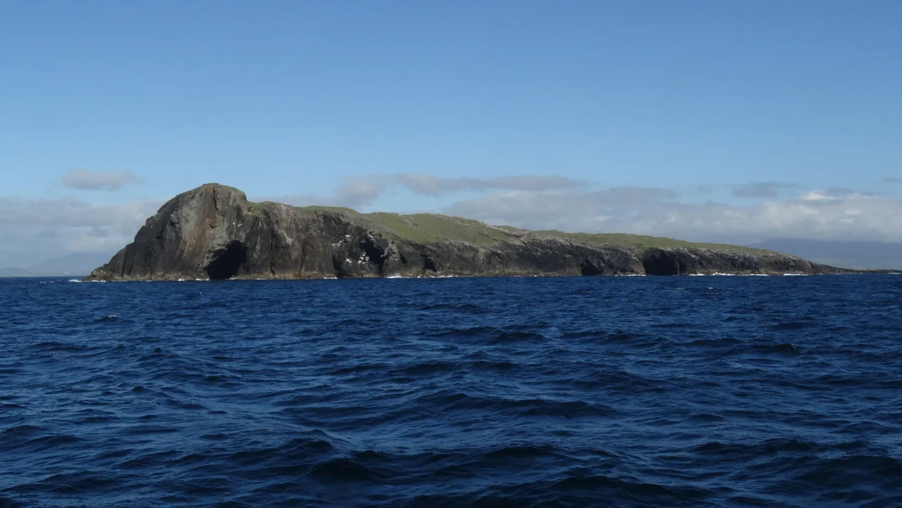

Caher Island
Its Irish name is Cathair na Naomh - the City of the Saints - and the title is older than any written record of the place. Hermit monks settled Caher Island sometime in the seventh century, building stone enclosures, a small chapel, and the carved slabs that still rise from the grass today. The monks are long gone, but every August, on the Feast of the Assumption, currachs and small boats cross the breaking water from Inishturk to land pilgrims at Portatemple. They walk the same loops the monks walked. Then the weather closes, and the island returns to its silence.
The City of the Saints
Caher lies between Clare Island and Inishturk, off the County Mayo coast, a low green shape rising out of the Atlantic with cliffs on its western side and a gentle slope facing east. It has no harbour, no pier, no permanent residents. What it has, instead, is one of the most intact early Christian monastic sites in Ireland: a chapel in a stone enclosure, a scattering of cross-slabs and inscribed stones, and the foundation traces of hermit huts where seventh-century monks chose to live as close to nothing as a person could get. The carvings on some of the slabs are clear enough to read after thirteen hundred years of Atlantic weather, which is its own kind of miracle.
The Pirate Queen's Vengeance
Caher belongs to the world of Grace O'Malley - Gráinne Mhaol, the sixteenth-century chieftain whose galleys ranged the Mayo coast and whose fortresses still stand on Clare Island and at Carrickkildavnet. After she was widowed in 1565, tradition says, O'Malley took a shipwrecked sailor as her lover; the affair ended when Clan MacMahon of Ballyvoy killed him. Her response was characteristic. She sailed to the MacMahon stronghold at Doona Castle in Blacksod Bay, took it, and brought the killers back to Caher Island, where she killed them on the saints' own ground. The story earned her a nickname that followed her for the rest of her life: the Dark Lady of Doona.
Reaching Portatemple
Getting to Caher is not casual. The standard approach is by currach or small boat from Inishturk, swinging in from the east to the rocky landing the charts mark as Portatemple. It is not, by any honest reading, a safe harbour - heavy Atlantic swells can break through even on calm days, and the seabed irregularities between Clew Bay and Killary Harbour mean unexpected peaks can rise out of moderate seas without warning. The Admiralty chart comment for the area says it plainly: the entire stretch breaks in bad weather. Boatmen who know the run wait for the right combination of tide, wind, and swell, and even then they keep one eye on the horizon.
The Assumption Pilgrimage
On the fifteenth of August every year, the Feast of the Assumption brings pilgrims out to Caher. They walk a station route past the chapel ruins, the cross-slabs, the old enclosure walls, stopping to pray at each. The tradition has been kept here in some form for centuries, surviving the dissolution of the monasteries, the long colonial centuries, the depopulation of the western islands. Most of the year the island sees no one. For one summer day it sees prayer. Then the boats turn back to Inishturk, and the Atlantic resumes its slow erasure of everything human.
From the Air
Caher Island sits at 53.717°N, 10.030°W between Clare Island and Inishturk, off the County Mayo coast. Best viewed from 2,000-4,000 feet AGL, with Clare Island to the north-northeast and Inishturk to the west-northwest. Ireland West Airport Knock (EIKN) lies about 50 nm to the east-northeast; Connemara Regional (EICA) is about 40 nm to the south. The waters here build long Atlantic swells - the island is often ringed by visible white-water even in moderate seas.
Nearby Stories
- Ballyconneely 3.2 km away
- Dugort 5 km away
- Aughagower 7.2 km away
- County Galway 8.6 km away
- Enaghbeg 18 km away
- RMS Carinthia (1925) 26 km away
- Action of 7 May 1794 54 km away
- Inishtooskert 175 km away