
Cairn Gorm
On 20 March 1986, the anemometer on Cairn Gorm registered 173 miles per hour. That is the highest official wind speed ever recorded on land in the United Kingdom. A higher gust — 194 mph — was logged on 19 December 2008, but the reading came in too late for Met Office verification, so 173 stands. The summit, at 1,245 metres, is the sixth-highest peak in the British Isles. It is not the highest in the Cairngorms range — Ben Macdui at 1,309 metres claims that distinction — and the Gaelic name Cairn Gorm can mean either Blue Cairn or Green Cairn, depending on whether you read gorm as the colour of sky or vegetation. But it is the mountain you can see most readily from Aviemore, the mountain whose name was lent to the entire range, and the mountain at the centre of the most fraught argument in modern Scottish mountaineering.
Coldest Station in the Country
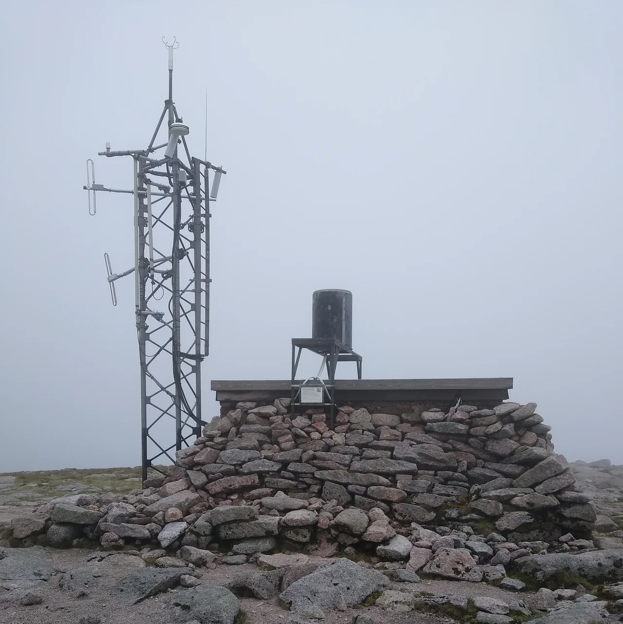
The summit has its own weather instrument — actually two, sitting alongside each other: an automated station run by Heriot-Watt University and a Met Office synoptic station, code 03065, providing temperature, wind and frost data. Cairn Gorm averages 212.8 frost days per year, more than any other weather station in the United Kingdom. The climate type, formally, is tundra — Köppen ET — even though the summit elevation is modest by European standards. The severity is in the cool summers, not extreme winter lows. The warmest month on record is July 2006, mean temperature 9.9°C. The coldest is March 2013. The highest temperature since 1985 is 25.5°C, set on 23 May 1989, and the lowest was on 6 March 2007. Foehn winds — warm dry currents falling on the lee side of the mountain — can drive November highs surprisingly high. But this is the same place that broke the wind record on a sea-level scale, and the cool, exposed, tundra-grade conditions hold true through most months of any year.
The Six Who Did Not Come Back
On the night of 21–22 November 1971, a blizzard caught a school party from Ainslie Park High School in Edinburgh, on a winter expedition across the Cairn Gorm plateau. Five pupils and an 18-year-old volunteer trainee instructor, Sheelagh Sunderland, were sheltering at Feith Buidhe when the storm overwhelmed them. All six died. The Cairngorm Plateau Disaster, as it is now known, remains the worst mountaineering accident in the history of the United Kingdom. It reshaped how Scottish outdoor education handled winter conditions: stricter equipment standards, mandatory weather assessment, the establishment of dedicated mountain leadership qualifications. Cairn Gorm in good weather is a straightforward hike from the ski area car park up the Windy Ridge path on Sròn an Aonaich. In poor weather, particularly during white-outs on the broad, featureless summit plateau, navigation can fail completely. The summit is ringed in many directions by precipitous drops — Coire an t-Sneachda, Coire an Lochain — whose edges are not obvious until they are below your feet.
The Funicular Argument
Skiing came in 1961 — a chairlift and chalet opened that December — and over the following decades more than 600 hectares of the north-western slopes in Coire Cas and Coire na Ciste were developed for alpine skiing. By 1990 the original infrastructure was worn out, and Cairn Gorm's defining feature meant the lifts were constantly being shut down by the wind: chairlifts had to stop above 25 mph, which on this mountain means much of the time. The Cairngorm Chairlift Company proposed a funicular railway as the answer. Environmental groups strongly opposed it, citing damage to fragile mountain soils and plants. The compromise reached with Scottish Natural Heritage allowed the railway to be built, but with an unusual restriction: only skiers and spectators could exit the top station onto the hill. Ordinary funicular passengers could visit the Ptarmigan restaurant and visitor centre at 1,087 metres but could not step outside to start a walk. The construction, originally budgeted modestly, ended up costing around £19.6 million, mostly from Highlands and Islands Enterprise with £2.7 million from the European Union. It opened in December 2001. It then suffered a structural failure in 2018, sat closed through the pandemic years, and reopened in 2023 after a substantial taxpayer-funded repair. The argument over what should happen on Cairn Gorm is not resolved. It probably never will be.
Wildlife at the Edge
The mountain is one of the last British strongholds for several Arctic and sub-Arctic species. Dotterel and ring ouzel breed here in spring and summer. Snow bunting and ptarmigan, both adapted to the highest, coldest ground, are present year-round. Mountain hare turn white in winter. Red deer graze the lower slopes, and a free-roaming herd of reindeer — originally reintroduced from Sweden in 1952 by the Utsi family — moves between Cairn Gorm and Glenmore. Among the wildflowers, dwarf cornel, cloudberry, and butterwort cling on at altitudes where almost nothing else in Britain will grow. The grand southern view from the summit is toward the remote Loch Avon — pronounced Loch A'an — a deep glacial trough hemmed in by cliffs and rarely visited even by experienced hill-walkers. This is one of Scotland's major ice climbing destinations in winter: Coire an t-Sneachda and Coire an Lochain host classic routes when the conditions hold. When they do, the mountain becomes briefly Alpine. When they don't, it goes back to being a tundra in the wrong country.
From the Air
Cairn Gorm: 57.117°N, 3.644°W, summit 1,245 m (4,084 ft). Distinctive broad domed summit above Aviemore, with ski area on northwest slope (visible Coire Cas and Coire na Ciste corries) and the funicular railway making a conspicuous straight scar up the hill. Best viewed at 6,000–8,000 ft AGL. Nearest airport is Inverness (EGPE), 28 nm north. Aviemore (no ICAO) lies 5 nm northwest. Mountain weather here is famously unpredictable — UK record wind 173 mph recorded at the summit — and clouds can form below 1,000 m with no warning. Maintain generous terrain clearance and check MWIS forecast before approaches.
Nearby Stories
- Grantown-on-Spey 5.7 km away
- Battle of Killiecrankie 6.4 km away
- Battle of Tullich 7.5 km away
- Dalwhinnie distillery 11 km away
- Airlie Castle 14 km away
- Urquhart Castle 14 km away
- Auchindoun Castle 14 km away
- Meggernie Castle 23 km away