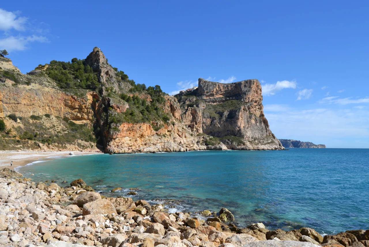

Cap de la Nau
Here the Spanish mainland simply stops. Cap de la Nau is the easternmost point of the whole Valencian Community, a blunt limestone headland where the coast, having run east for kilometre after kilometre, finally turns and gives way to open sea. Beyond the cliffs there is nothing but water until the low smudge of Formentera, the smallest of the Balearic Islands, toward which the cape seems deliberately to point. The name means Cape of the Ship, and from a boat offshore it is not hard to see the prow that sailors imagined in its steep grey mass.
Where the Mainland Runs Out
A headland this prominent does real work on a map. Cap de la Nau marks the southern limit of the Gulf of Valencia, the great curve of coast that opens to the north, and it closes that gulf like a full stop. It belongs to Xabia, in the comarca of Marina Alta, and it is the sort of place that defines a region by its edges: everything in the Valencian Community lies to the west of this rock. Ships rounding it feel the character of the coast change, from the sheltered sweep of the gulf to the more exposed water that runs south toward Alicante. The cape points across the water toward Formentera, the low-lying southernmost of the Balearic Islands, as if marking the shortest line between the mainland and the archipelago.
Cape of the Ship
The cape is rocky, steep, and built almost entirely of limestone, the same pale stone that shapes so much of this coastline into cliffs and coves. It rises abruptly from the Mediterranean, and it is easy to understand how it earned its maritime name; approached under sail, the headland's profile suggests the high bow of a vessel driving through the swell. In English the same feature is sometimes called Cape Nao, in Spanish Cabo de la Nao, but all three names carry the same image, a ship rendered in stone, permanently anchored at the corner of Spain.
The Cave of the Organs
The most remarkable thing about Cap de la Nau hides where most visitors never see it. Directly beneath the headland opens a large sea cave, the Cova dels Orgues, the Cave of the Organs, which can be reached only from the water. No path descends to it; to enter, you come by boat or kayak, sliding out of the sunlight into a chamber of dripping limestone where the sea breathes against the walls. Caves like this shape the whole submarine face of the cape, a hidden architecture carved patiently by the same Mediterranean that laps so calmly at the surface. On calm days small boats nose in under the cliffs to explore it, gliding into a shadowed chamber where the light turns green and the swell echoes off the stone.
A Coast of Cliffs and Coves
Cap de la Nau does not stand in isolation but anchors one of the most dramatic stretches of the Costa Blanca. To the south the cliffs of Benitatxell fall sheer toward hidden coves reachable only on foot or by sea; to the north the coast breaks into the bays and headlands of Xabia. This is a shoreline of white limestone and deep blue water, of pine clinging to rock and the constant presence of the Balearic horizon. The cape is its pivot, the point on which the whole coastline turns from north-facing gulf to open eastern sea.
The Light at 122 Metres
Crowning the headland, 122 metres above the waves, stands the Cap de la Nau lighthouse, still doing the job the cape has always demanded of anyone who lived near it: watching the sea and warning those upon it. From the terrace beside the light the view runs down cliffs that fall dizzyingly to the water and out across the strait toward the Balearics. On a fine evening it is one of the great vantage points of the Costa Blanca, the eastern extremity of mainland Spain, with the whole Mediterranean opening ahead. Few places on the Spanish coast feel so much like an ending and a beginning at once.
From the Air
Cap de la Nau projects into the Mediterranean at 38.74 degrees north, 0.22 degrees east as the easternmost tip of mainland Valencia, its lighthouse standing 122 metres above the sea. From the air the headland is a clear limestone spur pointing toward Formentera, with the cliffs of Benitatxell to the south and Xabia's bays to the north. A coastal pass at 2,000 to 3,500 feet gives the full profile of cliffs and the wake-white water below. Alicante-Elche (LEAL) lies about 75 km southwest; Ibiza (LEIB) sits east across roughly 90 km of open sea.
Nearby Stories
- Killing of Lasa and Zabala 6.2 km away
- Monastery of Aguas Vivas 7.3 km away
- Cocentaina 7.9 km away
- Cueva de Bolomor 37 km away
- Es Vedrà 45 km away
- Mutxamel bombing 55 km away
- Cala d'Albarca 58 km away
- Battle of Cape Cherchell 221 km away