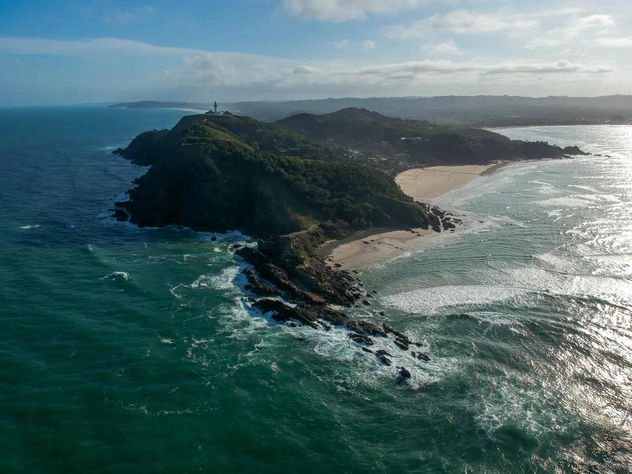

Cape Byron
Stand on this narrow finger of rock and there is nothing east of you but the Pacific, all the way to South America. Cape Byron is the easternmost point of the Australian mainland, the place where the continent runs out of land. It pushes into the ocean at 28.63 degrees S, 153.64 degrees E, about three kilometres beyond the town of Byron Bay, and on the morning side of a clear day it catches the sun before almost anywhere else in the country. The Arakwal people, custodians of this country within the Bundjalung nation, know the headland as Walgun, 'the shoulder', a name that reads true once you see the way the land hunches out into the sea.
Named for Foulweather Jack
On 15 May 1770, sailing up the east coast in the Endeavour, Captain James Cook passed this headland and gave it a name. He honoured not a poet but a sailor: Vice-Admiral John Byron, who had circumnavigated the globe in HMS Dolphin between 1764 and 1766. Byron's reputation at sea earned him the nickname 'Foulweather Jack', for the gales that seemed to follow him everywhere he went. A common assumption holds that the cape commemorates the Romantic poet Lord Byron, but that would have required remarkable foresight on Cook's part. George Gordon, Lord Byron, the poet and John Byron's grandson, was not born until 1788, eighteen years after the Endeavour slipped past this shore.
The Walk Around the Edge
The best way to know the cape is to walk it. The Cape Byron walking track loops 3.7 kilometres through the Cape Byron State Conservation Area, and it can be joined at any point, with car parking at Captain Cook Lookout, Palm Valley, Wategos Beach, and the lighthouse. The track climbs from sheltered sandy coves through coastal heath and pockets of rainforest to the white lighthouse on the clifftop, then drops back toward the beaches. Along the way the view swings constantly, from the curve of Byron Bay's beaches to the open ocean, and a marked plaque pins the precise easternmost point underfoot. It is a walk of an hour or two that somehow contains an entire coastline.
Whales Off the Corner
Because the cape juts so far out, the great whale migration passes unusually close. Humpbacks travelling between Antarctic feeding grounds and warm northern breeding waters round this corner in winter, and from the headland you can watch them blow, breach, and slap the surface offshore. Whale watching has become a genuine pillar of the local economy. The waters here belong to the 22,000-hectare Cape Byron Marine Park, established in November 2002, which reaches from Lennox Head in the south to the mouth of the Brunswick River in the north and shelters dolphins, turtles, and rays alongside the passing whales. Not far below the surface, off this same headland, lies the wreck of the MV Limerick, a freighter sunk by a Japanese submarine in 1943.
One Corner of a Continent
Cape Byron belongs to an exclusive club: the four compass extremes of the Australian mainland, plus its highest point. To the north is Cape York, the northernmost tip; to the south, South Point on Wilsons Promontory; to the west, the aptly named Steep Point; and rising above them all, Mount Kosciuszko, the continent's highest summit. Reaching all four corners has become a quiet pilgrimage for some Australian travellers. But Cape Byron is the easiest of the extremes to stand on, and the most generous in what it gives back: a lighthouse, a walking track, a beach below, and a horizon that holds nothing but open ocean and, if you are lucky, the spout of a passing whale.
From the Air
Cape Byron sits at 28.6335 degrees S, 153.6383 degrees E, the easternmost point of the Australian mainland, roughly 3 km east of Byron Bay town. The white Cape Byron Lighthouse on the headland is the key visual reference, with Wategos Beach tucked to its north and the broad arc of Byron Bay's beaches sweeping west. A viewing altitude of 1,500-3,000 feet captures the whole headland and the marine park waters offshore, where whale activity is common in winter. Nearest airports are Gold Coast Airport (YBCG / OOL) about 45 km north and Ballina Byron Gateway (YBNA / BNK) roughly 30 km south. Expect onshore winds and occasional sea fog; the clearest views come on settled mornings.
Nearby Stories
- Nimbin 6.1 km away
- Casino Post Office 22 km away
- Richmond River Light 22 km away
- Fingal Head Light 26 km away
- Glow-Worm Caves Tamborine Mountain 42 km away
- HMS Porpoise (1799) 687 km away
- Wreck Reefs 717 km away
- SS Elingamite: Gold, Fog, and a Captain Wrongly Blamed 1777 km away