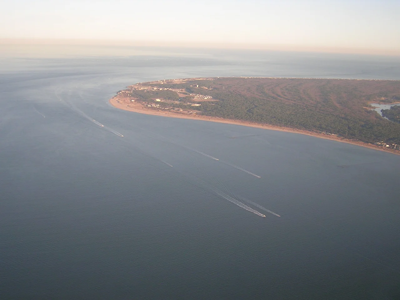

Cape Henry
After 144 days at sea, three small ships rounded the sandy point and found shelter. It was April 26, 1607. The men aboard the Susan Constant, the Godspeed, and the Discovery — 104 of them, all male, ranging from gentleman adventurers to indentured laborers — had been at sea since December. They erected a wooden cross in the dunes, knelt down, and gave thanks. They named the cape for the king's son: Henry Frederick, Prince of Wales. Then they pushed back into the Chesapeake to find a more defensible site upriver, where they would build Jamestown. The First Landing happened here.
Gateposts to a New World
Cape Henry forms the southern jaw of the Chesapeake Bay's mouth. Across the water to the north stands Cape Charles, named for Henry's younger brother — the future Charles I, who would lose his head to Cromwell. Together the two capes form the Virginia Capes, the eighteen-mile-wide gateway through which every Chesapeake voyage has passed for four centuries. Captain Christopher Newport, the one-armed mariner commanding the London Company's expedition, had been aiming for this sheltered estuary. The colonists' charter from King James devoted itself to spreading Christianity to peoples who, in the document's framing, lived in 'Darkness and miserable Ignorance' — a framing that erased the Powhatan Confederacy of roughly 14,000 people already living in the watershed, with sophisticated governance, agriculture, and trade networks of their own.
The Light That Would Not Go Out
By 1791 the new United States needed a lighthouse here. Congress authorized one — the first federally funded public works project in American history — and President Washington personally approved the contract. The Cape Henry Lighthouse, completed in 1792, threw its beam across the bay for ninety years. When the original sandstone tower began to crack, a taller iron lighthouse rose beside it in 1881. Both still stand today on the grounds of what is now Joint Expeditionary Base Fort Story. The old tower remains the oldest authorized lighthouse in the United States — federal infrastructure older than nearly anything else the federal government built.
The Battle That Won the Revolution
Most Americans think Yorktown won the war. Sailors know better. On September 5, 1781, just off these capes, French Admiral de Grasse fought British Admiral Graves in what came to be called the Battle of the Capes — the most consequential naval engagement in American history. De Grasse held the gateway. Cornwallis, besieged at Yorktown a few miles up the bay, could not be resupplied or evacuated. Six weeks later he surrendered. Washington and Rochambeau got the credit. But without the French fleet bottling up these capes, the Redcoats would have sailed away to fight another season. The Treaty of Paris and American independence followed because of what happened in the water off Cape Henry.
Pirates, Pines, and a State Park
Less heroic moments mark the cape, too. In 1700, three accused pirates — John Houghling, Cornelius Franc, and Francois Delaunée — were gibbeted here, their bodies hung in iron cages as warning to other crews. The First Landing State Park now covers much of the cape itself: 2,888 acres of bald cypress swamps, longleaf pine, and live oak draped in Spanish moss, the northernmost reach of Southern coastal forest. The Cape Henry Memorial within the federal grounds marks where Newport's men erected their cross. Whatever you make of the colonists' arrival — celebration, mourning, or both — the dunes endure where it began.
What You See From Above
From altitude, the cape resolves into a clean geographical fact: the sandy hook where the Atlantic narrows into the largest estuary in North America. The two lighthouses rise from the dunes, the older one stubby and pale, the newer one black-and-white striped. Naval Station Norfolk's piers crowd the western shore. The Chesapeake Bay Bridge-Tunnel stretches northward across the bay's mouth. Container ships and aircraft carriers slip past the spot where three small wooden ships once anchored.
From the Air
Cape Henry sits at 36.92°N, 76.02°W on the southern entrance to Chesapeake Bay. From 4,000 to 8,000 feet AGL the two lighthouses, the wide sandy point, and the Bay Bridge-Tunnel reaching north toward Cape Charles are all clearly visible. Nearest airports: Norfolk International (KORF) about 8 nm west-southwest, Newport News/Williamsburg (KPHF) about 24 nm northwest. The cape lies inside Class C airspace and the busy approach corridor for both Norfolk and the Naval Station — coordinate with Norfolk Approach (124.55) before any low-altitude transit. Naval Air Station Oceana (KNTU) lies just south. Best viewing from a southwest-to-northeast pass at 3,000 to 5,000 feet on a clear day with light easterly winds.
Nearby Stories
- Capitol (Williamsburg, Virginia) 4.7 km away
- Battle of the Chesapeake 5.7 km away
- Chesapeake Bay Impact Crater 8.8 km away
- Battle of Great Bridge 11 km away
- James River Reserve Fleet 13 km away
- Blackwater River (Virginia) 33 km away
- SS Monroe (1902) 50 km away
- Bodie Island Lighthouse 102 km away