Caverna do Maroaga Environmental Protection Area
The cave is named after a man who hid in it. During the 1960s, when Brazilian military engineers pushed the BR-174 highway north toward Venezuela, they cut through Waimiri-Atroari territory and met resistance from the Indigenous nation whose homeland the road violated. According to local history, a Waimiri-Atroari leader named Maroaga took refuge in this underground chamber as the conflict unfolded. Decades later, when the Brazilian state declared the surrounding 374,700 hectares a protected area in 1990, it carried his name. The Caverna do Maroaga Environmental Protection Area sits in the municipality of Presidente Figueiredo, Amazonas, where some of the oldest rock in the Brazilian Amazon holds caves, waterfalls and a record of the past that is both geological and political.
The Oldest Rock in the Amazon
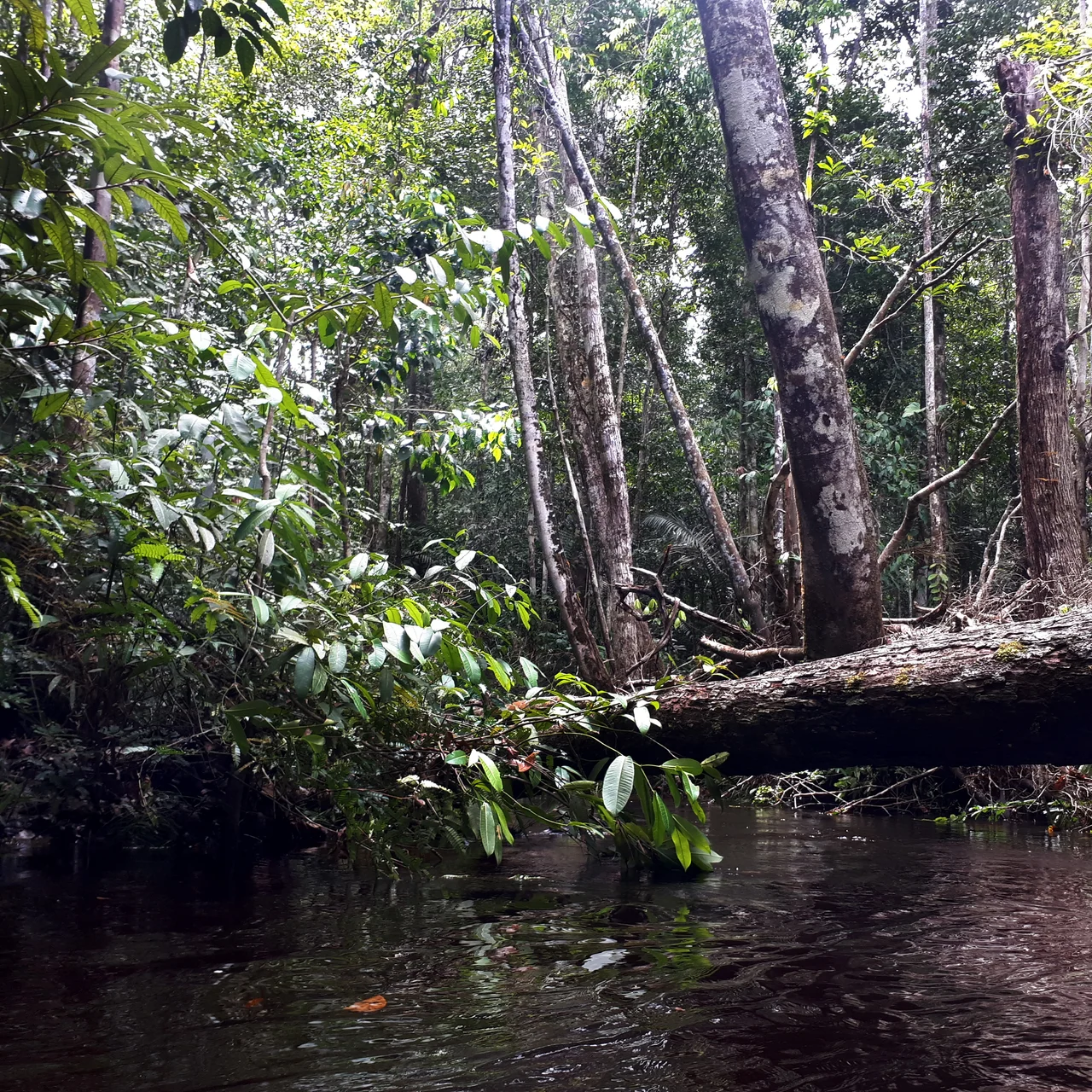
The caves here are eroded into some of the most ancient geological formations in northern Brazil, Precambrian rock laid down long before anything that might today be called the Amazon existed. Evidence of prehistoric human presence has been documented inside the Maroaga cave, pushing the site's human history back far beyond the modern story of its name. Above ground, the landscape is rainforest cut by rivers that form dozens of waterfalls. About 96 percent of the vegetation is dense rainforest dominated by emergent trees typical of terra firma, with 3 percent open rainforest and 1 percent campinarana-rainforest contact. Scattered patches of open campina forest and seasonally flooded igapo forest along streams add variety. Orchids and bromeliads thrive in the shaded understory, clinging to trunks and branches throughout the reserve.
Creatures of the Canopy and the Dark
The vertebrate fauna reads like a who's who of Amazon wildlife. Jaguar (Panthera onca) and margay (Leopardus wiedii) hunt through the understory. The neotropical otter (Lontra longicaudis) and the endangered giant otter (Pteronura brasiliensis) patrol the rivers. Guianan red howler monkeys (Alouatta macconnelli) boom from the canopy at dawn, and red-handed tamarins (Saguinus midas) chirp through the middle branches. Harpy eagles (Harpia harpyja), among the most powerful raptors on Earth, nest in the tallest emergents. The Guianan cock-of-the-rock (Rupicola rupicola), an intensely orange bird that displays at communal leks, is prized by wildlife traffickers and under continuing pressure in the region. The caves themselves are notable for many species of bats that roost in the cool darkness by day and fan out across the forest at dusk.
Created to Protect Caves, Used for Water
The APA was established by state decree 12.836 on March 9, 1990, with the specific aim of preserving the municipality's speleological heritage. Boundaries were adjusted in 1994. In 2002 the area joined the Central Amazon Ecological Corridor, a network linking protected zones across the state. A deliberative council was created in 2009 and its regulations approved in January 2010. The APA surrounds the southwest shore of the reservoir behind the Balbina Dam, whose 1987 flooding drowned some 2,360 square kilometers of Waimiri-Atroari land and displaced Indigenous communities for modest hydroelectric returns. The APA boundaries run between BR-174 to the west and the Uatuma River, which drains the dam, to the east. The Uatuma Biological Reserve protects the northeast side of the reservoir. The APA adjoins Waimiri-Atroari Indigenous Territory to the north.
Tourism Without Infrastructure
The waterfalls and caves should draw crowds. The Porteira waterfall is the headline attraction, one of many cascades in Presidente Figueiredo that have earned the municipality the nickname Land of Waterfalls. But the APA has almost no tourist infrastructure. There is no organized security, no surveillance, no lodgings and no restaurants near most of the waterfalls. Visitors come anyway, and their presence causes some environmental damage: trampling, trash, graffiti on cave walls. About 42 communities live inside the APA, their economies built on small-scale agriculture of banana, cassava, cocoa, rice, corn, cupuacu and guarana, along with cattle raising, logging, fishing and crafts sold into the Manaus market. Commercially valuable hardwoods are harvested here including mahogany, cedar, bay and the legume tree Hymenolobium petraeum. The APA is a mixed-use area rather than a strict reserve, with the ordinary contradictions that balance implies.
From the Air
Located at 1.96S, 59.85W, in the municipality of Presidente Figueiredo, Amazonas. The area sits north of Manaus along the BR-174 highway corridor. Nearest airport is Manaus/Eduardo Gomes International (SBEG), roughly 120 kilometers south. Recommended viewing altitude 33,000-37,000 feet. From cruise the landscape shows as dense canopy cut by the Balbina Reservoir, whose distinctive dendritic pattern of drowned forest remains visible from the air. The Uatuma River drains the dam eastward. Expect afternoon convective cells during the wet season, December through May.
Nearby Stories
- Biological Dynamics of Forest Fragments Project Area 16 km away
- Amazon Tall Tower Observatory 48 km away
- Lower Rio Negro Mosaic 60 km away
- Novo Airao 85 km away
- Waimiri Atroari Indigenous Territory 100 km away
- Pitinga Mine 113 km away
- Parintins 300 km away
- Oyapock 810 km away