Waimiri Atroari Indigenous Territory
In 1972, roughly three thousand Waimiri-Atroari lived in the forests between the Jauaperi and Alalaú rivers. By 1974, Brazilian government records counted only a thousand. The difference was not accident. The army was pushing BR-174, a federal highway from Manaus to Boa Vista, straight through Waimiri-Atroari land, and according to Funai estimates later published by the Brazilian Truth Commission, the military regime's goal appears to have been to eliminate the people standing in the road's way. Two thirds of a nation, gone in two years. The forest around you absorbed what happened and kept growing.
The People Before the Road
At the start of the twentieth century, somewhere between two thousand and six thousand Waimiri-Atroari lived across the basin of the Jauaperi and Camanaú rivers - their villages scattered through an Amazon territory roughly the size of New Hampshire. Their first recorded contact with Europeans came in 1884, when the botanist João Barbosa Rodrigues traveled their villages. The woodsmen who followed him - hunting pelts, rubber, rosewood, and Brazil nuts - came without invitation, and the Waimiri-Atroari responded with bows and arrows. The Brazilian government responded with soldiers. Whole villages were destroyed in the cycle of raids and reprisals that defined the next eighty years. In 1911, the Indian Protection Service tried friendly contact on the Jauaperi, and briefly succeeded, but the gatherers kept coming. The forest that outsiders saw as resource was home.
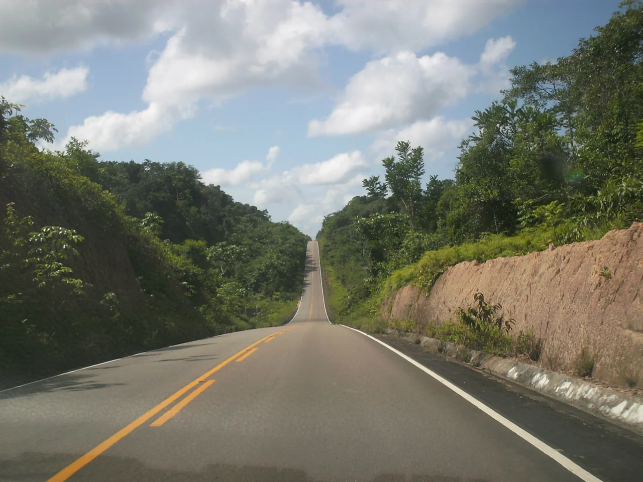
The Highway the Army Built
The state governments of Roraima and Amazonas wanted a road between Manaus and Caracaraí. The federal government took the plan and expanded it into BR-174, all the way to Boa Vista. Construction of the section crossing Waimiri-Atroari territory ran from 1972 to 1979 under an army construction battalion that ignored Funai's guidelines for contact. When Funai sent the Italian priest Giovanni Calleri into the territory to speed things along, he and nine of his ten companions were killed. The Waimiri-Atroari understood what the road meant. In 1973 and 1974 they attacked the Indian Posts, and in 1974 they killed Gilberto Pinto Figueiredo, the Funai agent leading the attraction effort, along with his entire staff. By then, epidemic disease carried in by the workers was doing the real killing. The population fell from about three thousand to about one thousand in two years.
What the Reservoir Swallowed
The road was only the first cut. In 1979, construction began on the Balbina Dam on the Uatumã River, a hydroelectric project built across ground so flat that the reservoir swelled to enormous size. Presidential decree in 1981 declared more than ten thousand square kilometers a matter of public utility, and about 2,928 square kilometers of land formerly occupied by the Waimiri-Atroari disappeared under the water. The dam never produced the power its planners promised. Instead, decomposing vegetation in the stagnant reservoir turned it into what the National Institute for Amazonian Research calls a methane factory - a hydroelectric plant that releases more greenhouse gas than a coal plant of equal output. Downstream, acidic water killed the fish. The forest had been drowned to generate power that never came.
The Tin Beneath Their Feet
The same year the reservoir started rising, prospectors for Paranapanema found cassiterite - tin ore - in tributaries of the Pitinga River, inside the reservation. In 1981, another presidential decree removed 526,800 hectares from the reserve so the mine could be dug, and the Pitinga operation began producing the following year. The deposit is thought to be the largest undeveloped tin reserve in the world. The people whose territory was carved up to reach it were, by 1988, reduced to 374 survivors. The Northern Corridor Project meanwhile turned their remaining land into a zone of military outposts, and Funai, the agency supposedly protecting them, was ordered to keep ethnologists and missionaries out while agribusiness and energy companies moved in.
The Blockade at Night
By 1989, the Waimiri-Atroari Indigenous Territory was at last officially demarcated at 2,585,911 hectares. A compensation program funded by the dam's operator began providing health care, schools, and agricultural support. The population began to grow again. By 2014, a census counted 1,749 people. Each evening from six at night to six in the morning, the Waimiri-Atroari close BR-174 where it crosses their land, because wild animals and hunters move through the forest after dark and the trucks barreling between Manaus and Boa Vista will not slow down. The state of Roraima sued them over the blockade. They keep closing it anyway. After everything the highway took, it is a small thing to ask of the road - and a reminder of who was here first.
From the Air
Coordinates 0.86 S, 60.52 W. Recommended viewing altitude FL080-FL120 over dense Amazon canopy between the Jauaperi and Alalaú basins. The territory stretches roughly 2.58 million hectares straddling Amazonas and Roraima states, northwest of the Balbina Reservoir (a distinctive dendritic black patch clearly visible from altitude). BR-174 cuts a thin north-south line through the forest. Nearest airports: Manaus Eduardo Gomes (SBEG) to the south, Boa Vista (SBBV) to the north. Clear dry-season weather (June-November) gives best views.
Nearby Stories
- Pitinga Mine 4 km away
- Xixuau 43 km away
- Caverna do Maroaga Environmental Protection Area 105 km away
- Lower Rio Negro Mosaic 165 km away
- Jaú National Park 203 km away
- Sao Gabriel da Cachoeira 659 km away
- Auyan-tepui 745 km away
- Oyapock 817 km away