Sao Gabriel da Cachoeira
Ninety percent of Sao Gabriel da Cachoeira is indigenous. That is not a historical claim or a statistic about the surrounding region. It is the demographic reality of the city itself, where Tukano, Baniwa, Yanomami, and members of twenty more peoples live, work, vote, and run the municipal government. The Federation of Indigenous Organizations of the Upper Rio Negro is headquartered here, and travelers who want to visit villages upriver need its authorization. Most Brazilian cities grew up displacing the people who lived there first. In Sao Gabriel, that story never happened.
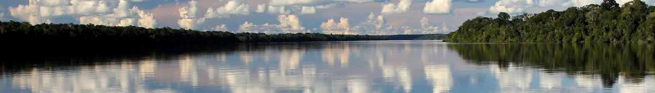
Where the Rio Negro Narrows
The city sits on the left bank of the Rio Negro, 850 kilometers upriver from Manaus, close to the borders of Colombia and Venezuela. There are no roads in. You arrive by boat, usually a three-to-four-day cargo vessel from the Porto de Sao Raimundo in Manaus where you hang a hammock on the deck, or by a small plane that runs only between Manaus and the tiny local airstrip. Everything the city needs, from fruit to furniture to diesel fuel, comes upriver. The region beyond the city contains 430 settlements and roughly 35,000 indigenous people spread along the middle and upper Negro. Sao Gabriel is where those communities come to trade, to see doctors, and to negotiate with a Brazilian state that has not always honored its promises to them.
FOIRN and the Right to Visit
The Federation of Indigenous Organizations of the Upper Rio Negro, known by its Portuguese acronym FOIRN, runs out of an office on Avenida Alvaro Maia. The federation handles indigenous land rights, sells crafts on consignment for member communities, and controls access to the traditional territories that make up most of the municipality. If you want to go upriver and visit a Tukano or Baniwa village, you need written authorization from FOIRN first. This is not a formality. The surrounding indigenous lands are legally protected, and the communities themselves decide which outside visitors they want to host. FOIRN's bookstore and display room holds publications by Rio Negro authors in their own languages, and a wall of historical photos documents the federation's four decades of work.
The Mountain Above the Clouds
About 140 kilometers northwest of the city, in the Parque Nacional do Pico da Neblina near the Venezuelan border, stands Pico da Neblina, the highest peak in Brazil. Neblina means mist or fog, and the mountain earned its name by spending most of the year hidden in cloud. The summit is almost three kilometers above sea level, and the climb is not casual. Guides will not take anyone up without previous mountaineering experience, and the park is co-managed with the Yanomami whose territory covers the approach. The mountain itself is a tepui-like formation, an ancient sandstone plateau eroded into near-vertical walls. Springs that fall down its slopes feed the Rio Negro, and those icy springs are what make the beaches around Sao Gabriel unusually cold during the low-water season.
The Fortress on the Hill
Morro da Fortaleza rises on the city's edge, and trenches still run along its slopes from a fort built in 1763. The fort was part of a Portuguese effort to hold the upper Rio Negro against Spanish claims, and it never saw much action. What draws visitors to the hill today is the Anta stone, a boulder cut with high-relief petroglyphs: a leg, a human footprint, and figures that locals read as animal vessels. The indigenous legend says the stone is the petrified body of a tapir that once fed a starving people. From the top of the Fortaleza, you can see the Serra da Bela Adormecida, the Sleeping Beauty Mountain, thirty kilometers away. The ridge traces the profile of a woman lying on her back, her hair spread out, waiting for a kiss that is not coming.
Dry Season Beaches
Between September and January, when the river is low, Praia Grande emerges from the Rio Negro as a half-kilometer strip of white sand. The water is cold, fed by springs from the Neblina massif, and it looks deceptively calm. The current beneath the surface is strong. Locals will warn you, and they are right to. The beaches of the upper Rio Negro appear and disappear with the flood cycle, and Praia Grande is only one of several that surface when the water level drops enough. More than half the city's residents are under twenty, which keeps the nightlife busy even in a place with no dance clubs. The city has no luxury hotels and has not tried to become a tourist destination. What it has is a functioning bilingual Portuguese and indigenous-language life that exists almost nowhere else in urban Brazil.
Respect as the Basic Rule
The city's official tourism materials include something unusual: explicit guidance on how to behave around indigenous residents. Ask before taking anyone's picture. Keep respectful distance in outlying neighborhoods where tourists are rare. Do not stare at indigenous women. Do not pollute. These are not suggestions for cultural sensitivity elsewhere; they are the ordinary terms of being a guest in a place where the people who live there are not performers in your vacation. Sao Gabriel da Cachoeira has been making indigenous languages co-official alongside Portuguese for more than two decades. When you visit, you are visiting the capital of a region that has not been assimilated, and the city's expectation is that you will act accordingly.
From the Air
Located at 0.13 degrees S, 67.09 degrees W on the left bank of the Rio Negro, about 850 km upriver from Manaus and close to the Colombian and Venezuelan borders. The local airfield is Sao Gabriel da Cachoeira Airport (SBUA), served only by flights to and from Manaus. Pico da Neblina rises 200 km northwest, often cloud-covered. Best viewed from 5,000 to 8,000 feet along the Negro corridor, where the dark, tannin-stained river contrasts sharply with the bright sandbars that emerge in the dry season between September and January.
Nearby Stories
- Tariana people 195 km away
- Mamirauá Sustainable Development Reserve 229 km away
- Purus Varzea 250 km away
- Japurá-Solimões-Negro Moist Forests 264 km away
- Great Depression in Latin America 278 km away
- Tonantins 282 km away
- Operation Jaque 612 km away
- Auyan-tepui 770 km away