Xixuau
To reach Xixuau, you board a boat in Manaus that heads upstream on the Rio Negro toward Boa Vista. You get off the next day at Moura, where the Jauaperi empties into the Negro, and you find another boat - smaller, slower - to carry you up the Jauaperi. Thirty hours after leaving the city, the river delivers you to a cluster of palm-thatched malocas built in the round, peaked style of the neighboring Waimiri-Atroari. No road leads here. There are no fees, no permits, only an understanding that you reached out to the community through the Amazonia NGO before arriving, so that the people who live here knew you were coming.
A Village on the Jauaperi
Xixuau sits inside the Extractive Reserve Baixo Rio Branco-Rio Jauaperi, a stretch of protected forest along an affluent of the Rio Negro. The population is small and fluid - people move between communities along the rivers, following work or family or the season. The architecture borrows from the Waimiri-Atroari, whose territory lies just to the south: round wooden houses with palm-thatched roofs that breathe in the heat and shed the rain. The coordinates read 0 degrees 48 minutes south, 61 degrees 33 minutes west, but coordinates miss the point. The location is defined less by latitude than by river distance - how many hours of current separate you from the nearest place with electricity.
The Forest That Moves
The Jauaperi breathes with the seasons. From March through September, the river swells and spills into the surrounding forest, and you can paddle a canoe through the trunks of trees standing in water up to their lower branches. This is the flooded forest, the igapó, a landscape that has no equivalent in temperate geography. From October through February, the water retreats, and white sandy beaches emerge along the banks. The forest is always beautiful. It is just beautiful in two entirely different ways, and the village's rhythm follows the water - what you can fish, where you can walk, which trees bear fruit - all depend on where the river is today.
What Lives Here
A list of residents reads like an inventory of Amazonian abundance: giant river otters that hunt in pairs, armadillos that shuffle through the leaf litter, capuchin and spider monkeys moving through the canopy, marmosets smaller than a child's hand, tapirs thick as barrels, sloths hanging motionless in the trees. The rivers hold pink river dolphins that sometimes surface alongside canoes, their sonar clicking through the water as you paddle. Fishermen pull rainbow bass, surubim, aruanã, and pacu from the same water. Overhead pass toucans, herons, macaws, eagles, parakeets, and woodpeckers. Howler monkeys call from the canopy with a roar that carries for miles. Giant caimans wait near the kitchens for scraps - the village's most casual neighbors.
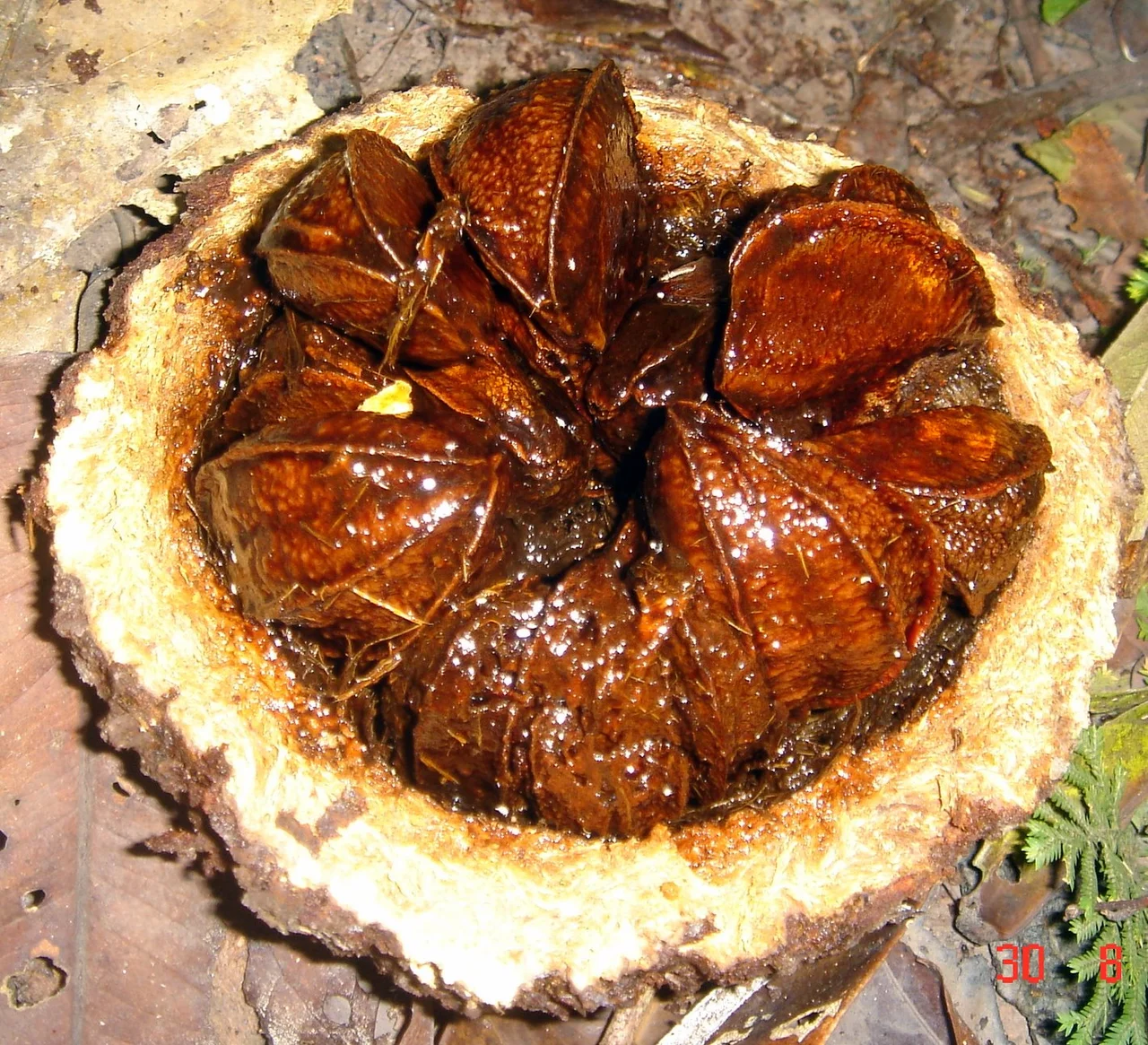
Brazil Nuts and Handiwork
The Brazil nut tree grows wild throughout the reserve, and each large woody fruit opens to reveal ten to fourteen nuts packed inside like segments of an orange. The community harvests them for food and for export, a source of income that relies on the forest staying intact. The women make handicrafts from forest materials - seeds, plant fibers, and natural dyes worked into necklaces, bracelets, and earrings. Meals lean heavily on fish caught that morning by local fishermen using line and hook, cooked simply with whatever comes out of the garden. Before you visit, you sort out vaccinations - yellow fever and typhoid are standard - and usually start malaria prophylaxis, either Lariam or Malarone. The forest asks for some preparation.
Why the Trip Takes So Long
Thirty hours by boat from Manaus is not a logistical inconvenience. It is the whole point. The length of the journey preserves Xixuau as much as the formal protection of the Extractive Reserve does. Tourism that requires a full day and a half of river travel does not arrive by accident. The visitors who come want the place that took that long to reach, and the community can control the pace at which outsiders enter its life. You cannot helicopter in for an afternoon. You cannot day-trip from a cruise ship. You go when you are invited, you stay long enough for the rhythm to change, and then you take the long ride back - down the Jauaperi, down the Negro, and back into the city that waited on the other end of the water.
From the Air
Coordinates 0.799 S, 61.558 W. The village sits on the Rio Jauaperi, a north-bank tributary of the Rio Negro. Recommended viewing altitude FL060-FL100 - low enough to pick out the winding dark-water river threading through flooded forest. The Rio Negro's distinctive black water (stained by tannins) makes a clear navigation reference. Nearest airports: Manaus Eduardo Gomes (SBEG) is the practical base - there is no airstrip at the village. Expect dense forest canopy and seasonal flooding visible from altitude, especially March-September.
Nearby Stories
- Waimiri Atroari Indigenous Territory 73 km away
- Jaú National Park 131 km away
- Lower Rio Negro Mosaic 164 km away
- Novo Airao 193 km away
- Sao Gabriel da Cachoeira 543 km away
- Auyan-tepui 721 km away
- Guyana-Venezuela Territorial Dispute 847 km away