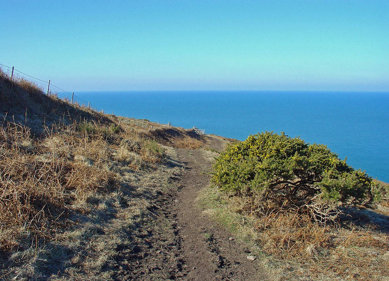

Cemaes Head
From across the Teifi estuary, Cemaes Head does not look like much. A long whaleback of green pasture sloping down to the sea, divided by stony field-banks, with no spectacular silhouette and no real summit. The drama is hidden. Walk over the brow and stand at the cliff edge on the north-western face, and the ground simply ends. Five hundred and seventy-five feet of mudstone drops vertically into the Atlantic. The cliffs are the highest in Pembrokeshire. And the rock itself, viewed from a boat below, shows the most violent geology you will see anywhere on the British coast.
Reading the Folds
The bedrock at Cemaes Head is Llanvirn-Caradoc black mudstone, deposited roughly 470 million years ago in the Ordovician period, on the floor of an ocean that no longer exists. Then the continents that bordered that ocean began to close. Over hundreds of millions of years, the mudstones were squeezed, tilted, folded back on themselves, and finally lifted to where the modern Atlantic could grind at them. Stand on the clifftop and look down, and you can see the layers running not horizontal but vertical, then doubling back, then twisting through tight acute folds like ribbon. The Geological Survey calls this the Cardigan Rock Sequence; geology students travel here to see what plate tectonics actually does to a piece of seabed. The cliffs are soft enough that the sea is constantly removing them, so the fold structure is fresh and clean — which also means that climbers stay away.
The Highest Cliff
Pengarn, the highest point of the headland, reaches 189 metres above sea level — about 620 feet, marked by a pillar trig point at grid reference SN 13214 48500. The cliffs proper, on the seaward face, run up to 175 metres or about 575 feet. That makes Cemaes Head the highest cliff in Pembrokeshire, in a county not short of dramatic coast. The western flank takes the full Atlantic. South-westerly gales arrive with nothing between them and Newfoundland. The eastern side, dropping down to the Teifi estuary and Cardigan Bay, is comparatively sheltered. Standing at the trig point on a calm day you can see Cardigan Island to the east, the long curve of Cardigan Bay opening northward, and the headlands of Pembrokeshire stepping south one by one toward Strumble Head.
Choughs and Welsh Ponies
In 1984, the Wildlife Trust of South and West Wales acquired 20 hectares of the headland as a nature reserve — their fiftieth, with help from the Countryside Commission, Dyfed County Council, the Nature Conservancy Council, and the World Wildlife Fund. The reserve protects the seabird cliffs, where herring gulls, shags, fulmars, cormorants, razorbills and guillemots all nest, and the heather-and-gorse maritime grassland on the cliff top. Welsh mountain ponies were reintroduced to trample down bracken — a clever piece of conservation logic, because choughs need short turf to find food, and choughs are the soul of the place. The red-billed, black-feathered crows are rare in Britain, mostly confined to the Welsh and Irish coasts. At Cemaes Head you can sit on the cliff and watch them aerobatting over the void.
The Lookout Post
On the cliff top above Traeth Godir Coch, the stony beach exposed at low water, stands the abandoned shell of a Victorian coastguard lookout. It appears on Ordnance Survey maps from 1887. During the Second World War it was extended seawards with a brick wide-windowed lean-to, and the door enlarged with matching red brick — a hasty wartime conversion. The lookouts here were watching for enemy aircraft and submarines. The oil storage tanks at Milford Haven, only thirty miles to the south, were heavily bombed during the war; spotters at Cemaes Head would have been among the first to see incoming raiders. The post was abandoned after 1945, its job passed to a newer Coastguard station across the estuary at Gwbert. The roof has long since gone. The walls are slowly disintegrating into the heather.
The First Stile
Cemaes Head sits near the northern end of the Pembrokeshire Coast Path — a 186-mile national trail itself part of the 870-mile Wales Coast Path. By convention, all the stiles and gates on the Pembrokeshire route are numbered from north to south. The stile on Cemaes Head carries the number 1. From Poppit Sands to Ceibwr Bay is a five-and-a-half-mile section, exposed, undulating, with significant ascent and descent — many walkers count it among the toughest miles on the whole path. The medieval barony of Cemais once stretched south from this headland to Fishguard and inland to the Preseli Hills, an area of 359 square kilometres. The Welsh word cemais simply means a bend or loop in a river. The land took its name from the loops of the Teifi; the headland took its name from the land.
From the Air
Cemaes Head sits at 52.11 degrees north, 4.73 degrees west, on the northernmost coast of Pembrokeshire at the western edge of the River Teifi estuary mouth. From the air the headland is a clear pale-green plateau dropping steeply on its north-west face to dark sea cliffs; Cardigan Island lies 2 nm to the east-northeast across the estuary mouth. The peak at Pengarn (189 m / 620 ft) is a useful inland reference; Poppit Sands beach lies just inside the estuary to the south-east. Best viewed at 1,500-3,000 feet AGL on a coastal pass. Nearest airfield is Haverfordwest (EGFE), about 18 nm south-southeast. Atlantic weather can change quickly; south-westerly winds funnel up this headland with considerable strength.
Nearby Stories
- HMS H47 4.6 km away
- National Botanic Garden of Wales 5 km away
- Narberth 6.3 km away
- Aberystwyth Lifeboat Station 9.3 km away
- Skomer 13 km away
- Diamond (1823 ship) 21 km away
- Talley Abbey 22 km away
- HMS Tyler 32 km away