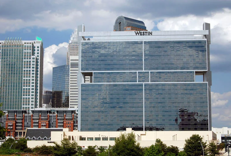

Charlotte/Uptown
The street grid of Uptown Charlotte is rotated forty-five degrees from compass north. If you stand at Trade and Tryon and look at a sign that says "North Tryon Street," you are actually looking northeast. The misalignment is original - the city was platted along the colonial roads, not along the cardinal directions - and it produces a small disorientation every visitor eventually notices. The four wards radiate from that crooked center: First, Second, Third, Fourth, each named in the early city plats and each still wearing the personality the centuries gave it. The skyscrapers in the middle, the banking towers that put Charlotte on the financial map, sit on top of all that older geometry like a glass crown on a colonial head.
Trade and Tryon, the Geographic Heart
The intersection of Trade and Tryon Streets is the geometric center of Charlotte - not a metaphorical center, an actual one, the point from which the wards were laid out and the city distances were measured. Standing there now, you are surrounded by Bank of America Corporate Center to the south, the historic Independence Building site, the Square sculptures by Raymond Kaskey representing Commerce, Industry, Transportation, and Future, and a constant churn of light rail, buses, and lunch-hour office workers. The same intersection was where William R. Davie's militia ambushed Lord Cornwallis on September 26, 1780. The same intersection was the colonial county courthouse. The same intersection has remained Charlotte's center for nearly two and a half centuries, which is a kind of urban continuity Americans rarely manage.
The Four Wards and What They Became
First Ward, for decades a tract of public housing, was redeveloped as mixed-income, mixed-use neighborhood in the late twentieth century - vibrant now, residential, with light rail and arena access threading through. Second Ward is the city's government center, lifeless after office hours, and carries a heavy history: it was Brooklyn, a self-sufficient African-American neighborhood erased by a 1960s urban renewal project that planners called slum clearance and historians have since called what it was. Third Ward holds Bank of America Stadium and Gateway Village, evolving fast around the future Gateway Station transit hub. Fourth Ward is the best-preserved corner of Uptown - shady streets, brick sidewalks, Charlotte's only remaining Queen Anne houses, Fourth Ward Park at the center. The wards used to be the whole city. Now they are pockets of older texture under the canyon of office towers.
Getting Around the Tilted Grid
I-277 wraps Uptown in a loop that is fast most of the time and frozen during events. Most visitors arrive by car and park in surface lots near the edge of the loop - cheaper than the decks closer to Tryon - then walk. Uptown is dense enough to walk; almost every attraction sits within a few blocks of another. The Lynx Blue Line light rail runs nineteen miles from the University of North Carolina at Charlotte through NoDa and Uptown to South End, then south along South Boulevard. The CityLynx Gold Line is a free streetcar - free, an unusual word in American transit - that runs from Plaza-Midwood through Uptown to Biddleville near Johnson C. Smith University. Buses serve everywhere. Horse-drawn carriages serve the romantic in warm months.
What There Is to See
The Levine Center for the Arts anchors the cultural district on South Tryon: the Bechtler Museum of Modern Art with its terracotta cube and mirrored Firebird, the Mint Museum Uptown for American art and craft, the Harvey B. Gantt Center for African-American Arts + Culture, and the Knight Theater for performances. Discovery Place Science on North Tryon is the science museum with the OMNIMAX dome - the largest IMAX Dome in the Carolinas. Bank of America Stadium sits at the Third Ward edge, six bronze panthers crouched at its entrances. The NASCAR Hall of Fame celebrates the region's racing heritage. Fourth Ward Park rewards a slow walk. The Charlotte-Mecklenburg Public Library on North Tryon, with its green copper roof, holds a third-floor archive of local history that most visitors never find.
Live and Loud
Speed Street in mid-May brings half a million people to Uptown for the Coca-Cola 600 weekend, shutting down streets and packing every hotel. The Fourth of July fireworks draw a hundred thousand to the center city; the Labor Day Parade is modest but established; the Charlotte Film Festival collaborates across multiple Uptown theaters. Comic-book collectors descend in July for the Heroes Convention at the Convention Center. The Duke's Mayo Bowl plays at the stadium in late December. Concerts at Bank of America Stadium have become more common since David Tepper bought the Panthers in 2018. Uptown can be quiet on a weekday evening when the office workers leave. It can also, with the right event on the calendar, be one of the loudest streets in the Carolinas.
From the Air
Centered at 35.2272°N, 80.8431°W. From the air, Uptown Charlotte is the unmistakable cluster of skyscrapers at the heart of the metro - Bank of America Corporate Center is the tallest at sixty stories. The I-277 loop forms a recognizable ring around the central business district. Nearest airport is Charlotte/Douglas International (KCLT) about 5 nautical miles west; Concord-Padgett Regional (KJQF) lies northeast. Best viewing altitude 3,000-6,500 feet; the skyline is visible from 30+ miles on a clear day.
Nearby Stories
- Battle of Colson's Mill 12 km away
- Kings Mountain Mine 13 km away
- Thyatira Presbyterian Church, Cemetery, and Manse 16 km away
- Andrew Jackson State Park 19 km away
- Charleston Naval Hospital Historic District 22 km away
- Hickory Motor Speedway 22 km away
- North Carolina Aviation Museum 29 km away
- Battle of Fishdam Ford 47 km away