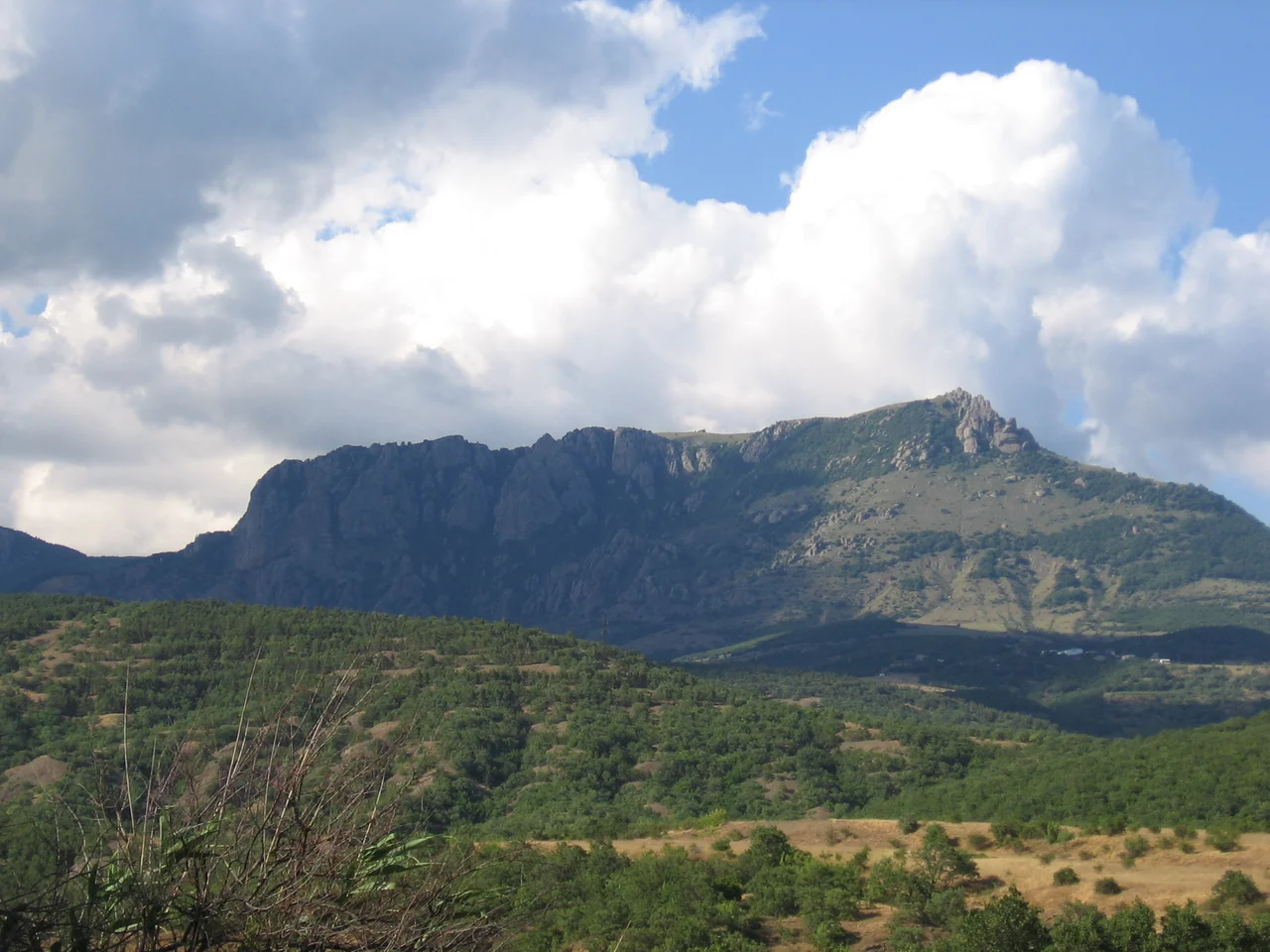

Chatyr-Dag
From the plains around Simferopol, one mountain stands apart from the rest of the Crimean range, its flat, sloping summit unmistakable against the sky. The Crimean Tatars named it for exactly what it looks like: Çatır Dağ, the Tent Mountain. Rising in isolation between Simferopol and the coast at Alushta, it does not so much peak as spread, a great pitched roof of rock and grass. Drivers on the highway below have watched its silhouette for centuries. What they cannot see from the road is that the mountain is hollow, threaded underneath with some of the most remarkable caves in Crimea.
Two Plateaus, One Roof
Chatyr-Dag is built in two tiers, and the difference between them is the whole character of the mountain. The lower, northern plateau slopes gently down into steppe grass, an open, sunlit expanse easy enough to wander. Toward its southern end, where it meets the steep rise of the upper level, it grows wilder, softened by beech forests and glades of juniper, with a grove of ancient yews clinging to the eastern side. Above it, reached by severe slopes, the upper plateau opens into a vast shallow bowl carpeted with alpine meadow, its rim broken by named summits. The highest of these is Eklizi-Burun, standing 1,527 meters above the sea, the summit of the Chatyr-Dag massif and one of the highest points in Crimea, though several peaks on the Babugan yayla to the west stand taller still. Those upper slopes are steep enough to draw rock climbers to multipitch routes, the kind of ascent that takes more rope than a single length can provide. It is a mountain of two moods, gentle below and formidable above, and a walker can pass from one to the other in the course of a single afternoon's climb.
The World Beneath the Grass
The real wonder of Chatyr-Dag is invisible from the meadows on top. The massif is honeycombed with caves, carved over ages as water dissolved its way through the limestone. Among them are the Marble Cave, one of the peninsula's premier show caves, and Emine Bair Hosar, along with a cluster of lesser-known passages that draw cavers and geologists alike. Walking the sunlit alpine bowl of the upper plateau, a visitor stands directly above a hidden underworld of stone. This is the paradox of karst country: the same rain that greens the surface is quietly excavating chambers below, so that the brightest, most open landscape conceals the darkest, most enclosed one just beneath the soles of your boots.
A Mountain for All Seasons
Chatyr-Dag rewards walkers year-round, though it wears each season very differently. In summer the lower plateau's trails wind through cool beech shade and juniper before opening onto the exposed upper meadows, where the wind never quite stops. In winter the plateaus vanish under snow, and the bowl of the upper tier becomes a stark white amphitheater rimmed by rock. The mountain's position, planted squarely between the inland capital and the seaside resorts, makes it one of the most accessible high places in Crimea, a full day's escape from the plains or the beaches. Few ranges pack so much variety, from steppe to forest to alpine tundra to cave, into a single tented silhouette.
The Landmark of the Plain
There is a reason the Crimean Tatars named this mountain the Tent Mountain and not something grander. Its flat, sloping crown reads unmistakably as a pitched roof, and that silhouette has served as a landmark for travelers crossing the peninsula for as long as people have lived here. Rising in relative isolation from the surrounding range, Chatyr-Dag is visible for great distances across the plain, a fixed point by which to steer. Approaching from Simferopol, drivers watch it grow along the highway that runs toward Alushta; approaching from the coast, hikers use it to orient themselves among the other summits. The mountain's Crimean Tatar name has outlasted empires and regime changes, a small durable act of naming that fixed a shape in the language. To see it once is to recognize it forever, a tent pitched permanently on the roof of Crimea.
From the Air
Chatyr-Dag rises at 44.75 degrees north, 34.30 degrees east, in the Crimean Mountains between Simferopol and Alushta. From altitude, its distinctive twin-plateau, tent-like profile stands out clearly from the surrounding ridges, with Eklizi-Burun the highest point on its western rim. The nearest airport is Simferopol International (ICAO UKFF), about 25 kilometers to the northwest. Expect changeable mountain weather and maintain safe terrain clearance.
Nearby Stories
- Object 100 8.1 km away
- Livadia Palace 11 km away
- Battle of the Alma 12 km away
- Novyi Svit Winery 13 km away
- Saky Air Base 16 km away
- Surp Khach Monastery 20 km away
- Taigan Safari Park 23 km away
- Abkhazia 523 km away