_crossing_the_North_Channel_of_the_Chesapeake_Bay_in_Northampton_County,_Virginia.jpg)
Chesapeake Bay Bridge-Tunnel
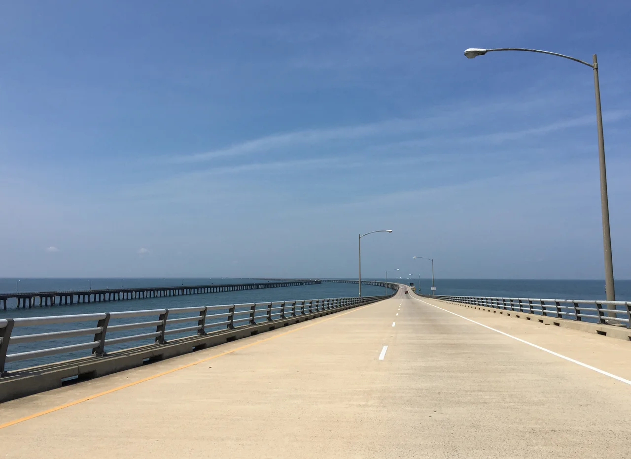
You are driving across open ocean. That is the only honest way to describe it. Cars on both sides, water everywhere else, and ahead of you the road simply ends — sinking into the Atlantic at a man-made island the size of five football fields. Then you are underwater, your headlights pushing through a concrete tube buried 100 feet below the keel of whatever supercarrier might be passing overhead. A mile later the road climbs out, runs across another stretch of open water, and dives again. This is the Chesapeake Bay Bridge-Tunnel, and when it opened on April 15, 1964, it was named one of the Seven Engineering Wonders of the Modern World.
The Problem They Had to Solve
The mouth of Chesapeake Bay is eighteen miles wide. For 357 years after John Smith mapped it in 1608, the only way across was by boat. The Virginia Ferry Corporation ran the route from the early 1930s, eventually scheduling ninety crossings a day. Storms shut it down. Backups stretched for hours. Meanwhile, the U.S. Navy needed unobstructed access to Naval Station Norfolk, the largest naval base on Earth. A conventional bridge tall enough for aircraft carriers would be vulnerable; a strike on it would close the harbor. The engineers' answer was elegant: build a bridge mostly, but dive under the two main shipping channels in tunnels anchored to artificial islands.
Building Islands in the Sea
The Sverdrup & Parcel engineers of St. Louis designed four artificial islands of about five acres each, raised from the bay floor with rock and sand barged from quarries onshore. The tunnels — the Thimble Shoal and the Chesapeake Channel — were prefabricated as enormous concrete sections, floated into position, sunk into trenches dredged into the bay bottom, joined underwater, then buried again. Twelve miles of low trestle, two miles of causeway, two pairs of high-level bridges, and two mile-long tunnels: 17.6 miles end to end, the longest bridge-tunnel complex in the world when completed. It took three and a half years and 1,500 workers. Seven died during construction.
Wind, Trucks, and a Continuous Cycle
The bridge requires inspection every five years. Inspection takes five years. The cycle therefore never ends — somewhere on the trestle, at any given moment, a crew is checking the steel. Tunnels carry their own hazards: a height limit of thirteen feet six inches that overheight trucks occasionally ignore, with expensive results. In April 2007 an oversized truck slammed the tunnel ceiling and closed the crossing for three weeks. Wind is the persistent enemy of the bridges themselves. When gusts exceed forty knots the gates come down — empty box trucks and motorcycles get held back, then everyone else. Strong winds have flipped vehicles on the trestle. Sixteen times since 1964, vehicles have gone over the rail entirely. Most of those drivers did not survive.
The Second Tube
The original facility was two lanes, one each direction. Traffic grew. A parallel set of bridges was dualized by 1999. The harder job — dualizing the tunnels — began in 2017 at Thimble Shoal. A purpose-built tunnel boring machine, drilling a forty-two-foot-diameter bore through the bay floor at depths reaching 134 feet below the surface, has been working at it ever since. The project's $756 million budget and 2023 completion date have both slipped; current estimates point to 2028. The Chesapeake Channel tunnel will be dualized later, possibly opening around 2040. When both are finished, you will be able to cross the bay without anyone in the oncoming lane forty feet away from your bumper.
From the Cockpit
From altitude the CBBT looks like a thin pencil line drawn across an enormous blue plate. The four islands sit like beads on a string; the tunnel approaches are visible as gaps where the line dips and reappears. Container ships and naval vessels enter and leave through the channels above the buried tubes. From the artificial islands, you can sometimes see fighter jets returning to Oceana, Coast Guard cutters working the shipping lanes, and — on the eastern shore, just past Fisherman Island — the empty pine forests of Kiptopeke and the Eastern Shore National Wildlife Refuge stretching north.
From the Air
The CBBT runs from 37.00°N, 76.11°W at the south end to 37.16°N, 75.97°W at the north, on a roughly north-northeast heading. From 5,000 to 8,000 feet AGL on a clear day the entire 17.6-mile structure is visible at once, including all four artificial islands. Nearest airports: Norfolk International (KORF) about 11 nm southwest of the south island, NASA Wallops Flight Facility (KWAL) about 35 nm north of the north island. The crossing lies within Class C airspace around KORF and very close to the active naval and air operations of NAS Oceana (KNTU) and Naval Station Norfolk — contact Norfolk Approach (124.55 / 125.2) before any transit below 5,000 feet. Restricted area R-6604 lies east over the Atlantic; carrier flight operations frequent the area. Visibility 6 statute miles or better recommended for full structural appreciation.
Nearby Stories
- Capitol (Williamsburg, Virginia) 4.7 km away
- Battle of the Chesapeake 5.7 km away
- Chesapeake Bay Impact Crater 8.8 km away
- Battle of Great Bridge 11 km away
- James River Reserve Fleet 13 km away
- Blackwater River (Virginia) 33 km away
- SS Monroe (1902) 50 km away
- Bodie Island Lighthouse 102 km away