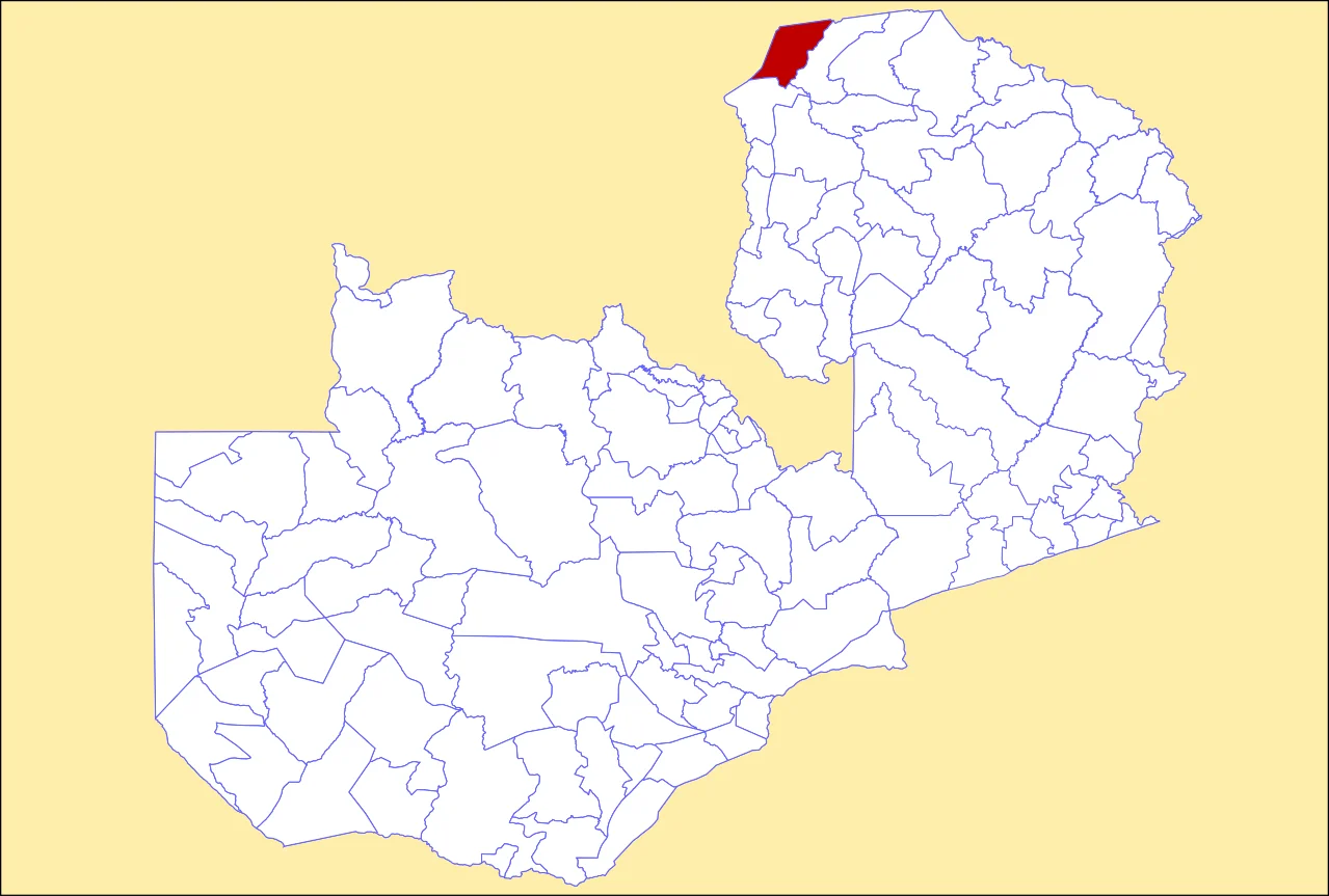
Chiengi District
On colonial-era maps you can almost see the accident that made Chiengi. A thin strip of land curling north along the eastern shore of Lake Mweru, hemmed in by the Kalungwishi River to the south and the Congolese border to the north, it was carved out of Nchelenge District after Zambia's independence in 1964 and given its own administrative life. Most of its 190,000 people live in fishing villages strung along 70 kilometers of lakeshore. The largest settlement is not the district headquarters at Chiengi town but a village called Puta, five kilometers south, named after the local chief whose family has ruled there for generations.
Lake Mweru Country
Lake Mweru lies on the Zambia-Congo border and drains northward into the Luapula, which will eventually feed the Congo River. For the people of Chiengi the lake is everything - protein, income, transport, weather. The shoreline villages run their boats onto shallow beaches in the morning and sort their catch on the sand: tigerfish, chisense, bream, occasionally a larger Nile perch. The fish dries on wooden racks and travels inland to markets in Nchelenge and beyond, or crosses the lake to the Congolese side where prices sometimes favor the trip. Puta, the largest village in the district, sits on one of the better landings. A bad road connects it to the district headquarters at Chiengi town. Everything else moves by water.
The Hills and What Used to Live There
Inland from the lake the land rises into a hilly wilderness - part of it now inside Mweru Wantipa National Park - where the district's eastern edge folds into rugged bush country. These hills have always been known for wildlife, though what remains today is a shadow of what was. Early colonial district officers hunted to feed themselves, and the district commissioner's residence at Chiengi boma had wooden bars built across the veranda so the officer could sit out in the evening while lions prowled through the settlement. Elephants used to come down to the dambo below the government buildings to feed. Most of those elephants are gone now - killed by poachers over the decades, with the survivors pushed into the national park or across the Congolese border. The bars on the veranda remain.
A District Without
Chiengi today is undeveloped by the standards of even its neighbors. The main road is gravel, frequently cut by rains and collapsing bridges, so that in the wet season the district can become functionally isolated from the rest of Zambia. As of the late 2000s there was no landline telephone service and no television signal; plans for a satellite link depended on funding that had not materialized. Things have improved at the edges - mobile phone coverage has reached the larger villages, and solar panels have put a few hours of electric light into homes that never had it - but the core experience of living here is still shaped by distance. Medical care is far. Secondary schools are far. The government vehicles that show up in the fishing villages are memorable enough that children still run to see them.
The View from the North
From the air, Chiengi shows as a narrow green fringe between the flat blue expanse of Lake Mweru and the hills that mark the beginning of the Democratic Republic of the Congo. In the wet season the Kalungwishi River to the south spreads into a wide floodplain that is almost indistinguishable from the lake's southern marshes. In the dry season the lake shrinks back, leaving muddy margins where herds of cattle from the Congolese side wade in to drink. The Mweru Wantipa National Park shows as a thick green mass in the district's interior - the refuge, for now, of whatever wildlife has managed to survive the century since the lions last walked past the boma veranda.
From the Air
Coordinates 8.48°S, 28.93°E - at the northern tip of Zambia's Luapula Province, on the eastern shore of Lake Mweru. No commercial airport in the district; the nearest service is Kasaba Bay Airport (FLKY) on Lake Tanganyika to the east, or small strips at Nchelenge further south. The nearest international hub is Ndola International Airport (FLSK/NLA) in the Copperbelt, roughly 600 km to the south. Lubumbashi in the DRC is actually closer but across a border with no routine commercial connection. Recommended visual altitude FL100-FL150 reveals the full Lake Mweru shoreline, the Kalungwishi floodplain, and the Mweru Wantipa highlands. Wet-season visibility can be poor with heavy convective buildups November-April.
Nearby Stories
- Dikulushi Mine 25 km away
- Lake Mweru Wantipa 32 km away
- Lake Mweru 70 km away
- Piana-Mwanga Hydroelectric Power Station 80 km away
- Marungu highlands 127 km away
- Moba, Democratic Republic of the Congo 160 km away
- Mbala District 163 km away
- Tanganyika Province 209 km away