.jpg)
Tanganyika Province
There is a phrase that appears in United Nations reports from the 2006 period of the Second Congo War: 'the death triangle of Manono-Mitwaba-Pweto.' Three towns in what is now Tanganyika Province, connected by bad roads through Mai Mai militia country, where neither the Congolese army nor the UN peacekeepers had reliable control. An estimated five to six thousand armed fighters, many of them small independent bands that had devolved into common banditry, operated in the area. That was one face of Tanganyika. The other is Lake Tanganyika itself - the longest freshwater lake in the world, fringed on the Congolese side by fishing villages, the port city of Kalemie, and forested mountains rising sharply from the water's edge. Today's Tanganyika Province is both of these things, trying to become more of the second and less of the first.
Born From a Split
Tanganyika is one of the 26 provinces the Democratic Republic of the Congo carved out of its older map in the 2015 repartitioning. Alongside Haut-Katanga, Haut-Lomami, and Lualaba, it emerged from the dissolution of the former Katanga Province, which had been one of the most economically powerful and politically restive regions of the country for decades. Tanganyika was formed from the old Tanganyika district, with the port town of Kalemie elevated to provincial capital. The new territory of the province corresponds roughly to the historic Nord-Katanga province that briefly existed between 1962 and 1966, during the chaotic early years of post-colonial Congo - when the Luba-Katanga people rebelled against the secessionist State of Katanga and the central Kinshasa government struggled to reassert control. Administrative history matters here because each boundary change left scars.
The War That Made the Triangle
In July 2006, during the dragged-out end of the Second Congo War, Katanga Province was fractured by fighting between the Rwandan-backed Rally for Congolese Democracy-Goma (RCD-G) and the Kinshasa-government forces, which were assisted by local Mayi Mayi fighters. Over time some of those combatants were absorbed into the Congolese army (the FARDC), but many Mai Mai elements never fully demobilized. UN peacekeepers in Kalemie estimated 5,000 to 6,000 armed militants remained active in the region, holding strongholds around Nyunzu, Kabalo, and Kongolo, and in the triangle formed by the towns of Manono, Mitwaba, and Pweto. Many of those fighters had lost their political causes years earlier. What remained was banditry - robberies, attacks on villages, extortion on roads. The civilians caught between the state, the UN, and the militia lived in a situation where no one could fully protect them. The death triangle got its name for a reason.
Kalemie and the Lake
Kalemie sits on Lake Tanganyika's western shore, a deepwater port town of perhaps 200,000 people that has been the province's anchor through every administrative incarnation. From here, ferries cross to Kigoma in Tanzania, carrying passengers and cargo between two of Africa's larger regional economies. The MV Liemba - the German-built ferry from 1913, originally the Graf von Gotzen, scuttled during World War I and raised again in 1924 - still runs parts of this route. Small fishing boats work the lake day and night for dagaa sardines and larger fish. Kalemie's location gives the province a crucial link to East African trade networks even when interior roads fail, and they often fail. In the rainy season, overland movement between Kalemie and the mining territories to the west can stop entirely. The lake remains open.
Governors and the Work of Peace
The political history of Tanganyika's leadership reads as a catalogue of the region's turbulence. Prosper Mwamba-Ilunga served twice as president of the old Nord-Katanga province in the early 1960s. Jason Sendwe - a major figure in the Balubakat political movement that opposed Katangan secession - served twice as president and died in 1964. Fortunat Kabange Numbi held the office briefly and also died in 1964. Ildephonse Masengo, Henri Ndala Kambola, Zoe Kabila (brother of the former president Joseph Kabila, serving 2019 to 2021), Julie Ngungwa Mwayuma (2022 to 2024), and Christian Kitungwa Muteba - the current governor - have each inherited a territory where governance, security, and economic development intersect with lingering consequences of war. The six territories of the province - Kabalo, Kalemie, Kongolo, Manono, Moba, and Nyunzu - each require their own mix of policing, reconstruction, and investment. Lithium at Manono, fish at Moba, copper at Pweto, and the lake that connects it all. Tanganyika is not yet at peace, but it is quieter than it was.
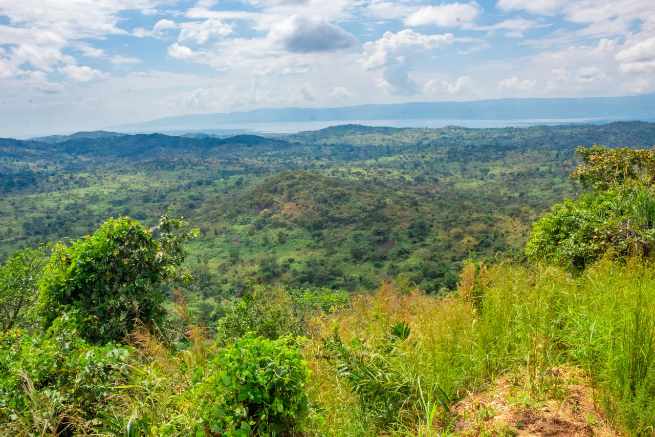
From the Air
Located at 6.69 degrees south, 28.07 degrees east in eastern DR Congo. Capital Kalemie sits on Lake Tanganyika's western shore. The province extends from the lake inland to the Lualaba River. From altitude, the dominant landmark is Lake Tanganyika itself running north-south along the province's eastern boundary, with the mountainous escarpment rising from its western shore.
Nearby Stories
- Luvua River 51 km away
- Piana-Mwanga Hydroelectric Power Station 71 km away
- Lake Uniamési 73 km away
- Niemba Ambush 74 km away
- Kalemie 103 km away
- Mpala 117 km away
- Marungu highlands 135 km away
- Luba Empire 196 km away