_-_geograph.org.uk_-_5423599.jpg)
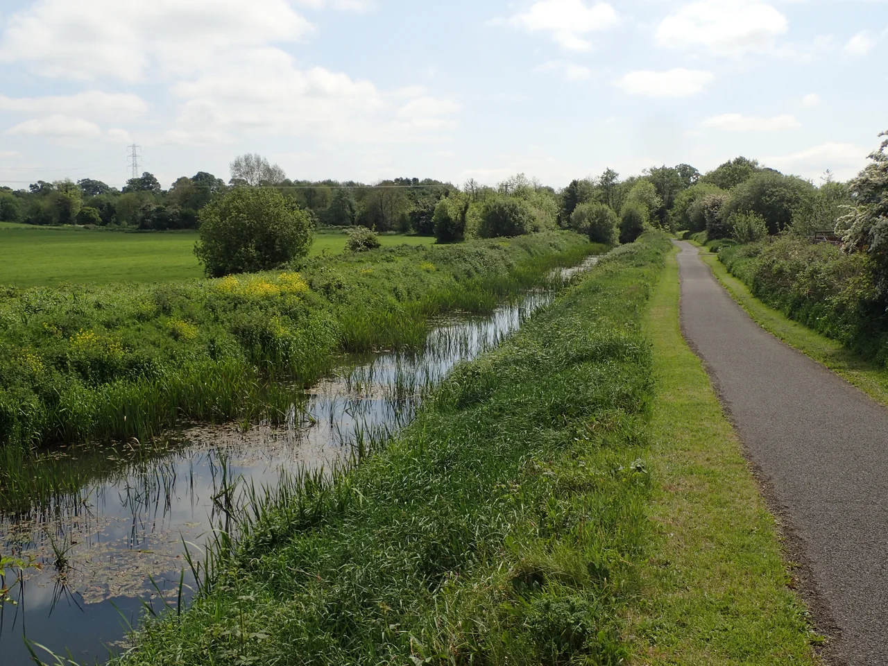
Coalisland Canal
It is hard to think of a more determined or more troubled piece of Irish infrastructure than the Coalisland Canal. Construction began in 1733 and the canal was not officially opened until 1787 - fifty-four years for 7.2 kilometres of channel and seven locks. By comparison the much longer Newry Canal took ten. Coal had been found in East Tyrone at the end of the seventeenth century. The pits at Drumglass could have supplied Dublin's entire fuel needs. All that was missing was a way to move the coal cheaply to market. The story of how the canal tried, and failed, and tried again - involving sand-built lock walls, peat-bog foundations, vertical shafts, inclined planes, and an exotic French-Italian architect called Davis Dukart - is one of the great epics of engineering optimism in Irish history.
A Mountain of Coal, No Way Out
By 1727, Dublin was importing 60,000 to 70,000 tons of coal a year from England and Scotland. The Tyrone coalfield at Drumglass, fifty miles inland, could have undercut every cargo on the Liffey - if only the coal could reach a navigable waterway. Thomas Knox, a colliery owner, had petitioned the Irish Parliament for a canal as early as 1709. Thomas Prior in 1727 and Francis Seymour in 1729 published further schemes. Arthur Dobbs, the Surveyor-General, sketched an alternative route to Lough Neagh. The Commissioners of Inland Navigation for Ireland, established in 1729, finally authorised work on a 4.5-mile canal from Coalisland to the River Blackwater in 1732. Acheson Johnson began supervising the project in the summer of 1733, and the troubles began almost immediately.
Built on Sand and Peat
The Coalisland Canal needed seven locks to drop 51 feet from the Coalisland Basin down to the River Blackwater. The upper two locks were sunk into sand. The lower three were sunk into peat bog. Both environments required piles and paved lock floors, neither of which was done properly. The River Torrent, which fed water into the basin, carried so much silt and clay that it clogged the channel almost as fast as it filled it. The lower reaches sat so close to the river that the canal flooded in wet weather and drained in dry. Public money kept flowing - £25,000 between 1746 and 1782 - but the canal still wasn't finished. By the time the Newry Canal had been open for thirty years, the Coalisland was still being patched together.
Dukart's Folly
If the main canal struggled, the extension to Drumglass became one of the most ambitious failures in eighteenth-century European engineering. In 1761 Parliament approved a plan for a three-mile canal from Coalisland up to the pits, rising through sixteen locks. Christopher Myers had managed half a mile and part of one lock when a French-Italian architect named Daviso de Arcort - known locally as Davis Dukart - was brought in for a second opinion. Dukart proposed something radical: two level sections of canal, largely in tunnel, with coal carried in boxes on small tub boats. The boxes would be lowered down vertical shafts onto barges on the canal below. By 1767 part of an aqueduct was built and £3,839 spent. The tunnels were abandoned in favour of inclined planes, called locally "dry hurries." William Jessop and John Smeaton, two of the era's most distinguished civil engineers, were consulted in 1773. Cradles replaced rollers. Counterbalances were tried. Nothing worked. Dukart's Canal opened in 1777 and was effectively shut by 1787 - the year the main canal was finally complete.
What the Canal Actually Carried
By the time the canal opened, the world had moved on. The Act of Union in 1800 made imported English coal cheaper to Dublin than Tyrone coal hauled down a leaky inland channel. The colliery owners gave up on the Dublin market. But Coalisland itself flourished as an industrial centre, importing raw materials by water and exporting tiles, bricks, earthenware, spades, shovels, sulphuric acid and sulphur. After 1812 the Office of Public Works dredged and rebuilt the channel. Traffic climbed from 8,200 tons in 1837 to 18,888 tons by 1866. The Lagan Canal Company bought the canal in 1888, deepened it, and ran 80-ton barges into Coalisland Basin. Between 1890 and 1900, traffic doubled to 36,000 tons and a £89 loss turned into a £355 profit. The canal had finally, after a century of struggle, become a paying enterprise.
The Quiet Death
The peak came in 1931 with 57,000 tons of grain, sand and coal moving along the canal and £650 of profit. Then road transport happened. By 1939 the company was making less than £50 a year. Wartime traffic was negligible. All traffic ceased in 1946. In April 1954 the Coalisland Canal was officially abandoned and relegated to a drainage ditch. The basin at Coalisland was drained in 1961 and now lies beneath a car park beside the Coalisland Cornmill. Most of the rest of the channel survives, owned by the local council and the Department of Agriculture. The Friends of the Coalisland Canal formed in the 1990s. In May 2003 they joined the Inland Waterways Association of Ireland, and in April 2008 they held a small boats rally on stretches of the canal that had not seen a boat in over fifty years. Whether the full waterway will ever sail again is an open question. The channel, mostly intact, is still waiting.
A Map Drawn in Quiet Water
Walk the towpath today and the engineering follies are still legible in the landscape. The aqueduct fragment over the River Torrent. The traces of inclined planes where Davis Dukart's tub-boats once tried to roll uphill. The seven locks of the main canal, some still holding water, some collapsed. The site of the basin under the supermarket car park. The Coalisland Canal is not famous - it never quite succeeded enough to be. But it is one of the most honest pieces of industrial heritage in Ulster, a record of what eighteenth-century Ireland tried to build with the technology and the political economy it had. Sometimes, in a place where almost everything has been argued over, it is useful to walk beside something that simply tried to move coal.
From the Air
The canal runs from Coalisland (54.55°N, 6.70°W) southeast to the River Blackwater at 54.51°N, 6.65°W, a stretch of about 7.2 km. Recommended viewing altitude 1,000-2,000 ft AGL to follow the canal's distinctive linear cut through the lowland fields east of Coalisland. The disused channel is most visible in winter and early spring before vegetation closes in. Nearest airfields: Belfast International (EGAA) about 30 nm northeast, City of Derry (EGAE) about 50 nm northwest. Lough Neagh shimmers just 3 km to the north - a useful navigational landmark.
Nearby Stories
- Milltown Cemetery 0.3 km away
- Carrickmore 2.5 km away
- Castlewellan Forest Park 5.9 km away
- Carncastle 7.4 km away
- County Monaghan 8.1 km away
- Ahoghill 9.1 km away
- Claudy bombing 11 km away
- Kingsmill Massacre 12 km away