_in_James_City_County,_Virginia.jpg)
Colonial Parkway
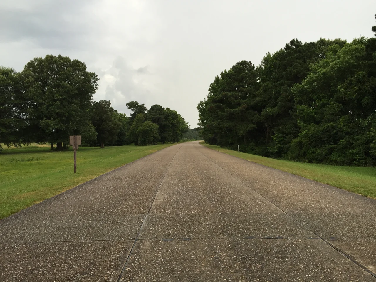
The pavement has no painted lines, just a fine grain of rounded river gravel set in concrete that catches the light differently from any other road in America. The Colonial Parkway runs 23 miles across the Virginia Peninsula, linking the three corners of the Historic Triangle - Jamestown, Williamsburg, Yorktown. There are no traffic lights, no commercial trucks, no billboards. At the Williamsburg midpoint, the parkway tunnels under the historic district so completely that visitors above can walk colonial streets without ever hearing a car. At the ends, the road runs right beside the James and York rivers, with pull-offs every few miles where Canada geese have the legal right of way. The parkway took 25 years to build and another 70 to defend from encroachment. It still holds the line.
Olmsted's Theory, Virginia's Road
The National Park Service surveyed the route in 1930, drawing a 500-foot right-of-way and rejecting the original inland routing along colonial roads. Instead, the parkway was aligned along the York River through U.S. Navy land - including the Naval Weapons Station at Yorktown and the former DuPont explosives factory complex at Penniman, later Cheatham Annex - to avoid grade crossings and what the engineers' notes called "visual junk." The design followed the parkway theory of Calvert Vaux and Frederick Law Olmsted, the designers of New York's Central Park: limited access, broad sweeping curves, a landscaped right-of-way devoid of commercial development. To reinforce a colonial feel, culvert headwalls and overpasses were clad in Virginia-style brick laid in English and Flemish bonds. Molded coping rails, string courses, and buttresses borrowed prototypes from buildings in Williamsburg. The result is an Olmstedian parkway dressed in eighteenth-century brick - one of the most coherent pieces of designed landscape in the country.
Twenty-Five Years
Construction started on the ten miles between Yorktown and Williamsburg, on land the Navy gave the Park Service for free. The road reached Williamsburg by 1937. After debate, the planners decided to tunnel under the historic district rather than around it. The tunnel was finished by 1942 - just in time to be sidelined by World War II. Structural problems and flooding kept it closed until 1949. During the war, the Navy closed the parkway through its lands for convoy training, building new utility lines and access roads across the road. In 1945, the Navy agreed to halt all transports on the parkway and help restore the landscape it had torn up. The final stretch to Jamestown was completed for the 350th anniversary of Jamestown's founding. Workers rebuilt the isthmus to Jamestown Island, which had been severed by weather since the colonial era. The full parkway opened for traffic on April 27, 1957.
Drive It Slow
The Colonial Parkway is, on paper, a road. In practice, it is something closer to a long pull-off with a few scenic detours through trees. The speed limit is 45 mph for most of the route, 35 in a few stretches, enforced by National Park Service rangers. There are no painted lane lines. The river gravel surface gives the road an earth-tone color that disappears into the surrounding landscape, especially in autumn. Hurricane Isabel in 2003 inflicted significant natural damage and forced sections of the parkway to close for repairs - the cost of running a road along two tidal rivers. Canada geese, by long custom and the rangers' tacit assent, have the right of way. Cyclists share the road. The Parkway hosts heavy commuter traffic at certain hours of the day, but its narrow brick overpasses and unmarked lanes keep speeds honest.
The Murders
Between October 1986 and September 1989, eight young people - four couples - were murdered along or near the Colonial Parkway. The killings became collectively known as the Colonial Parkway murders. Cathleen Thomas and Rebecca Dowski were found in their car off the parkway in October 1986. David Knobling and Robin Edwards disappeared a year later, their bodies recovered along the Ragged Island Wildlife Management Area. Cassandra Hailey and Richard Call vanished in April 1988. Daniel Lauer and Annamaria Phelps disappeared in September 1989. In January 2024, DNA evidence conclusively linked Alan Wilmer Sr. - a waterman from the Northern Neck who died in 2017 - to the murders of Knobling and Edwards. In January 2026, the FBI Norfolk Field Office officially connected Wilmer to the 1986 murders of Thomas and Dowski, and he has since been confirmed as the killer in additional cases. The parkway's beauty does not erase what happened on it. The pull-offs at the river ends remain quiet places to look out across the water, but decades of silence finally broke when forensic science delivered answers the families had waited nearly forty years to hear.
Three Points
At the western end of the parkway lies Jamestown Island, where the Virginia Colony was founded in 1607 on the bank of the James River. At the midpoint is Williamsburg, where the colonial capital moved in 1699. At the eastern end is Yorktown, where General Cornwallis surrendered to George Washington in 1781, completing the American Revolution. The road exists to connect these three points. The trees overhead are mostly hardwood, shading the road in spring and summer, blazing in October, bare in February. The brick overpasses have weathered into something that looks older than 1957. From the air, the parkway threads through forest as a single dark green ribbon, broken only where it crosses the bridges and emerges to run beside the rivers. Drive it once, slowly, and you understand why the National Scenic Byway program named it one of just 31 All-American Roads.
From the Air
The parkway runs about 23 miles between Jamestown (37.21°N, 76.78°W) and Yorktown (37.24°N, 76.51°W) via Williamsburg. From the air, identify it by its narrow, unbroken green corridor of trees crossing the Peninsula, with brick overpasses at major highway crossings (I-64, U.S. 60, Route 199, U.S. 17). The Williamsburg tunnel is invisible from above; the road simply disappears for a few thousand feet. Best viewed 2,000-4,000 feet AGL. Nearest airports: Williamsburg-Jamestown (KJGG) at the western end, Newport News/Williamsburg International (KPHF) southeast.
Nearby Stories
- Siege of Petersburg 5.4 km away
- Battle of Gwynn's Island 7 km away
- Norfolk: The Navy's Capital Where the Fleet Calls Home 7 km away
- Southside (Richmond, Virginia) 11 km away
- Chesapeake Bay Bridge-Tunnel 24 km away
- White House (plantation) 25 km away
- Suffolk, Virginia 27 km away
- Fort Christanna 52 km away