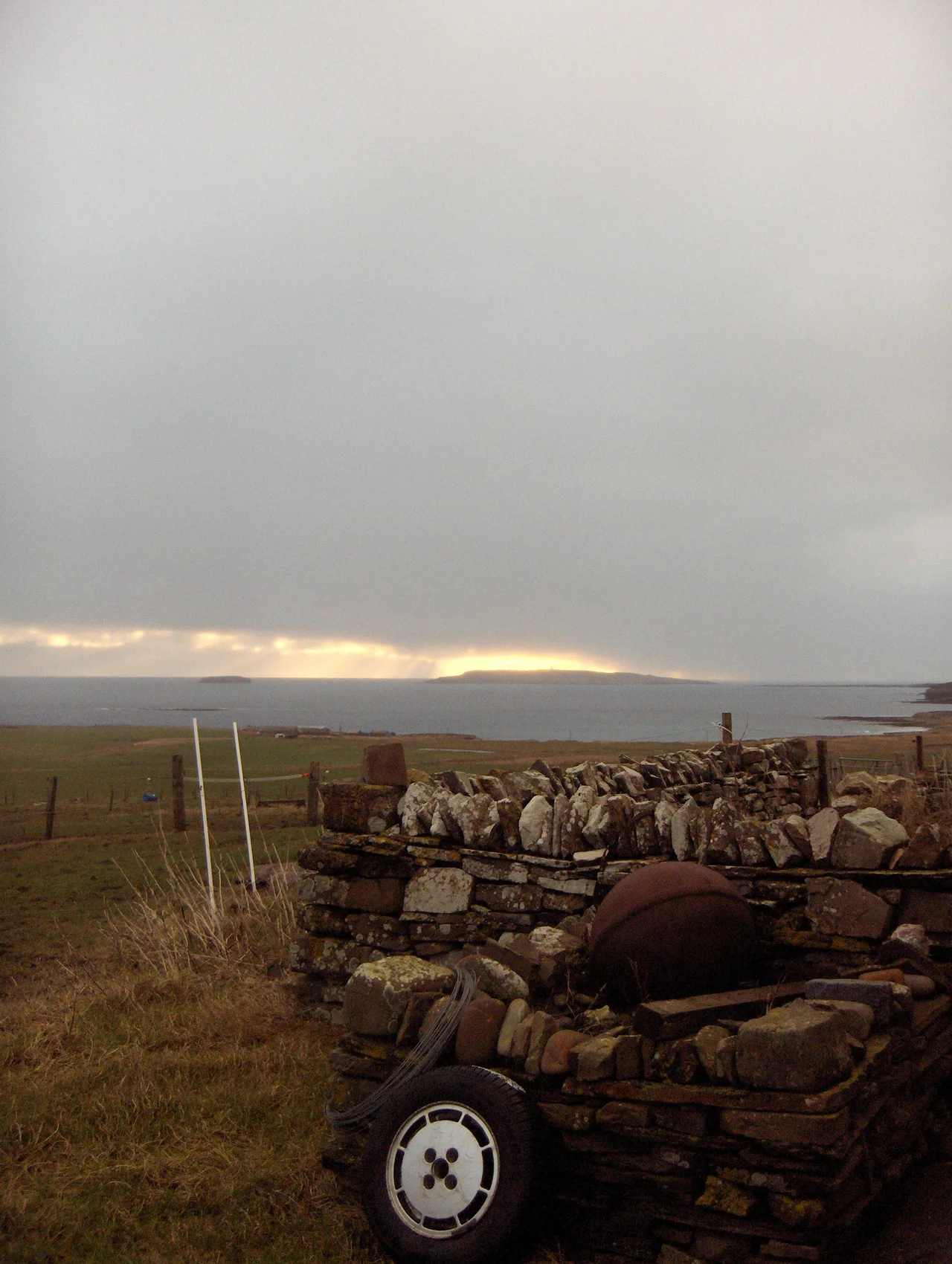

Copinsay
In 1958, the last people moved off Copinsay. They left a two-storey farmhouse, a steading behind it, a schoolhouse, and the houses of three lighthouse-keeping families. Their cattle had crossed to the Orkney mainland on the cow boat. The men who used to be lowered over the cliffs to gather bird's eggs no longer needed to be lowered. Today the island is owned by the RSPB - bought in 1972 in memory of the naturalist James Fisher - and the only year-round residents are seabirds. The fields are still farmed, in a way, but the farming is done for the birds.
Life on the Cow Boat
Copinsay sits a short distance off the east coast of Mainland Orkney, with a smaller companion island, the Horse of Copinsay, to the northeast. For generations the community on the island - a few families at the farm, a schoolteacher, the lighthouse keepers - lived a life closely tied to weather and to the boats. A weekly postal service connected them to the Mainland. Fortnightly shopping trips went to Deerness on the Mainland, weather permitting, which it often didn't. The farm kept horses, cattle, and sheep, and all of them had to be loaded onto the cow boat to make any change of residence. Children learned in the island schoolhouse. Three lighthouse keeper families lived on the slopes near the lighthouse, manning the rotating watches that kept the lamp burning. The cliffs gave the islanders something else: seabird eggs, which were a steady supplement to the diet.
The Pigs of the Horse
Among the more peculiar agricultural practices on Copinsay was the one that involved the smaller island next door. Each spring, the islanders rowed pigs across to the Horse of Copinsay and let them loose. The Horse was uninhabited, with no farming and no people, but it had cliffs full of nesting seabirds and the ground around the nests was carpeted in eggs. The pigs ate the eggs all summer - free-range, free-feeding, fattening on protein nobody else was going to harvest. Men were sometimes lowered over the cliffs on special ropes to bring back eggs for the islanders themselves, or rowed out to the Horse to gather them by hand. The whole arrangement was a small example of how island communities, when no one was watching, made elaborate use of whatever resources their geography happened to provide.
What They Left Behind
By 1958 the population had dwindled to the point where the last residents made the decision that island life was no longer viable. They went to the Mainland. The farmhouse stood empty. The schoolhouse stood empty. The lighthouse, by then automated or close to it, no longer needed three families to keep it lit. The Royal Society for the Protection of Birds bought the island in 1972, in memory of James Fisher, the British naturalist and broadcaster who had died in a car accident two years earlier. Fisher had been one of the most influential figures in twentieth-century British natural history, the author of definitive works on seabirds, and a colleague of Peter Scott and David Attenborough. Buying Copinsay in his name made sense: this was a seabird island, and the cliffs around it were among the finest seabird breeding sites in Orkney.
A Patchwork of Yesteryear
Today the RSPB still farms some of Copinsay's fields - not for produce but for habitat. Corncrakes need certain kinds of grassland, mown at certain times, with certain plants left standing. The result is a patchwork of yesteryear, as the RSPB puts it - the agricultural patterns of a vanished community kept alive on a depopulated island for the sake of birds that can't tell the difference. Copinsay and three adjacent islets - Corn Holm, Ward Holm, and Black Holm - together form a Special Protection Area under European conservation law, and the island is also an Important Bird Area designated by BirdLife International. The grey seals come ashore each November to pup. The puffins visit in July, mostly on the holms. The Copinsay Brownie - a domestic spirit of Orcadian folklore said to haunt the island - still has the place largely to himself. The Deerness community across the water still tells stories about who used to live here. The houses still stand.
From the Air
Coordinates 58.898N, 2.677W. Copinsay sits off the east coast of Mainland Orkney, a small island about 3 nm offshore from the Deerness peninsula. From altitude the island shows as a green clifftop with the lighthouse on its eastern point and the Horse of Copinsay to the northeast. Best viewing altitude is 1,500-3,000 ft for the bird cliffs. Nearest airport is Kirkwall (EGPA), about 9 nm west. Weather is typical Orkney - persistent wind, frequent low cloud, often hazy visibility. The Pentland Firth lies to the south, the Stronsay Firth and the rest of the Orkney archipelago to the north.
Nearby Stories
- Heart of Neolithic Orkney 2.8 km away
- Castle of Mey 7.9 km away
- Pentland Skerries 16 km away
- HMS Daring (H16) 22 km away
- Orcadian Basin 35 km away
- Fair Isle 42 km away
- Jarlshof 103 km away
- The Laki Eruption: The Volcano That Changed World History 956 km away