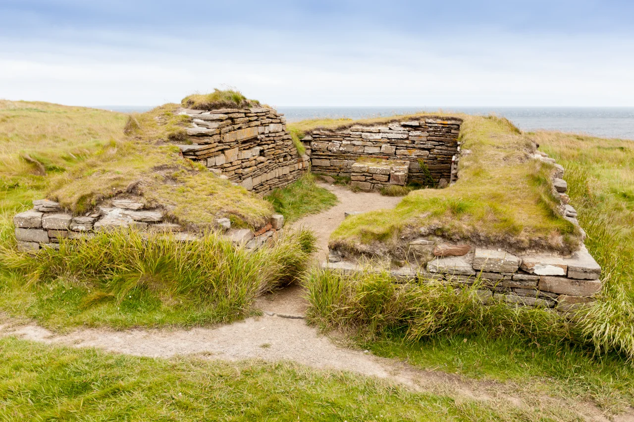

Heart of Neolithic Orkney
Stonehenge is famous. The Pyramids are famous. The Heart of Neolithic Orkney is older than both, and most people have never heard of it. Within a few square miles of the Orkney Mainland sit four monuments built by people who lived five thousand years ago, before metal tools, before written language, before the wheel reached Britain. A passage grave aligned to the winter solstice. A standing stone circle that may be the oldest henge in the British Isles. A larger stone circle that took an estimated eighty thousand hours to build. And the best-preserved Neolithic village in northern Europe. UNESCO inscribed the lot as a World Heritage Site in December 1999. The Neolithic visitors who walked between these places, in a single afternoon, would have seen the entire spiritual centre of their world.
Maeshowe and the Vikings Who Vandalised It
Maeshowe is a passage grave, a chambered cairn aligned so precisely that the rays of the setting winter solstice sun strike the back wall of the central chamber. The Stone Age builders who placed it understood the year better than most people understand it now. Two and a half thousand years after they finished it, a band of Vikings broke in. They sheltered there from a storm, or perhaps just from boredom, and they carved their names and observations into the stones. What they left behind is one of the largest collections of runic inscriptions in the world. The runes range from boastful (someone called Ofram the son of Sigurd announces himself) to crude graffiti about women and treasure. Five thousand years of human use, two distinct languages, one tomb.
Two Stone Circles
The Standing Stones of Stenness predate the more famous Ring of Brodgar. Only four megaliths remain of what was once a circle of up to twelve, but the largest still towers six metres above the ground. Radiocarbon dates place its construction around 3100 BCE, making it possibly the oldest henge in the British Isles. The Ring of Brodgar, less than a mile away, is younger and more spectacular: a stone circle 104 metres across, originally composed of sixty stones set inside a circular ditch up to three metres deep. Archaeologists estimate the structure took eighty thousand man-hours to construct. That is the equivalent of forty people working full time for a year, on a single ceremonial monument, in a society that had no metal tools.
Skara Brae, Frozen in Sand
Skara Brae is the showpiece. Eight stone-built houses cluster on the shore of the Bay of Skaill, connected by covered passages, furnished with stone beds and dressers and hearths that any modern Orcadian would recognise as a place to live. The village was occupied for around six hundred years between roughly 3180 and 2500 BCE, then abandoned. Sand drifted over it, and there it stayed for forty centuries until a winter storm in 1850 stripped the dunes and exposed it to the world. The preservation is so complete that you can see where the residents stored their pottery and where they kept their freshly butchered meat. It is the closest thing in northern Europe to a Stone Age Pompeii.
The Ness That Was Not Invited
When UNESCO inscribed the Heart of Neolithic Orkney in 1999, nobody knew about the Ness of Brodgar. The site, a 2.5-hectare archaeological complex sitting on the narrow neck of land between the Stenness and Brodgar circles, was only identified in 2003 after a geophysical survey turned up unexpected anomalies. What came out of the ground over the next twenty years rewrote what archaeologists thought they knew about Neolithic Britain. A massive stone wall, multiple decorated buildings, painted plaster, a structure described as a Neolithic 'cathedral' with walls four metres thick. The Ness is not part of the official World Heritage Site, but Historic Scotland concedes that it 'contributes greatly to our understanding' of the four that are. The excavations were filled back in for preservation in August 2024.
The Climate Reckoning
These monuments stood through five millennia of weather. They will not necessarily stand through the next century. In 2019, Historic Environment Scotland completed the first ever application of the Climate Vulnerability Index to a cultural World Heritage property. The verdict was sobering. The entire site, and Skara Brae in particular, is rated 'extremely vulnerable' to climate change. Rising sea levels, more intense rainfall, and the risk that a single severe storm could partially destroy the village. The same dunes that preserved Skara Brae for five thousand years cannot protect it from sea-level rise. The institutions that manage the site are racing to document, stabilise, and where necessary record digitally what might soon be lost in physical form.
From the Air
The Heart of Neolithic Orkney spans the area around 59.00°N, 3.19°W on the west-central Orkney Mainland, between the Lochs of Stenness and Harray. Kirkwall Airport (EGPA) is 12 km east, with paved facilities and limited instrument approaches. From 2,000 to 3,000 ft AGL, the two lochs form a distinctive figure-eight, with the Ring of Brodgar visible as a faint circle on the northwestern isthmus, the Stones of Stenness visible as a small cluster on the southeastern isthmus, Maeshowe as a low mound to the east, and Skara Brae on the Bay of Skaill on the west coast. Westerly winds frequently exceed 30 kt, and visibility can collapse rapidly. The site is best photographed from the east in late-afternoon light.
Nearby Stories
- Castle of Mey 9.7 km away
- Copinsay 12 km away
- HMS Sword Dance (1918) 27 km away
- Strathnaver Museum 28 km away
- HMS King Edward VII 35 km away
- Fair Isle 74 km away
- Jarlshof 135 km away
- The Laki Eruption: The Volcano That Changed World History 926 km away