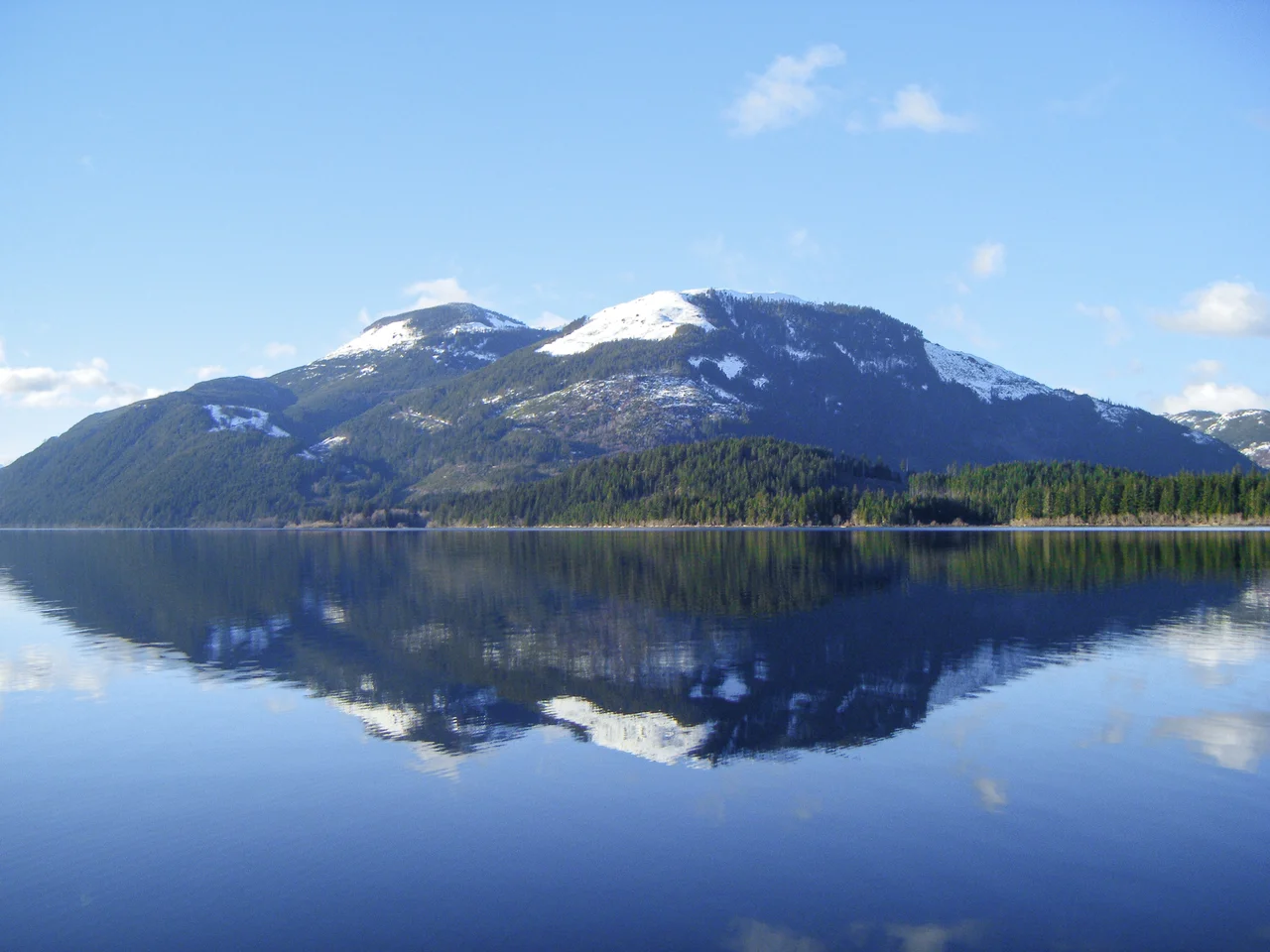

Cowichan Lake
A lake thirty kilometres long is held in place by a wall shorter than a kitchen counter. The weir at the east end of Cowichan Lake stands 97 centimetres above the water, and in the driest weeks of a Vancouver Island summer that modest lip of concrete and steel is what decides whether the Cowichan River keeps running. Everything downstream depends on it: the salmon, the towns and farms that draw on the river, the tubers who drift the river on August afternoons. It is a strange thing to stand at the outlet in Lake Cowichan and realise how thin the margin is between a lake and a riverbed.
Kaatza, the Lake
Long before it was a resource, it was simply home. The Ts'uubaa-asatx Nation, known until recently as the Lake Cowichan First Nation, take their name from a phrase meaning People of the Lake, and the lake itself carries the name Kaatza, which translates plainly and completely as "the lake." Some places do not require elaboration. The nation's people were known for cedar canoes, crafted here and traded outward to neighbouring groups including the Ditidaht on the island's west coast. The wider Cowichan name comes from the Salish confederation of the surrounding valley and is usually rendered as "the warm land," a description anyone who has spent a July week in this basin will recognise as accurate.
The Shape of the Water
Cowichan Lake runs roughly west to east for about 30 kilometres, narrow for most of its length and widening to some four kilometres at its broadest. Its eastern shore sits about 28 kilometres west of Duncan, deep enough into the mountains that the drive in feels like a departure. The town of Lake Cowichan occupies the east end, where the lake tips over into the Cowichan River, and it is the largest community on the water. Along the south shore lie Mesachie Lake and Honeymoon Bay, with Gordon Bay Provincial Park between them and the timber. Across on the north shore is Youbou. The shoreline in between stays strikingly undeveloped, not through protection but through ownership: timber companies have held most of the surrounding land for generations.
When the Mills Ran
This valley was once one of the great lumber centres of British Columbia, and the lake was its working surface. Logs came down off the slopes and out across the water; two major railways pushed spur lines around and along the shore to carry the timber east. Mills anchored the communities, and the communities existed because of the mills. The last of them was the operation at Youbou, which closed permanently in January 2001 and had its equipment auctioned off that June. A mill town without its mill has to become something else, and Youbou has spent the years since doing exactly that, turning from an industrial address into a lakeside one.
Iron to Gravel
The railways went quiet, but their grades remained, and grades built for locomotives make superb trails. The abandoned lines around Cowichan Lake now form part of a public trail network that runs eastward down the valley, and its centrepiece stands well downstream: the Kinsol Trestle, completed in 1920 on what became a Canadian National route, carrying 187 metres of timber framework 44 metres above the Koksilah River. The last train crossed it in 1979. It stood derelict for nearly three decades before rehabilitation work began in 2008, and it reopened to walkers and cyclists in July 2011. Crossing it, you are standing on the single most persuasive argument that industrial infrastructure can outlive the industry that built it.
A Metre of Margin
Return to the weir, because everything here eventually does. Built in the 1950s and operated under provincial licence in connection with the pulp mill at Crofton, it was designed to bank enough winter water to keep the Cowichan River flowing through the dry months. The design assumptions of the 1950s no longer match the summers the valley now gets. Low-flow years have arrived with uncomfortable regularity, and the river that supports one of Vancouver Island's most storied salmon runs has come close to failing in late summer. A replacement weir with greater storage capacity has been the focus of a long regional effort. It is an unglamorous piece of engineering to care so much about, and the valley cares enormously.
From the Air
Cowichan Lake lies at 48.875 N, 124.26 W in the mountains of southern Vancouver Island, roughly 28 km west of Duncan and about 30 nm northwest of Victoria. Best viewing altitude is 4,000 to 6,000 feet, high enough to take in the full 30 km east-west length of the lake in one sweep against the surrounding forested ridges. Key visual landmarks: the narrow bright ribbon of the lake itself, unmistakable amid dark timber; the town of Lake Cowichan and the outlet weir at the extreme east end where the Cowichan River begins; Youbou on the north shore and Honeymoon Bay on the south; and the patchwork of cutblocks on the surrounding slopes that traces a century of logging. Nearest fields are the small airport at Duncan about 15 nm east and Victoria International (CYYJ) roughly 35 nm southeast; Nanaimo Airport (CYCD) lies to the north. Valley fog is common on calm mornings, and summer smoke from regional wildfires can sharply reduce visibility.
Nearby Stories
- Port Alberni 1.7 km away
- West Coast Trail 3.8 km away
- Harris Creek Sitka Spruce 4.8 km away
- Kinsol Trestle 4.8 km away
- Chemainus 5.6 km away
- Englishman River Falls Provincial Park 6.3 km away
- Alberni Inlet 14 km away
- Bowen Island 32 km away