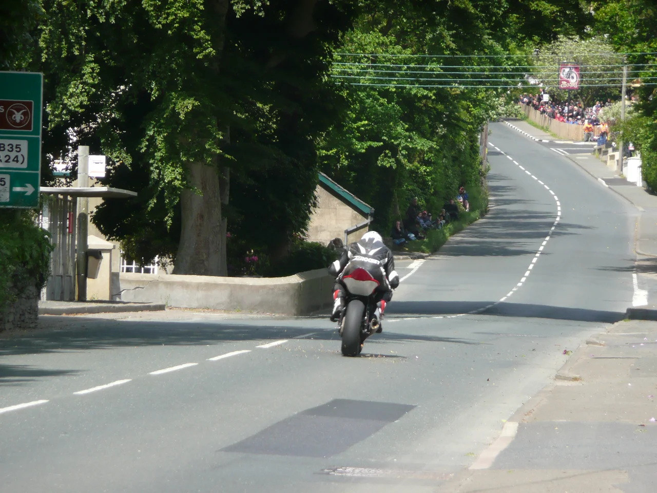

Crosby
For one week every year, the road through Crosby is closed to cars and given over to motorcycles travelling at well over a hundred miles per hour. The village of about 900 people, sitting at the crossroads where the A1 from Douglas meets the smaller roads to Mount Rule and Garth, becomes one of the watching points on the legendary Isle of Man TT Mountain Course. The rest of the year it is a quiet place: a play park, a football pitch, a cricket ground, a Methodist chapel, a pub, and an old stone church whose oldest walls go back to the twelfth century. Crosby's name comes from the Gaelic Baile na Croise, the town of the cross, and the crossroads have shaped its identity for at least a thousand years.
Where the Roads Meet
Crosby lies in the centre of the parish of Marown, halfway between Douglas and Peel on the A1, the island's primary east-west road. The River Dhoo flows just to the south, running down the Central valley toward the capital. The village name itself is geography in shorthand: cross-town, cross farm, the place where roads meet a market. About 900 people live here today, which makes Crosby small enough to know your neighbours and large enough to support a football team. Marown F.C., founded long before the village had any kind of national fame, plays its home games at the Memorial Playing Fields. Crosby Cricket Club, founded in 1946, shares the same site. The amenities map of the village reads like a generous list of necessaries: a children's play park, a chapel, a pub. The pub has another role too, as a popular spectator spot for the TT.
An Old Church, a New Use
St Runius is the old parish church of Marown, and it sits in Crosby. Parts of it go back to the twelfth century. It was expanded in 1754 and then, when a newer parish church was built up the road in 1859, the old building was demoted to a mortuary chapel. Part of the east side was demolished. For a century it slowly decayed, used for funerals rather than weekly worship. Then in 1959 a restoration was completed and the church was reopened on 9 August. It now hosts services through the summer and on the major festivals of the church year - Christmas, Easter, Whitsun. A second place of worship sits nearby: Crosby Wesleyan Methodist Chapel, opened on 6 October 1833, when Methodism was sweeping through the small towns of the British Isles. Both buildings are still in use, in a village where a thousand-year continuous Christian presence is not particularly remarkable.
A Station That Outlived Its Line
Crosby got its railway station on 1 July 1873, when the Isle of Man Railway opened the Douglas-to-Peel line through Marown. The station served until 7 September 1968, when the line closed. Ninety-five years, then nothing. The station was demolished, but the trackbed survives. It is now the Heritage Trail, a walking and cycling route that follows the old rail alignment across the centre of the island. The crossing keeper's cottage, on the east side of the village, was preserved and turned into a shelter for walkers. There is also a language centre nearby: Marown Language Centre, a foreign-language teaching facility and a training centre for teachers, sits close to the old St Runius church. A trail, a language school, a Norman-era church, a Victorian chapel - the village reuses its old infrastructure as quickly as it loses it.
Crosby Crossroads, 1911 and After
Motor racing came to the Isle of Man very early, partly because the island had its own government and could legalise road racing while Britain still banned it. From 1906 the Crosby section of the A1 was part of the Highland Course, used for the early Tourist Trophy car races. Between 1906 and 1922 the RAC Tourist Trophy ran here. In 1911, the Four Inch Course - which included Crosby crossroads and the village itself - was first used by the Auto-Cycling Union for motorcycle racing. That course evolved into the Isle of Man TT Mountain Course, the most famous and most dangerous road race in the world. Since 1911 it has been used for the TT, and from 1923 for the Manx Grand Prix. Riders pass through Crosby travelling at around 170 miles per hour. Spectators stand a few feet away, behind hay bales and steel barriers, in the same village where children play in the park on quieter weeks.
From the Air
Located at 54.180 degrees north, 4.567 degrees west, geohash gcsu0, in the centre of the Isle of Man on the main Douglas-to-Peel valley. The nearest airport is Isle of Man (Ronaldsway) Airport (EGNS / IOM) about 12 km to the south-east. Across the Irish Sea, alternates include Belfast City (EGAC), Liverpool John Lennon (EGGP) and Blackpool (EGNH). From cruising altitude, look for the lower central valley of the island, with the River Dhoo glinting south of the village and the line of the old Isle of Man Railway (now the Heritage Trail) tracing across the green country between the eastern and western coasts.
Nearby Stories
- St Bees Lighthouse 15 km away
- Celtic Array 22 km away
- Kirkmaiden 23 km away
- Isle of Whithorn 23 km away
- Seascale Lifeboat Station 31 km away
- German submarine U-1024 36 km away
- SS Georgetown Victory 40 km away
- Blackpool Illuminations 56 km away