Cuyamaca Peak
On the clearest days, standing at Cuyamaca Peak's 6,512-foot summit, you can see two bodies of water simultaneously: the Pacific Ocean to the west, and the Salton Sea filling its desert basin to the east. The Coronado Islands appear to the southwest, small dark shapes on the water. In between lies the whole geography of San Diego County — coast, chaparral, mountains, desert — compressed into a single panorama that spans more than 60 miles. It is the kind of view that makes the 3.5-mile hike from Paso Picacho feel like a reasonable trade.
Second Highest in San Diego County
Cuyamaca Peak rises to 6,512 feet, making it the second-highest point in San Diego County behind Hot Springs Mountain in the Santa Rosa Mountains. The peak anchors the Cuyamaca Mountains, a cluster of summits that includes Stonewall Peak and Middle Peak. The surrounding state park takes the Kumeyaay name: "Ah-Ha Kwe-Ah Mac," meaning the place where it rains, a description that reflects the elevation-driven orographic precipitation that distinguishes this high country from the desert terrain to the east. The peak itself is accessible via a trail from Paso Picacho Campground, gaining roughly 1,600 feet over 3.5 miles — manageable, but not trivial.
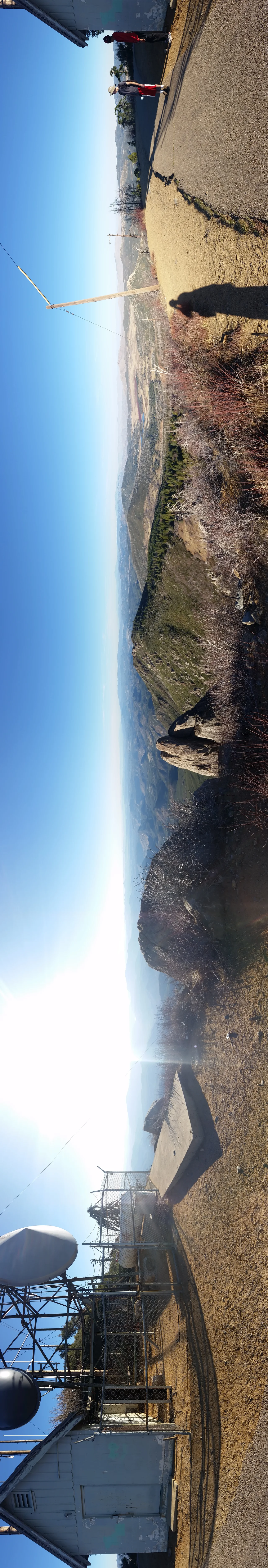
The Cedar Fire's Mark
In October and November 2003, the Cedar Fire swept through the Cuyamaca Mountains with a ferocity that left most observers stunned. The fire burned virtually all of the forest on Cuyamaca Peak — mature conifers, oaks, and the dense understory that had developed over decades. The summit and its approach trails, previously shaded by established woodland, were stripped bare. By 2007, observers were noting visible regrowth — the chaparral recovering first in the characteristic way of California's fire-adapted landscapes, with shrubs resprouting from root crowns and annuals filling the open ground. The forest recovery continues, slower than the chaparral, measured in decades.
What the Summit Shows You
The panoramic view from Cuyamaca Peak is genuinely unusual in that it encompasses two such different landscapes simultaneously. Most high points in San Diego County reveal one dominant direction — coastal to the west, or desert to the east. The Cuyamaca summit, sitting at the precise hinge point of the Peninsular Ranges, shows both. The Pacific, visible on clear days, confirms how close the ocean remains even at these elevations. The Salton Sea, shimmering below sea level in the Colorado Desert, illustrates how quickly the landscape drops away to the east. Between them, the chaparral-covered ridges and the agricultural grid of the valleys tell the story of the county's geography in a single glance.
Kumeyaay High Country
Before it was a state park, before the Stonewall Mine brought its brief gold rush and its boomtown, before the ranching era, Cuyamaca Peak was Kumeyaay high country. The mountain and its surroundings hosted seasonal camps, acorn harvesting, and the cultural activities that connected the Kumeyaay communities of the coast to those of the desert through this elevated middle ground. The name Cuyamaca itself derives from Kumeyaay language, though its precise meaning has been recorded in different ways. The landscape carries this history in its place names, its spring locations, and the trails that follow routes established long before European maps acknowledged they existed.
Recovery as a Continuing Story
Twenty-plus years after the Cedar Fire, the ecological recovery of Cuyamaca Peak is still ongoing. The post-fire landscape has its own character — more open, more shrub-dominated, the remaining standing snags from 2003 becoming wildlife habitat as they decay. New conifers have established in places, seedlings that will take a century to reach the size of what burned. Hikers who climb the peak today see a mountain in the middle of its own story: not the climax forest that existed before the fire, not the raw moonscape of immediate aftermath, but something in between — a landscape actively working its way back toward complexity.
From the Air
Cuyamaca Peak stands at 32.947°N, 116.606°W at 6,512 feet elevation, the dominant high point visible in the Cuyamaca Mountains of eastern San Diego County. The summit is visible from both directions on Interstate 8 and clearly identifiable from cruising altitude. Montgomery-Gibbs Executive Airport (KMYF) and Gillespie Field (KSEE) are the nearest facilities to the west. At altitude, the peak's position between coastal and desert terrain makes it a natural waypoint in the visual landscape of the San Diego backcountry.
Nearby Stories
- Fish Creek Mountains Wilderness 1.7 km away
- Black Mountain Open Space Park 5 km away
- La Jolla Complex 7.6 km away
- Naval Amphibious Base Coronado 8.2 km away
- Temecula Massacre 8.6 km away
- Salton City: The Beach Resort That Became a Wasteland 10 km away
- Mountain Warfare Training Camp Michael Monsoor 10 km away
- Antique Gas and Steam Engine Museum 17 km away