
Cyclades
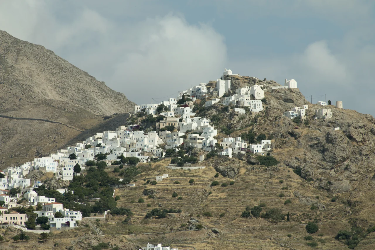
The word *kyklos* means circle in Greek. The Cyclades take their name from the ring they form around Delos, a tiny island that the ancient world considered one of its most sacred places — the mythological birthplace of Apollo and Artemis, so holy that no one was permitted to be born or die on its shores. The islands that orbit Delos carry that history in their bones. Some 2,200 islands, islets, and rocks make up the archipelago; 24 are inhabited. Together they constitute the most recognisable image of Greece: white cubist villages stacked against hillsides, blue-domed churches bright against a cobalt sky, the Aegean running dark and glittering below.
The Circle Around Delos
The geography of the Cyclades is straightforward on a map and revelatory in person. The islands are scattered across the southern Aegean, south of Athens and north of Crete, in a rough arc that spans roughly 200 kilometres from tip to tip. Each island has its own character — Syros has an elegant neoclassical capital in Ermoupolis; Naxos is the largest and most self-sufficient; Folegandros and Amorgos remain relatively unhurried even in high season; Milos has volcanic geology and coloured sea caves.
Santorini and Mykonos are the names most travellers know, and both carry the weight of that fame: high prices, heavy crowds, and a polished tourism infrastructure that can feel like it exists in a separate world from the quieter islands nearby. They are genuinely beautiful, and they are genuinely expensive and busy. The Cyclades are large enough to accommodate both versions of themselves.
Islands of Wind and Light
The *meltemi* is the dominant fact of a Cycladic summer. This steady north wind funnels through the archipelago in July and August, strong enough to roughen the sea, cool the midday heat, and cancel ferry routes when it intensifies. Sailors love it. Swimmers learn to respect it. Windsurfers and kitesurfers chase it deliberately, heading to islands like Paros — which sits at the centre of the archipelago and acts as the main ferry hub — specifically for its reliable Aegean winds.
The light is the other constant. At this latitude, in summer, the sun angles through dry Aegean air with a clarity that has been attracting painters, photographers, and poets for over a century. The whitewash on the walls is not merely decorative; it reflects heat and light in equal measure, keeping interiors cool while making villages legible from kilometres away. Architecture and climate reached an agreement here centuries ago, and the result has become one of the most imitated visual styles in the world.
Getting There and Moving Around
The practical shape of a Cyclades trip is determined by the ferry schedule. From Piraeus, the main port of Athens, ferries run daily to most of the major islands. Faster catamaran services cut travel times roughly in half at roughly double the price. Rafina, the port closest to Athens International Airport (LGAV), is often a better starting point than Piraeus if you are flying in.
Within the archipelago, Paros functions as the hub — the island with the most ferry connections to the most other islands, making it a natural base for island-hopping. Ferries between islands can be cancelled in rough weather; seas are generally calmer at night, and the late evening and early morning departures are the most reliable. Outside the main summer season, schedules thin considerably, and some routes stop running entirely by November and resume in April.
For the Paros and Antiparos area specifically, the nearest airport is Paros National Airport (ICAO: LGPA), with daily connections to Athens operated by Olympic Air and Aegean Airlines.
When to Come
The Cyclades are at their most photogenic and most uncomfortable in July and August: every beach is crowded, prices are at their highest, some islands face genuine water shortages, and the ferries are packed. The consensus among experienced travellers is that May through June — early season, when the infrastructure is open and the heat is moderate — and September through mid-October offer the best combination of access and space.
Winter on the Cyclades is a different world. Most tourist businesses close. The permanent populations go about their lives. The light is lower and the seas rougher. For those willing to accept limited services, the islands in winter reveal a character that high season never shows. A hot drink called *rakomelo* — raki, honey, and hot water — circulates in the tavernas from October onward, and it is exactly what the cooling Aegean evenings call for.
What the Islands Hold
Beyond the beaches and sunsets, the Cyclades contain layers of history that run from the Neolithic forward. Delos itself is one of the most extensive archaeological sites in Greece — an open-air museum of an entire ancient city, uninhabited today in keeping with a custom that goes back 2,500 years. On Paros, the Archaeological Museum holds fragments of the Parian Marble, a 3rd-century BC chronicle of Greek cultural history inscribed on the island's famous white stone. On the uninhabited islet of Despotiko, southwest of Antiparos, excavations since 1997 have been revealing a major sanctuary of Apollo that was, in its time, a significant pilgrimage site for the central Aegean.
The Cyclades are the Greece of the travel posters, yes. But they are also the Greece of ancient trade routes, Venetian castles, monastic islands, medieval villages built deliberately inland to avoid pirate raids, and seas that have been carrying people and ideas between the islands for at least 5,000 years. That history is present in every stone.
From the Air
The Cyclades span the central and southern Aegean at roughly 36.5°N to 37.5°N, centred near 25.2°E. From cruising altitude, the archipelago is visible as a scatter of pale, rocky islands against dark Aegean water — whitewashed villages distinguishable as bright clusters on the hillsides. The main regional airport is Paros National Airport (ICAO: LGPA) at 37.01°N, 25.11°E, serving the central Cyclades. Athens Eleftherios Venizelos (LGAV) is the primary international gateway, approximately 200 km to the northwest. Santorini (LGSR) and Mykonos (LGMK) also have airports with direct international connections in season. At 8,000–12,000 feet, the circular arrangement of the islands around the Delos area becomes visually apparent.
Nearby Stories
- Panagia Gremniotissa 13 km away
- Milos 17 km away
- Panagia Kanala 18 km away
- Delos 18 km away
- Serifos 19 km away
- Amorgos 27 km away
- 1956 Amorgos Earthquake 27 km away
- Ikaria 57 km away