
Douglas Harbour
On Friday 27 February 1948, Douglas Harbour became the first port in the world to be equipped with radar. The radar was watching for ships approaching one of the most treacherous patches of water in the Irish Sea: Conister Rock, the small islet known to Manxmen as St Mary's Isle, sits just north of the harbour entrance and disappears completely at high tide. For most of the harbour's history, ships had simply piled onto it in fog or storms. The Tower of Refuge had been built on the rock as a place to cling to until rescue came. Radar - new, untested, military-surplus technology - was a more modern answer to the same problem.
Two Harbours in One
Douglas Harbour is really two harbours separated by a bridge. The Outer Harbour, exposed to the sea, has two jetties, four piers, eleven berths and an area set aside for lifeboats. The Inner Harbour - now known as Douglas Marina - lies west of the Outer Harbour and shelters small boats and yachts. The two are separated by the Bascule Bridge, a 1979 pedestrian bridge that replaced an earlier steel swing bridge that had carried road traffic across the channel. The rivers Dhoo and Glass drain into the Inner Harbour. Until 2001 the Inner Harbour dried out at low tide, leaving boats sitting on mud. In that year the Flap Gate was installed, creating a half-tide dock where water levels could be maintained even when the sea retreated. Pontoons were added, the marina expanded, and small working boats and yachts could now stay afloat all day.
The Red Pier
The first proper pier at Douglas, the Red Pier, was begun in 1793 and completed in 1801. The foundation stone was laid by John Murray, 4th Duke of Atholl, who had just been appointed Governor General of the Isle of Man. The architect was George Steuart, a Scotsman whose reputation rested on country-house and church work in England. An earlier attempt at a pier had been started in 1760 but wrecked in a severe storm before completion. The Red Pier added a Georgian-era lighthouse at its end, ornate and decorative, the kind of small architectural set-piece that the eighteenth century enjoyed. The pier opened the island to packet steamers and made it possible to travel by sea from the Mersey to the Clyde via Douglas in twenty-five hours. By the 1830s, Sir William Hillary - the founder of the Royal National Lifeboat Institution - had begun arguing that Douglas needed a far larger harbour with proper breakwaters.
Abernethy's Breakwater Falls Down
Hillary's arguments dragged on for decades. Plans were drawn up by Sir John Rennie, then by Captain Vetch, then ultimately by James Abernethy, whose 1861 design was finally approved by the Lords Commissioners of the Admiralty. Work began in August 1862. The first storm season produced minor damage that was quickly repaired. Then, in May 1864, supporting timber frames gave way under the weight of stone placed on them. The frames had been set lower than the specification required - well below the 15-foot mark that was supposed to form the breakwater's true base. A storm in February 1865, described in the press as "unequalled in its fury and unexampled in its effects," tore through what remained of the structure. The construction was abandoned. On the night of Saturday 5 January 1867, an easterly storm with snow swept away the last of Abernethy's breakwater. Labourer Patrick MacAlinden had already been killed in the quarry adjoining the work, on 1 January 1864. The first attempt had cost lives and money and left nothing behind.
Coode, Hawkshaw, and the Music Hall Song
Governor Henry Loch commissioned new plans from John Coode, one of the leading civil engineers of the Victorian period. Coode's design met enormous opposition. A petition against it was signed by 182 mariners: 25 ship owners, 51 master mariners, 10 pilots and 96 other sailors. A music hall song called The Breakwater Dilemma, sung to the tune of Sweet Kitty Clover, mocked the entire scheme. The Reverend W. B. Christian argued that the calculations had not been adequately verified. Loch worked tirelessly to convince the doubters; he met Rev. Christian and explained the engineering in what was described as a conciliatory manner. A second engineer, John Hawkshaw, was brought in to review the work and largely agreed. Coode's own contemporary work on a breakwater at Port Erin would suffer repeated damage and be destroyed in 1884, having cost the island £45,600. But the Battery Pier at Douglas, eventually opened on 29 August 1879, survived. The Victoria Pier, opened 1 July 1872, had already added the deep-water berthing that tourism demanded. The King Edward VIII Pier, opened on 23 May 1936, completed the modern arrangement.
The Tower on the Rock
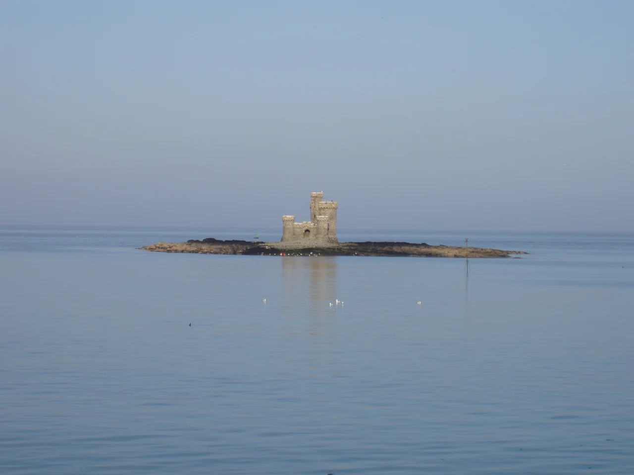
Conister Rock, the islet just north of the harbour entrance, was responsible for so many shipwrecks that it became the focus of one of the most distinctive small buildings in the British Isles. The Tower of Refuge was built on the rock so that sailors stranded by wrecks could have something to climb onto until lifeboats came. It still stands. It is visible from the Loch Promenade as a tiny medieval-looking castle apparently floating on the sea, with the tide rising and falling around it. The combination of the Tower of Refuge and the first radar installation in 1948 captures something about Douglas Harbour: it has always been a place where the practical demands of keeping ships safe pushed people to try things first - cheap medieval-style towers in the early nineteenth century, untested military electronics in the twentieth, half-tide flap gates in the twenty-first.
From the Air
Located at 54.148 degrees north, 4.474 degrees west, geohash gcsu4, on the south side of Douglas Bay on the east coast of the Isle of Man. The nearest airport is Isle of Man (Ronaldsway) Airport (EGNS / IOM) about 11 km to the south-west. Liverpool John Lennon (EGGP), Belfast City (EGAC) and Dublin (EIDW) are within short hops across the Irish Sea. From cruising altitude, look for the curve of Douglas Bay, with the harbour at the southern end protected by the breakwater of the Battery Pier and Victoria Pier. The Tower of Refuge is visible as a tiny castellated structure on Conister Rock just north of the harbour entrance; the line of the harbour with its piers and inner marina is unmistakable against the urban grain of central Douglas.
Nearby Stories
- St Bees Lighthouse 15 km away
- Celtic Array 22 km away
- Kirkmaiden 23 km away
- Isle of Whithorn 23 km away
- Seascale Lifeboat Station 31 km away
- German submarine U-1024 36 km away
- SS Georgetown Victory 40 km away
- Blackpool Illuminations 56 km away