
Douglas Head
In Manx the headland is called Kione Ghoolish, the Head of Douglas, and it sits at the southern lip of Douglas Bay like a hand cupped against the Irish Sea. Stand here on a clear day and the view sweeps north across the harbour, over the long arc of the promenade, all the way to the dark hump of Snaefell and the white houses scattered above Laxey. Stand here on a misty one and the wind throws gulls past your face and the only fixed point is the white tower of the lighthouse. A great many things have happened on this rock, most of them at the same time and most of them now gone.
Given to the People
Until 1870 the headland belonged to The Nunnery Estate. Then Sir John Goldie-Taubman handed a portion of it to Douglas Town Council, an unusual Victorian gesture that effectively dedicated the cliff to the public. The timing was perfect. Working-class tourism was booming, steam ferries crossed regularly from Liverpool, and Douglas itself was rebuilding around a two-mile promenade designed to absorb every holidaymaker the packet boats could deliver. Three steam ferries shuttled them across the harbour to South Quay, where they queued for the funicular up the cliff. By 1900 the headland was groaning with attractions: an open-air amphitheatre, a hotel, a camera obscura, a marine drive railway, a Black Mast viewing structure, a Warwick Tower, a tidal swimming pool at Port Skillicon, a clifftop restaurant. Most are gone. Some left footprints. A few left arches in the rock.
Stone Memorials
Three memorials anchor the headland's modern character. The first is a statue of Sir William Hillary, the Isle of Man resident who founded the Royal National Lifeboat Institution in 1824 and personally led the rescue of nearly a hundred men from the wrecked Vigilant on Conister Rock in 1822. Hillary lobbied for the Tower of Refuge on that same rock, visible from the headland, and the statue honours the man who first made the case that mariners deserved organised, volunteer rescue. The second is a large stone anchor placed for the bicentenary of the Battle of Trafalgar, dedicated to Manx sailors who served and died at Nelson's side. The third is a granite bollard from the Isle of Whithorn in Scotland, given in thanks after the Manx government recovered the bodies of the crew of the Solway Harvester, a scallop dredger that sank in January 2000, breaking with longstanding maritime tradition that had once left such recoveries to chance.
Listening to the Sea, and the Sky
During the Second World War the headland did not host tourists. It hosted radar. The Royal Navy established HMS Valkyrie here, a major shore-based radar station used for development, testing, and the training of operators who would carry the technology to ships across the fleet. The cliff's height and clear sea horizon made it ideal. After the war the headland returned to broadcasting of a gentler kind: Manx Radio launched in 1964 as the first licensed independent radio station in the British Isles, predating the BBC's local stations and the pirate ships that crowded the North Sea, and moved its operations to Douglas Head in 1969. Its transmitter mast still rises from the head.
Marine Drive, Closed for Repairs
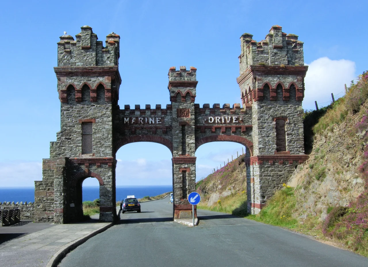
South of the head, Marine Drive curls along the cliffs toward Port Soderick, an extraordinary engineering achievement whose ornamental tollgate arch still survives at the Douglas Head entrance. Look inside the landside arch and you can see where the overhead tramway cable once attached to the stone, the only remaining hardware of the Douglas Southern Electric Tramway that ran on rails laid into the road from 1896 to 1939. The drive itself is now closed to through traffic because of recurring rockfalls, but stretches remain walkable and the views are exactly what Victorian promoters promised. The 1998 Irish comedy Waking Ned was partly filmed along these cliffs, a small modern footnote on a road whose audience has always been measured in surprises.
From the Air
Douglas Head is at 54.143 degrees north, 4.467 degrees west, the prominent rocky promontory immediately south of Douglas Bay. From altitude, identify it by the white lighthouse tower, the Manx Radio mast, and the long sweep of Marine Drive trailing south along the cliffs. The town of Douglas wraps around the bay to the north. Nearest airport: Isle of Man Airport at Ronaldsway (ICAO: EGNS), 9 nautical miles southwest. Sea fog and low-cloud conditions are common in approach to Douglas; the headland is often the first land feature visible to inbound mariners.
Nearby Stories
- St Bees Lighthouse 15 km away
- Celtic Array 22 km away
- Kirkmaiden 23 km away
- Isle of Whithorn 23 km away
- Seascale Lifeboat Station 31 km away
- German submarine U-1024 36 km away
- SS Georgetown Victory 40 km away
- Blackpool Illuminations 56 km away