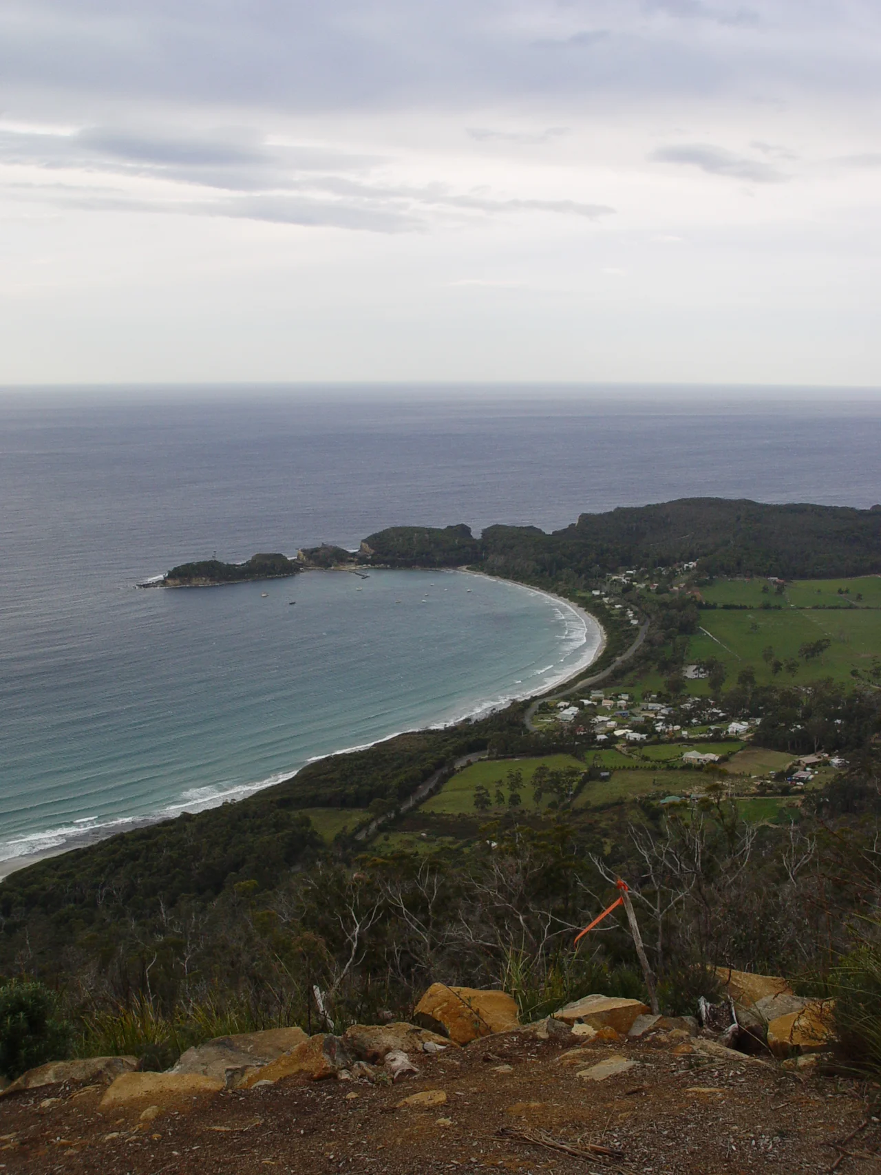

Eaglehawk Neck
Stand at the narrowest point and you could throw a stone across it. Eaglehawk Neck, officially dual-named Teralina, is a slender thread of sand and rock roughly 400 metres long and less than 30 metres wide at its thinnest, joining the Tasman Peninsula to the rest of Tasmania. For most of the 19th century this gap was the only way to walk off the peninsula, which made it the single most important door in one of the British Empire's most feared prison systems. Whoever controlled the Neck controlled the fate of thousands of convicts at Port Arthur, just down the road.
The Line of Dogs
The British did not trust soldiers alone to hold this gap. In 1832, Ensign John Peyton Jones of the 63rd Regiment proposed a cruder, more terrifying deterrent: a row of dogs chained across the isthmus, close enough to raise the alarm together but not quite close enough to fight one another. The Dog Line began with around nine animals and grew over time to as many as eighteen, a mix of breeds chosen for their ferocity. Lamps stood behind them so sentries could see anyone who tried to slip past in the dark. Some accounts placed dogs on platforms in the shallows as well, to close the gaps at the water's edge. The message to the convicts of Port Arthur was deliberate and constant: this way out is closed, and it has teeth.
Impassable, and Yet
Thomas Lempriere, a commissary officer at Port Arthur, declared Eaglehawk Neck simply impassable. The convicts disagreed, and a few proved him wrong. The bushranger Martin Cash, perhaps the most famous escapee of the era, got past the dogs by wading and swimming around the line out in the sea rather than testing it head-on. Guards spread rumours of sharks in the bay to discourage exactly this kind of attempt, and the water was bitterly cold besides. These were desperate gambles, and most who tried were caught. The punishments for recapture were severe, from floggings to time in the Separate Prison's silent cells. But the very existence of the Dog Line is a measure of something the records sometimes obscure: the men held on this peninsula never stopped trying to be free, and some were willing to risk cold water, sharks, and the lash for even a slim chance at it. The Neck was not impassable. It was simply designed to make the attempt feel like madness.
Where the Sea Breaks the Land Apart
The convict story is only half of why people come here now. Just south of the Neck, along Blowhole Road, the Tasman Sea has spent millennia carving the coastline into something theatrical. The Tasman Arch is a vast natural bridge of dolerite, the roof of a collapsed sea cave that swallows the swell beneath it. Nearby, the Devils Kitchen is a deep, raw chasm where the same collapse went further and left only a churning slot of water far below. A booming blowhole completes the set. These formations share a single origin: relentless ocean attacking cracks in hard rock until cave became arch and arch became canyon. It is the same patient force that, a little further along the shore, produced the famous Tessellated Pavement.
Pirates Bay and the Holiday Coast
Today the menace has drained out of Eaglehawk Neck, and what remains is a small coastal community wrapped around one of the prettiest beaches on the peninsula. The place was formally dual-named Teralina in 2021, restoring the original name alongside the colonial one. The long curve of Pirates Bay draws surfers to its eastern side, and in summer the population swells as families return to holiday shacks scattered along the shore. Clyde Island, at the bay's northern entrance, can be reached on foot at low tide and hides two old graves and a rumbling blowhole that splits the rock. The guards' quarters near the isthmus survive as a small museum, the last built reminder of the years when this beautiful, ordinary-looking gap was the most closely watched ground in Van Diemen's Land. Stand here on a bright summer afternoon, with children in the shallows and surfers beyond the break, and the contrast with the island's history could hardly be sharper.
From the Air
Eaglehawk Neck lies at roughly 43.02 degrees S, 147.93 degrees E, the pinched waist of the Tasman Peninsula about 50 km south-east of Hobart. From the air it is unmistakable: a thin sliver of land with Pirates Bay and the open Tasman Sea on the east and the sheltered waters of Norfolk Bay on the west. Look just south of the isthmus for the dark gashes of Tasman Arch and the Devils Kitchen along the cliff line. The nearest major airport is Hobart International (ICAO YMHB), about 45 km north-west; light aircraft use Cambridge Aerodrome (YCBG). The exposed eastern coast can be windy with quickly shifting sea fog, so plan for variable visibility over the cliffs.
Nearby Stories
- Cascade Brewery 9.2 km away
- Bruny Island 14 km away
- Maria Island 23 km away
- Mount Field National Park 59 km away
- Snowy River 547 km away
- Bundian Way 668 km away
- 2003 Fiordland Earthquake 1492 km away
- Doubtful Sound 1541 km away