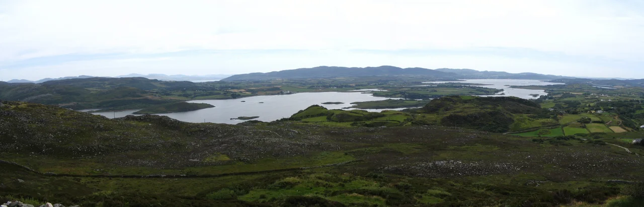

Fanad
Fanaid is the official name. Fanad in English. Fannet, in older records. The word comes from the Irish fana, meaning sloping ground, which describes precisely what this twenty-five-kilometre peninsula does: it slopes from the inland hills around Ramelton up and out into the Atlantic, ending in cliffs of granodiorite at Fanad Head. About seven hundred people live here. Thirty percent speak Irish. The peninsula's geology is mostly Dalradian quartzite, sculpted by ice sheets that retreated only about fourteen thousand years ago. The land you walk on today is the land the ice left behind. Some of it was probably sea floor as recently as ten thousand years back, when meltwater raised the Atlantic and drowned what is now the floor of Lough Swilly.
Mesolithic Hunters, Bronze Age Tombs
There is no direct evidence that Mesolithic hunters lived permanently on Fanad, only the reasonable assumption that they visited its coasts as they did most of Ireland's shorelines between 8,000 and 4,000 BC. The first hard evidence of settlement comes with the Neolithic farmers who arrived after 4,000 BC. They left megalithic court tombs at Tyrladden, Drumhallagh Upper, and Crevary Upper, and portal tombs at Gortnavern south of Kerrykeel and above Saltpans on the Swilly side. The portal tombs date roughly 3,800 to 3,200 BC. Bronze Age people followed, building stone circles near Rathmullan and burying their dead in cist graves whose contents have largely been lost. By the seventh century AD, the Cenel Conaill had spread north into Fanad, descended, the genealogies say, from Niall of the Nine Hostages himself.
The MacSweeneys and the Castle at Rathmullan
In or shortly after 1263, the O'Donnells, chieftains of Tir Conaill, granted the sub-chieftaincy of Fanad to the MacSweeneys. The MacSweeneys were galloglasses, mercenary warriors brought over from Scotland, and they took the job seriously. By the end of the sixteenth century they had built a castle at Rathmullan and a Carmelite monastery nearby. They also built the tower house at Moross on Mulroy Bay around 1532. Their rule lasted until the Plantation of Ulster broke the Gaelic order. The Church of Ireland came to Rosnakill in 1693. The Catholic chapel at Massmount near Tamney was built around 1780 on land donated by the Pattons of Croghan, an early Catholic emancipation gesture from a Protestant family. Layered identities are a Fanad specialty.
The Lighthouse and the Frigate
On 4 December 1811, the Royal Navy frigate Saldanha sank in a storm at the entrance to Lough Swilly. The wreck was the proximate cause of the lighthouse at Fanad Head, completed in 1818. By the 1837 description recorded by Samuel Lewis, the lantern stood ninety feet above the high-water mark and threw a deep red light seaward, with a bright fixed light into the lough. It could be seen, in clear weather, for fourteen nautical miles. The first lamp had limited reach; a more powerful one was installed in 1886. The three keepers' cottages now operate as self-catering holiday accommodation, the longest possible epilogue to the disaster that called them into existence. From the cliff path you can sometimes see the ghosts of small lobster boats working the same waters that swallowed the Saldanha.
Lord Leitrim and the Land War
On 2 April 1878, William Sydney Clements, the 3rd Earl of Leitrim, was assassinated near Cratlagh Wood by three local men: Neil Shiels, Michael McElwee, and Michael Heraghty. Leitrim held vast estates in northern Fanad, from Glinsk to Doaghbeg, and his reputation among his tenants was, by every contemporary account, terrible. His killing happened just as the Land War was beginning. In the decades that followed, the Irish Land Acts dismantled landlord domination throughout Fanad. The Bartons of Portsalon, Henry Letham along Mulroy Bay, and Thomas Norman around Tamney all eventually sold to their tenants. Fanad's population, which had peaked at about 10,344 in 1841 and crashed to 8,244 after the Famine, kept declining: 5,778 in 1891, 2,846 in 1961. The peninsula emptied itself slowly across a century.
Modern Fanad
Fanad today is quieter than it has been since the medieval period. The 2006 census counted 2,131 across four electoral districts. Fish farming in Mulroy Bay and on Lough Swilly provides some employment. Tourism brings seasonal income, particularly along the Wild Atlantic Way route from Fanad Head down through Portsalon and Rathmullan. The Harry Blaney Bridge of 2009 finally connected Fanad westwards to Carrigart and Downings, replacing the long detour through Letterkenny. Fanad United, the local football club, plays in the Ulster Senior League and is its most successful, with fourteen titles. Fanad Gaels (Gaeil Fhanada) keep Gaelic football and the Irish language alive in tandem. The peninsula slopes on, as the name says, toward an Atlantic that has shaped it for fourteen thousand years and counting.
From the Air
Located at 55.28N, 7.63W, on the north coast of County Donegal between Lough Swilly and Mulroy Bay. Nearest airports are Donegal (EIDL) 28 nm south-southwest and City of Derry (EGAE) 30 nm east. From cruising altitude, the peninsula is a long finger reaching north, capped by the white speck of Fanad Head Lighthouse. Knockalla Mountain, the high quartzite ridge running south from Fanad Head to Portsalon, is the most prominent feature inland. Atlantic visibility is variable; clearest in still autumn mornings.
Nearby Stories
- German submarine U-155 (1941) 7 km away
- Grianan of Aileach 8 km away
- Tory Island 8.9 km away
- Greencastle Lifeboat Station 9.2 km away
- Dungiven 12 km away
- The Rosses 21 km away
- German submarine U-1005 23 km away
- Bruichladdich Distillery 49 km away