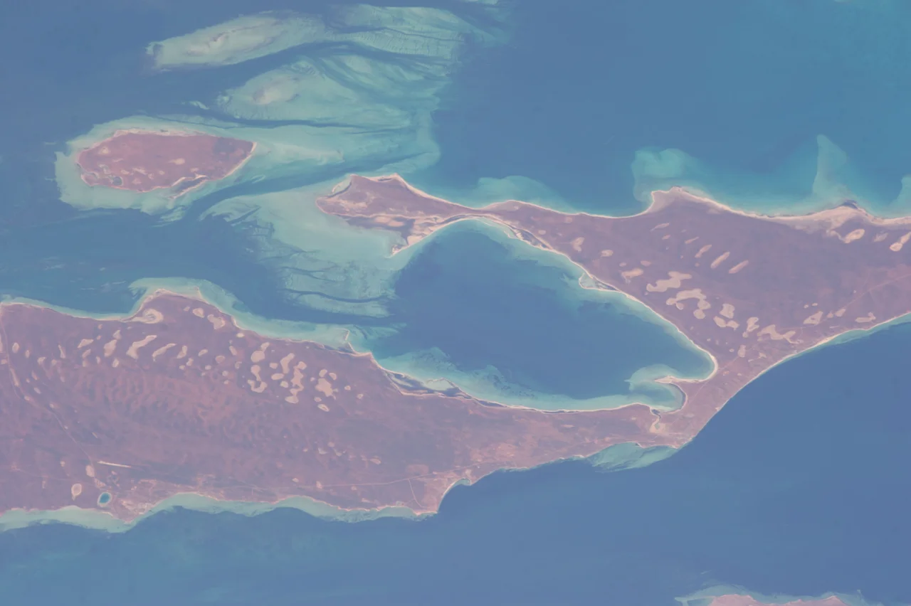

Faure Island
When the conservationists arrived on Faure Island in 1999, they began by counting sheep, and then removing them, more than 3,400 in all. The island had carried livestock for nearly a century, and feral cats hunted its dunes. Of the native mammals that once lived here, not one remained. But buried in the soil lay sub-fossil bones, the brittle evidence of small marsupials that had vanished generations earlier. Those bones were a blueprint. They told the new owners exactly which animals belonged here, and so began the slow work of building one of the most important wildlife arks in Western Australia: 58 square kilometres of low red sandplain, ringed by the turquoise shallows of Shark Bay, remade as a refuge for the nearly lost.
A Geographer's Island
Faure Island wears a French name, like so much of Shark Bay. Nicolas Baudin's expedition charted these waters in 1801, and Baudin named the island for Pierre Faure, the geographer aboard the corvette Le Naturaliste. The land itself is modest and low, its highest point just 26 metres above the sea. Red and white sandy plains roll across it, broken by claypans in the hollows and edged in places with limestone and red-sand cliffs that echo the nearby Peron Peninsula. Acacia shrubs dominate, with patches of mallee, spinifex, salt-tolerant samphire, and fringing mangroves. The climate is semi-arid and unforgiving: hot dry summers, mild winters, and an average of just 222 millimetres of rain a year, much of it erratic. Cyclones occasionally sweep through in summer, dumping water on a land that usually goes thirsty.
Sheep, Cats, and a Clean Slate
For most of the twentieth century, from 1905 onward, the Hoult family of Denham ran sheep and goats here, holding a pastoral lease that traced back to the 1870s. Livestock and the cats that followed European settlement did what they did across so much of arid Australia: they hollowed out the native fauna until nothing small and furred survived. In 1999 the Hoults sold the lease to the Australian Wildlife Conservancy, and the island's fortunes turned. The conservancy removed the sheep and then set about the harder task of eradicating the cats. They succeeded, and in doing so made Faure, at the time, the third-largest island anywhere on Earth from which feral cats had been completely wiped out. With the predators gone, the island became a blank slate, safe enough to fill again with the animals that belonged.
Bringing the Lost Home
Guided by those sub-fossil bones, the conservancy began reintroducing the mammals that had once lived here. The boodie, a burrowing bettong that builds warrens like a rabbit. The Shark Bay mouse, a soft-furred native rodent. The banded hare-wallaby, a small striped marsupial that survives in only a handful of places on the planet. The western barred bandicoot, now also known as the Shark Bay bandicoot. One by one, they took hold, and four species went on to establish self-sustaining populations, breeding and spreading without further help. Faure now shelters some of the largest populations of these threatened animals in existence. Not every attempt succeeded; an effort to reintroduce the greater stick-nest rat failed. Restoration is never guaranteed. But on this small red island, animals that had slipped to the edge of extinction are once again digging, breeding, and running free under the stars.
An Island of Birds
The wildlife above the waterline matters just as much as the mammals below it. Faure is a vital breeding ground for seabirds and a crucial stopover for migratory waders travelling the East Asian–Australasian Flyway, the great aerial highway that links Siberia to the Australian coast. Together with tiny neighbouring Pelican Island, it forms an Important Bird Area of more than 5,800 hectares, home to nesting fairy terns and to more than one per cent of the world's populations of red-necked stints and pied oystercatchers. Offshore, the island guards a secret of the bay itself: the Faure Sill, a vast underwater sandbank stretching from its shores, helps trap and concentrate the salty water that makes possible the ancient living stromatolites of nearby Hamelin Pool. Even the geography here is busy keeping rare things alive.
From the Air
Faure Island sits in the eastern arm of Shark Bay near 25.87°S, 113.88°E, roughly in line between the Monkey Mia resort to the west and the mouth of the Wooramel River to the east. From the air it reads as a distinct low landmass of red and white sand surrounded by pale turquoise shallows and seagrass banks, a clean waypoint for coastal navigation with no high relief to catch the eye. Shark Bay Airport at Denham (ICAO YSHK) lies about 35 km west; Carnarvon Airport (YCAR) is roughly 100 km north. The island is a private wildlife sanctuary with no public access, best appreciated from altitude. Recommended viewing height 2,500 to 4,500 feet; calm morning air gives the clearest read of the surrounding sandbanks and the Faure Sill.
Nearby Stories
- Shell Beach (Western Australia) 4 km away
- Dirk Hartog Island 21 km away
- Hartog Plate 31 km away
- Woodleigh Impact Structure 43 km away
- Pimbee National Park 64 km away
- Carnarvon Tracking Station 85 km away
- Eurardy Reserve 155 km away
- Chatham Islands 6500 km away