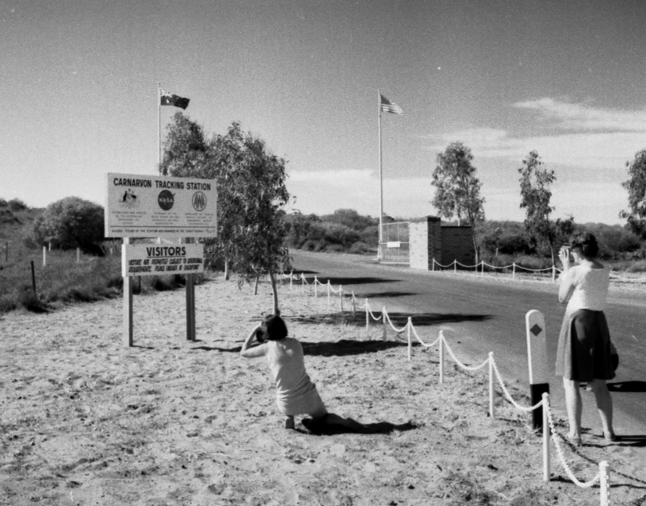

Carnarvon Tracking Station
When an Apollo crew left Earth orbit and lit the engine that would fling them toward the Moon, the command that authorised that burn often came from an unlikely place: a fenced compound of dishes and aerials in the red dirt ten kilometres south of a banana-growing town in Western Australia. For twelve years the Carnarvon Tracking Station was the largest NASA facility outside the continental United States, and because of where it sat on the curve of the Earth, it was frequently the last station to talk to a spacecraft before it slipped beyond the horizon and out over the empty Pacific.
A Station Built for the Moon
NASA opened Carnarvon in 1963 for Project Gemini, the two-man program meant to rehearse the skills needed for a lunar landing: rendezvous, docking, long-duration flight. It replaced an earlier station at Muchea, near Perth, and inherited some equipment from Project Mercury, the program that had first put Americans into orbit. Geography was the whole reason it existed. A spacecraft circling the Earth passes over Western Australia late in each orbit, and a station here could check a crew's status and systems at a decisive moment. As the agency expanded, so did the site, until it bristled with hardware: an FPQ-6 precision tracking radar, a scientific satellite network node, a system that monitored radio noise from the planet Jupiter, and a Solar Particle Alert Network watching the Sun for radiation storms that could endanger astronauts.
Go for the Moon
When the Apollo program turned toward the Moon itself, Carnarvon's position became critical. The trans-lunar injection, the engine firing that broke a spacecraft out of Earth orbit and committed it to the lunar trajectory, frequently happened over the southern hemisphere, and Carnarvon was the station positioned to uplink the command and confirm the burn. It was the prime link, too, during the tense final hours as returning capsules dropped back toward Earth. The crews never saw the place, but the controllers in Houston depended on the data flowing up from this patch of scrub. During the near-disaster of Apollo 13, Carnarvon's engineers earned a particular footnote in the rescue: as the crippled craft approached re-entry, they noticed two backup gyros had been left running and were drawing toward an overload that could have doomed the command module, and warned Houston in time.
The Last to Listen
After Apollo came Skylab, America's first space station, and Carnarvon tracked it too. But the program of which it was part, the Manned Space Flight Network, was always going to outlive its usefulness as communications satellites took over the job of relaying signals around the globe. Carnarvon's routine work ended on 4 October 1974, just after a pass of a small atmospheric-science satellite. The site kept enough capability for one last task, guiding the Helios-A solar probe onto its course on 10 December 1974. Then, on 18 April 1975, the last five staff closed the gates and walked away. To strengthen its link to Houston, NASA had even funded a second facility nearby in 1966, the OTC Satellite Earth Station, whose famous 'sugar scoop' antenna would carry the television of the first Moonwalk.
Foundations in the Scrub
What survives is mostly absence. After NASA left, the main building briefly housed Radio Australia, which needed a home after Cyclone Tracy flattened its Darwin transmitters at Christmas 1974, before that operation too shut down in 1996. The equipment was stripped out or buried, and nearly every structure was razed; only foundations and a single small building, now used by Telstra, remain. Yet the place is not entirely silent. Solar research that began under NASA still continues on the adjacent OTC site, which hosts a node of an international network listening to the Sun's vibrations. Engineers Australia has marked the station with an international engineering heritage award, and the nearby Carnarvon Space and Technology Museum keeps the story alive. Stand among the slabs at dusk, with the desert stars hardening overhead, and it is not hard to imagine the night this quiet ground helped send people to the Moon.
From the Air
The former Carnarvon Tracking Station sits at roughly 24.90°S, 113.72°E, about 10 km south of Carnarvon township and a few kilometres inland from the coast. Little remains visible from altitude beyond concrete foundations and the cleared site, though the nearby OTC station's large dish and 'sugar scoop' antenna are conspicuous landmarks just to the north-west. View from 2,000-4,000 ft in clear desert air; the flat red Gascoyne plain offers excellent visibility. Carnarvon Airport (ICAO YCAR) lies immediately north, roughly 12 km away, making this an easy overflight on approach. The coast and the mouth of the Gascoyne River lie just to the west.
Nearby Stories
- Bernier Island 3.7 km away
- Quobba 40 km away
- Hartog Plate 45 km away
- Francois Peron National Park 65 km away
- Pimbee National Park 75 km away
- Kennedy Range National Park 80 km away
- Gascoyne Junction 98 km away
- The Silent Wave: Java's 1994 Tsunami Earthquake 1572 km away