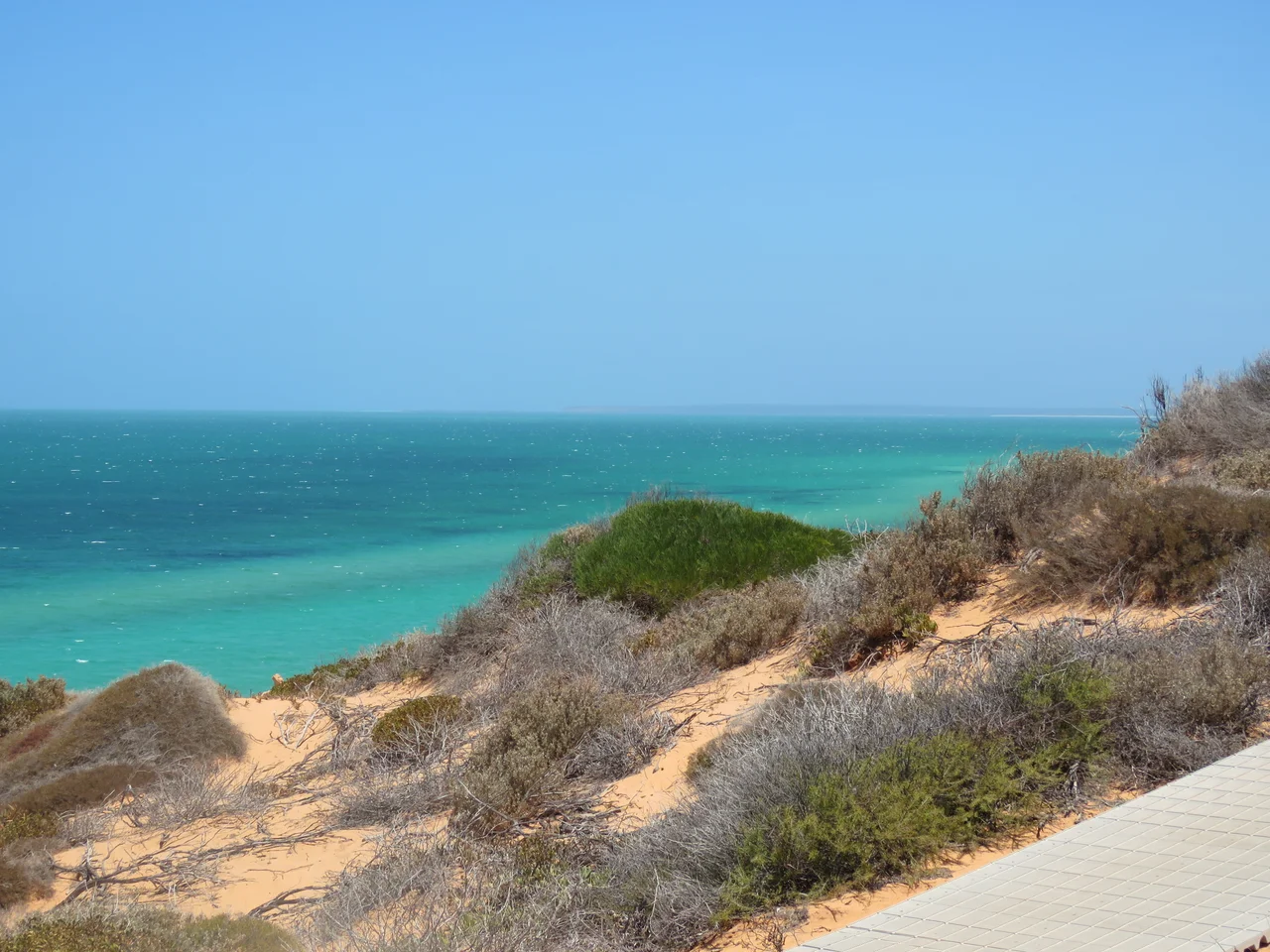

Francois Peron National Park
Stand on the cliffs at the tip of the Peron Peninsula and three colours fight for your attention. Behind you, dunes the deep rust-red of the inland desert. At your feet, sand bleached to brilliant white. And ahead, water of a turquoise so saturated it looks artificial. Few landscapes on Earth put the desert and the sea in such violent, beautiful collision. The Malgana people have known this country for more than 26,000 years and call it Wulyibidi. For most of the last century it was a sheep station. Today it is François Péron National Park, and the windmills that once watered livestock now mark the edge of an ambitious plan to undo a century of damage.
Where the Desert Meets the Reef
The drama is geological. The peninsula's red dunes are old inland sand, stained by iron, marching right to the lip of low cliffs. Below them the Shark Bay shallows glow with seagrass and clean white sand. From the clifftop lookouts at Skipjack Point, near Cape Peron, the water is so clear that the wildlife becomes a spectacle in itself. Patient watchers see manta rays glide past in slow formation, sharks cruising the drop-off, sea turtles surfacing for air, and the grey shapes of dugongs drifting over the grass. Inland, the flat plains are pocked with birridas, ghost-white clay pans that were once salt lakes, ringed with crusted gypsum. A high-clearance four-wheel drive and deflated tyres are the price of admission to the soft sand tracks that lead out to Bottle Bay and Big Lagoon.
The Sheep Station Years
For all its wildness, this land was worked hard. From the early 1900s the Peron Peninsula was a pastoral lease, Peron Station, where sheep grazed the fragile arid scrub. In 1922 station hands drilled an artesian bore, and three windmills pumped hot water from deep underground to nine watering points across the run. That same scalding bore still feeds an open-air tub at the old homestead, where visitors now soak in geothermal water that once kept the flocks alive. Decades of grazing, and the foxes, cats, and rabbits that came with European settlement, stripped the country of much of its native life. In 1990 the state government bought the lease, and in 1993 the land was gazetted as a national park, ending the era of sheep and beginning something far more unusual.
Project Eden
What followed was one of Australia's most ambitious experiments in restoration. Launched in 1995, Project Eden set out to do something close to impossible: turn back the ecological clock on an entire peninsula. When Baudin's French naturalists arrived in 1801, Shark Bay held 23 species of native mammal. By 1990, fewer than half remained, lost to grazing, rabbits, foxes, and feral cats. The peninsula's narrow neck made it defensible, so conservationists built a barrier fence, the Nanga Gate, and waged a relentless campaign of baiting against foxes and cats. Then, one species at a time, they tried to bring the lost animals home. Six were reintroduced. The work is slow, stubborn, and often heartbreaking: foxes were driven out, but cats proved tenacious, and several reintroductions failed even as bilbies and malleefowl took hold. Project Eden never restored the full menagerie, but it helped pioneer a model now used across Australia: protect the ground, then rebuild the wild upon it.
A Name from the Age of Sail
The park carries a French name from an age when France was racing Britain to claim this coast. François Péron was the zoologist aboard Nicolas Baudin's expedition, which spent seventy days charting Shark Bay in 1801. Péron was a driven, often exhausting man, and his shipmates left their names across the whole peninsula: Cape Lesueur for the expedition's brilliant young artist, and other capes and lakes for the French era. Long before the naturalists arrived, and long after the sheep departed, this has remained Malgana country. Wulyibidi endures beneath every European label, the oldest and truest name for a place where the desert spills into one of the most luminous seas on Earth.
From the Air
The park occupies the Peron Peninsula, centred near 25.70°S, 113.55°E, with Cape Peron at its northern tip about 726 km north of Perth. From the air the signature is unmistakable: a finger of red dune land thrust between the two turquoise gulfs of Shark Bay, fringed with white beaches and freckled with pale circular birridas. Denham and Shark Bay Airport (ICAO YSHK) lie at the peninsula's southern base; Carnarvon Airport (YCAR) is roughly 80 km north. Recommended viewing altitude 2,500 to 5,000 feet to capture the red-and-turquoise contrast and spot rays and dugongs in the shallows off Skipjack Point. Best light is morning, before the sea breeze hazes the coast.
Nearby Stories
- Shark Bay 5.6 km away
- French Western Australia 6.8 km away
- Useless Loop, Western Australia 13 km away
- Hartog Plate 41 km away
- Hamelin Pool Marine Nature Reserve 48 km away
- Gascoyne Junction 140 km away
- The Silent Wave: Java's 1994 Tsunami Earthquake 1669 km away
- Chatham Islands 6540 km away