
Gascoyne Junction
On Christmas Day in 1997, the thermometer at Gascoyne Junction climbed to 48.3 degrees Celsius, the hottest Christmas ever recorded anywhere in Australia. It is a fitting record for a town that sits in hot desert country at the meeting of two rivers, in a place so dry that the rivers are usually little more than beds of sand. And yet, every so often, those same rivers rise up and try to wash the town away.
Two Rivers, One Town
Gascoyne Junction takes its name from exactly what it is: the point where the Lyons River joins the Gascoyne, inland from Carnarvon. The Gascoyne River was named in 1839 by the explorer Lieutenant George Grey, after his friend Captain J. Gascoyne of the Royal Navy. Settlement came slowly. A police station went up around 1897, and for many years that station, a road board office and a hotel were just about the only buildings here. The town remains small, fewer than two hundred people, and it has stayed that way since the 1950s. Today there is a pub, a tourist park with diesel and unleaded fuel, the Shire of Upper Gascoyne council office, and a community resource centre that doubles as post office, transport agency and library. In a settlement this remote, one building does the work of many.
The Town That Almost Wasn't Killili
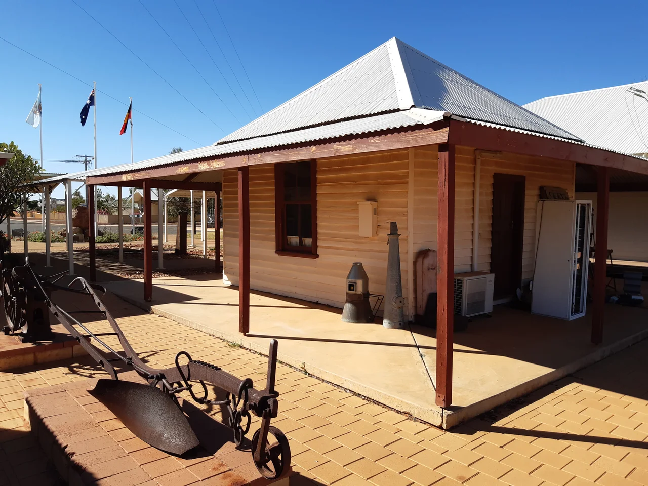
The town nearly carried a different name entirely. When the Government finally moved to declare a townsite in 1912, it chose "Killili," from a local Aboriginal word for bullrush, after the Surveyor General asked for a "euphonious native name." The name never took. For decades locals simply called the place Gascoyne Junction, or just The Junction, until in 1938 the Roads Board formally complained and asked that Killili be expunged from the records. The change was gazetted in 1939. The old road board office from that era still stands, heritage-listed now, having served in its long life as meeting hall, the district's first school, and finally a museum.
When the River Returns
The Gascoyne is an ephemeral river, dry far more often than it flows, which makes its floods all the more shocking when they arrive. In December 2010, days of torrential rain across the catchment, more than 250 millimetres in places within a single day, sent the river surging through town. Residents had to be evacuated. The floodwater destroyed the town's original pub, the Junction Hotel, a building that had stood since 1906, when it first opened as a general store. The damage across the wider region ran to tens of millions of dollars. In this country, water is scarce until suddenly, catastrophically, it is not.
Schooling Across the Distance
Educating children in a place this isolated has always taken ingenuity. For generations, local students learned through the Carnarvon School of the Air, the famous outback institution that beamed lessons across hundreds of kilometres to children on remote stations. The district's first proper schoolroom opened in 1960 inside the old road board office; a new Remote Community School followed in 2005, covering everything from kindergarten to year twelve, with senior and vocational classes delivered through the School of Isolated and Distance Education. Many of the students are of Indigenous descent. The nearest university courses are a long drive and a satellite link away. Out here, learning is something you reach for across great distances, and it has been for a very long time.
Gateway to the Outback's Giants
For travellers, Gascoyne Junction is less a destination than a threshold. It is the gateway to Mount Augustus, often described as the largest rock in the world, and to the dramatic escarpments of Kennedy Range National Park, and the road through town carries those bound for the deep interior. The community is shaped by mining, pastoral runs and fine merino wool. It is also, by one measure, the least religious place in the country: in the 2016 census, two-thirds of residents reported having no religion at all. It is a frank, practical, hard-country sort of place, where the heat is real, the distances are vast, and the river is always, eventually, coming back.
From the Air
Gascoyne Junction lies inland in the Gascoyne region of Western Australia at approximately 25.05 degrees south, 115.21 degrees east, on the Carnarvon-Mullewa Road. From the air the town is identifiable by the braided, often-dry channels of the Gascoyne and Lyons Rivers converging nearby, a green ribbon of riverine vegetation cutting across red desert plain. The town has a local airstrip; the nearest major airport is Carnarvon Airport (ICAO YCAR), roughly 165 km to the west. To the northeast, Mount Augustus rises as a massive landmark useful for navigation. Recommended viewing altitude is 3,000 to 6,000 feet over the river junction. This is a hot desert climate: visibility is usually superb, but summer heat haze and occasional dust can reduce it, and the dry rivers can transform dramatically during rare flood events.
Nearby Stories
- Kennedy Range National Park 25 km away
- Pimbee National Park 36 km away
- Bibra Family 79 km away
- Carnarvon Tracking Station 91 km away
- Lake MacLeod 118 km away
- Burringurrah Aboriginal Community 129 km away
- Milly Milly 134 km away
- Mount Augustus National Park 144 km away