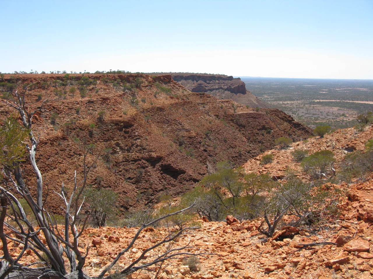

Kennedy Range National Park
Drive north-east out of Carnarvon and the land flattens into red dust and spinifex until, on the horizon, a long dark wall climbs straight out of the plain and refuses to end. This is the Kennedy Range — not a single peak but the broken edge of an ancient seabed, a mesa some 75 kilometres long and up to 25 wide, lifted whole and then sliced open. Its eastern face stands roughly 80 metres above the surrounding country, and where canyons cut into it the sandstone cliffs plunge a full 100 metres. From a distance it reads as one unbroken rampart, a single dark line drawn across the horizon. Up close, it dissolves into gorges, hidden pools, and rock the colour of rust and old gold, with each canyon opening into a world of its own.
Floor of a Vanished Sea
The Kennedy Range is older than almost anything you can name. Its layered sandstone was laid down beneath an ancient sea, then slowly bared as the softer ground around it eroded away, leaving the harder caprock standing proud. What survives is a flat-topped tableland — a textbook mesa — whose rim catches the first and last light of the day. Walk into Temple Gorge, the most accessible of the canyons, and you follow a dry creek bed between walls that close overhead until you reach the sheer face the early visitors named 'the Temple.' Honeycomb Gorge earns its name from the wind-pocked rock, eroded into a lattice of hollows. The interior of the range is mostly trackless and waterless, a place where the only sounds are wind and the scuff of your own boots.
Twenty Thousand Years of Knowing
Long before any map carried the name 'Kennedy,' this escarpment was a boundary line. The range marked the natural border between two Aboriginal peoples, the Maia and the Malgaru. The springs along its edge drew game to hunt, and outcrops of chert gave the hard stone needed for tools and blades. More than a hundred recorded sites attest that people lived here, deliberately and continuously, for over 20,000 years before Europeans arrived — a span of time that makes the pastoral and tourist chapters look like a single afternoon. To stand at the foot of the cliffs is to stand where countless generations stood, reading the same rock for water, shelter, and stone.
The Name and the Naming
In 1858 the explorer Francis Thomas Gregory led his expedition to the range and gave it a settler's name, honouring Arthur Edward Kennedy, then Governor of Western Australia. On the same journey Gregory named the nearby Lyons River before pushing on toward the great monolith of Mount Augustus. Pastoralists followed within a generation; Charles Brockman took up Boolathana Station in 1877, and for decades the surrounding country prospered on wool. Then the 1930s arrived all at once — overgrazing, drought, and the Great Depression — and most of the runs collapsed. The valleys and plains were left badly degraded, but the high tabletop of the range, hard to reach and harder to graze, came through almost untouched.
Reaching the Range
The gateway is Gascoyne Junction, a tiny outback town roughly 170 kilometres east of Carnarvon, set where the Lyons and Gascoyne rivers meet. From there an unsealed road runs north about 60 kilometres to the park's main entrance and the campground at Temple Gorge. The reward for the dust is a desert that blooms when the rains come: hakeas, eremophilas, feathery Calytrix, and drifts of papery everlasting daisies. The range even has a creature named for it — Lerista kennedyensis, the Kennedy Range broad-blazed slider, a small burrowing lizard found in this country. Entry is free, but come prepared: there is no drinking water in the park, and the nearest fuel is back at the Junction.
From the Air
Kennedy Range National Park lies at 24.58°S, 115.05°E in the Gascoyne region of Western Australia, roughly 150 km east of the coast at Carnarvon. The defining landmark from the air is the long, flat-topped mesa itself — a dark north–south escarpment some 75 km long standing about 80 m above the surrounding red plain, with the eastern wall notched by Temple, Honeycomb, and Drapers gorges. The Lyons and Gascoyne rivers converge to the south at Gascoyne Junction. Nearest aerodrome with scheduled service is Carnarvon Airport (ICAO YCAR), about 150 km west; Gascoyne Junction has a basic airstrip to the south-east. The inland desert air is typically very clear, and the contrast of dark caprock against pale plain makes the range visible from a great distance at cruising altitude; recommended sightseeing altitude is 4,000–6,000 ft AGL to read the gorge structure along the eastern face.
Nearby Stories
- Gascoyne Junction 30 km away
- North West Coastal Highway 87 km away
- Carnarvon Tracking Station 91 km away
- OTC Satellite Earth Station Carnarvon 99 km away
- Mount Augustus (Burringurrah) 121 km away
- Lake MacLeod 149 km away
- Milly Milly 177 km away
- Paraburdoo Mine 229 km away