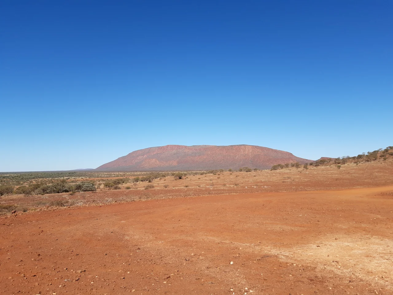

Mount Augustus (Burringurrah)
Long before surveyors gave it an English name, the Wajarri people knew this place as Burringurrah, and they knew what it was: a boy. The story tells of a young man who broke a law of his people and fled, and who was speared in the leg as he ran. He fell, and his prone body became stone. You can read that shape in the rock if you know how to look. The break in the leg, the long line of the back. What rises from the plain here is not just the largest rock on Earth by some measures. It is, in the oldest telling, a person.
The Boy Turned to Stone
Burringurrah has been a sacred site for thousands of years, and the land around it still holds the proof. On the loop walk that circles the base, three sites - Mundee, Ooramboo and Beedoboondu - carry rock engravings made by Wajarri hands, the surviving record of Dreaming stories passed down across countless generations. These are not museum pieces behind glass. They sit on living country, on a formation that the Wajarri understand not as scenery but as ancestor. To walk the loop is to move around the body of Burringurrah himself, through a story that was old when the first pastoralists arrived in the 1880s and that remains, for the people who hold it, entirely present.
Bigger Than Uluru, and Older
The numbers strain belief. Burringurrah rises roughly 860 metres above the surrounding plain and reaches 1,106 metres above sea level, with a central ridge nearly eight kilometres long sprawling across some 4,795 hectares. That makes it more than twice the size of Uluru, the rock most of the world pictures when it thinks of the Australian outback. Tourist brochures love to call it the planet's largest monolith, and it is genuinely vast - but geologists quietly note that the label does not quite fit. Uluru is a true monolith, a single bald dome. Burringurrah is an asymmetrical anticline, a buckled fold of ancient rock, dressed in wattles and cassias and eremophilas rather than left bare. It is greener, stranger, and far less visited than its famous cousin a thousand kilometres to the east.
A Mountain That Kills the Careless
The summit trail looks inviting and is anything but. The climb and return can take five hours across exposed rock, and the heat does not forgive. Four hikers - Hans-Juergen Buske, Anne Pollard, and Brian and Thelma Green - have died here, all of hyperthermia, all in conditions that turned a day walk into a trap. There is no shade on the trail and almost no mobile signal, so a person in trouble has no way to call for help and nowhere to escape the sun. After investigating the deaths, the coroner recommended closing the summit and gully trails through the hottest months entirely, except for guided ranger walks. The nearest town lies hours away. On Burringurrah, the gap between a scenic hike and a fatal one is measured in degrees.
Life on the Red Plain
For all its harshness, the country teems. More than 100 species of birds move across the rock and the surrounding scrub, and birds of prey ride the thermals that lift off the warm stone. Red kangaroos and euros - the stocky wallaroos of the ranges - graze in the cool of morning, while goannas patrol the sand and emus stalk the open ground. The plant life is desert-tough: silver-grey acacias, the bright sprays of eremophila, hardy cassias. There was even a brief gold rush here in the 1890s, when local geology raised hopes that flared and quickly faded. The gold mostly stayed in the ground. The rock, the birds, and the Wajarri story endured.
From the Air
Burringurrah sits at 24.33 degrees south, 116.84 degrees east, roughly 1,000 km north of Perth in the Gascoyne. From the air it is unmistakable: a single great ridge nearly 8 km long, rising 860 m above an otherwise flat red plain, casting a long shadow at dawn and dusk that betrays its anticline shape. There are no major airports nearby - Carnarvon (YCAR) lies about 460 km west on the coast, and Meekatharra (YMEK) sits to the southeast - so most aerial views come from general aviation on cross-country legs over the Gascoyne. Clear, dry winter air gives the best visibility; summer brings heat haze off the plain. Best viewed in low-angle light, which throws the ridge into sharp relief.
Nearby Stories
- Burringurrah Aboriginal Community 7 km away
- Paraburdoo Mine 97 km away
- Gascoyne Junction 127 km away
- Kennedy Range National Park 136 km away
- Juukan Gorge 165 km away
- Peak Hill, Western Australia 173 km away
- Mount Tom Price Mine 181 km away
- North West Coastal Highway 225 km away