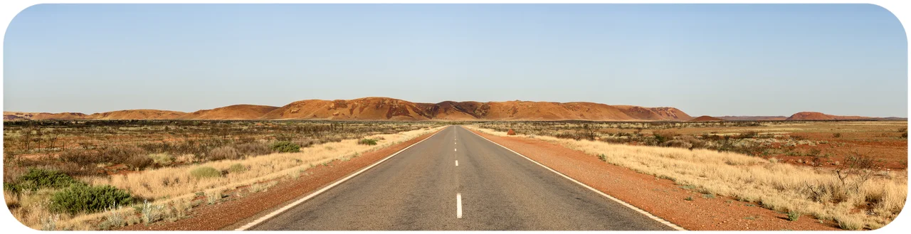

North West Coastal Highway
Somewhere north of the Minilya Roadhouse, a small sign marks the Tropic of Capricorn, and the realisation sinks in: you have driven into the tropics and the land has barely changed. That is the strange spell of the North West Coastal Highway. For 1,300 kilometres it runs from Geraldton up to Port Hedland, a single sealed ribbon laid across country so vast and so sparse that the roadhouses - not towns - become the landmarks you count your day by.
A Sense of Scale
Australians measure distance differently, and this highway is why. The run from Perth to Port Hedland, taking in the Brand Highway that feeds into the route's southern end at Geraldton, stretches more than 1,700 kilometres - and even that is dwarfed by the nearly 2,700 kilometres between Adelaide and Perth. The coastal highway itself, Geraldton to Port Hedland, is the 1,300-kilometre core of it. North of Geraldton you pass within reach of some of the largest iron ore deposits on Earth and over some of the planet's oldest exposed rock. The country does not announce these wonders. It simply rolls on, red and flat and enormous, and lets the odometer tell the story.
The Long Empty Middle
Between Geraldton and Carnarvon the road crosses roughly 400 kilometres without a single town - only roadhouses, and they do not hand out water for free. Carnarvon, the one real settlement on the whole northern run, arrives like an oasis: bananas and subtropical fruit grow in its plantations, fed by the Gascoyne River, even as it ranks among the windiest places in Western Australia. Beyond it the land flattens further. Bridges leap dry creek beds you would never notice but for the lines of eucalypts that trace the watercourses, standing tall above the spinifex and mulga. Most of the year those riverbeds are bone dry. Between November and April, a passing cyclone can fill them from nothing to ten metres deep in less than a day.
Turnoffs to Wonder
The highway is a spine, and its side roads lead to some of Western Australia's finest country. Near the Minilya Roadhouse, a turnoff runs out to North West Cape - to Exmouth, Coral Bay, and the Cape Range National Park that fringes Ningaloo Reef. The Overlander Roadhouse marks the start of World Heritage Drive to Shark Bay and the famous dolphins of Monkey Mia. Inland branches climb to the iron ore towns of Tom Price and Paraburdoo, and past Wittenoom, the asbestos ghost town the maps would rather forget. The road itself stays modest; what it connects is extraordinary.
Ports of the Pilbara
The highway's northern end belongs to industry on a colossal scale. Karratha and its sister town Dampier anchor the North West Shelf gas project and the region's second-busiest iron ore port. Roebourne opens the way to Wickham, to Point Samson, and to the ghost town of Cossack. The road finally meets the Great Northern Highway near Port Hedland - the number-one iron ore port in the region and, with around 15,000 residents, one of the larger towns in the state's northwest. From a dusty start at Geraldton, the highway ends where the trains a couple of kilometres long roll their red cargo onto ships bound for the world.
Respect the Distance
This is a road that punishes inattention. Its long, hypnotic straights have lulled drivers to sleep at the wheel, and fatigue is named again and again as the cause of serious crashes out here. Road trains - the multi-trailer freight haulers that own this highway - need kilometres of clear straight road to overtake safely, and overtaking one demands the same. At dawn and dusk, wildlife drifts to the verges. The roadhouses are not just fuel stops but survival points: coffee, a stretch, a chance to shake off the trance of the empty miles before pressing on into the next long stage.
From the Air
The North West Coastal Highway runs roughly north from Geraldton to Port Hedland along the Western Australian coast; a representative midpoint near the Minilya area sits around 23.56 degrees S, 114.23 degrees E. From the air the highway is a thin sealed line threading red rangeland, crossing the Tropic of Capricorn and the dry, eucalypt-lined beds of the Gascoyne and other rivers. Airports along the corridor include Geraldton (YGEL) at the south, Carnarvon (YCAR), Learmonth (YPLM) near Exmouth on the North West Cape spur, Karratha (YPKA), and Port Hedland (YPPD) at the north. Clearest conditions are in the dry season, roughly May to October; cyclone-season storms (November to April) can flood watercourses fast.
Nearby Stories
- Gnaraloo 20 km away
- Warroora 26 km away
- MV Korean Star 36 km away
- Lake MacLeod 51 km away
- Ningaloo Marine Park (Commonwealth Waters) 85 km away
- Kennedy Range National Park 87 km away
- Gascoyne Junction 168 km away
- Juukan Gorge 274 km away