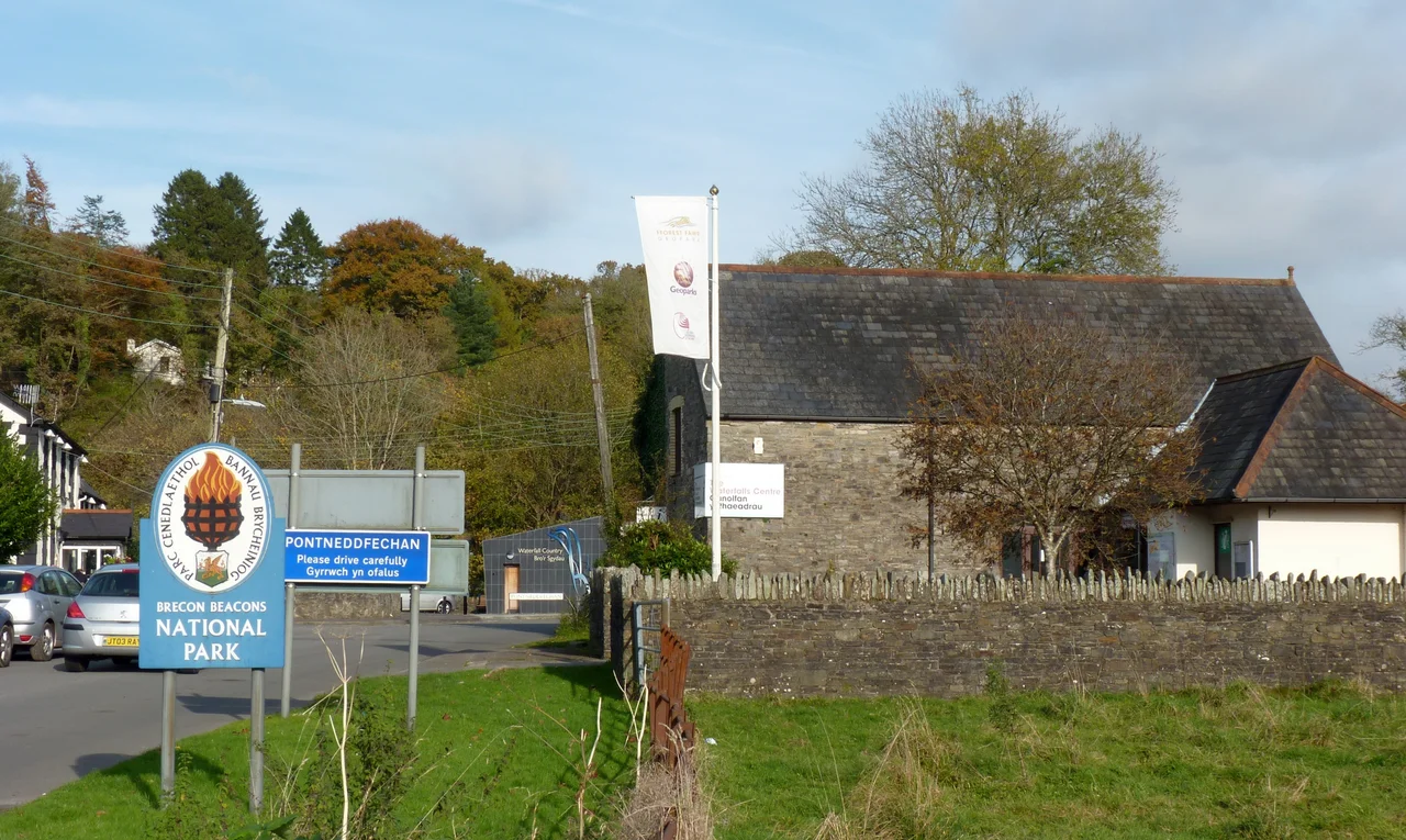

Fforest Fawr Geopark
Most national parks tell you about the present: the views, the walks, the wildlife, the place to stop for tea. A geopark tells you about the past, and not the human kind. Fforest Fawr Geopark, in the western half of the Brecon Beacons National Park in southern Wales, covers three hundred square miles of mountain and moor that record nearly five hundred million years of Earth's history. In October 2005 it became the first geopark in Wales, joining the European Geoparks Network and the UNESCO-assisted Global Network of National Geoparks. The point of a geopark is simple. The rocks here have a story. If you know how to read them, the landscape becomes a library.
Five Hundred Million Years
Walking south across Fforest Fawr, you walk through time. The oldest rocks in the geopark are in the northwest, dating from the late Ordovician period, around 450 million years ago, when this land was the floor of an ancient ocean south of the equator. South of that, Silurian-age sandstones and mudstones record a series of collisions between continents, the Caledonian Orogeny, that crumpled the rocks into tight folds. Further south again are the Devonian Old Red Sandstones, deposited around 400 million years ago when the area became part of a hot, arid continent, and then the Carboniferous limestones, laid down in warm tropical seas around 340 million years ago when the country was again submerged. The youngest rocks, late Carboniferous, run along the southern margin and mark the edge of the South Wales Coalfield. From north to south you cross continental drift, tropical seas, deserts, and back to swamp.
The Ice Came Through
Then, much more recently, the ice came. During the Quaternary period, repeated glaciations carved the landscape we see now. Glacial till, the unsorted debris dragged under ice sheets, covers large parts of the geopark. The major valleys hold recessional moraines, the ridges of rubble left as glaciers retreated. The most spectacular moraines are at the foot of the steep north face of the Black Mountain range, where two small lakes, Llyn y Fan Fach and Llyn y Fan Fawr, sit in glacial hollows below the summits of Picws Du and Fan Foel. Llyn y Fan Fach is the lake at the centre of the Welsh medieval legend of the Lady of the Lake, who rose from its waters to marry a local farmer. Welsh folk memory and Welsh geology meet in that small dark pool, and you cannot really tell where one ends and the other begins.
Going Underground
The east-west belt of Carboniferous limestone running through the middle of the geopark has been dissolved by water into one of Britain's most impressive cave systems. Ogof Ffynnon Ddu, the Cave of the Black Spring, is the deepest cave in Britain at 293.5 metres, with passages totalling more than fifty kilometres explored to date. Other caves include Porth yr Ogof, the Great Door, where the Afon Mellte river simply vanishes into a limestone cliff face and reappears further downstream. Above ground, the limestone shows itself in countless shakeholes, small craters where the rock has collapsed into voids beneath. Further south still, where Millstone Grit takes over, is the area locals call Waterfall Country, with what is widely acknowledged to be the finest collection of waterfalls in Britain. The Mellte, the Hepste, the Pyrddin and the Nedd Fechan all tumble in cascades down the wooded escarpments above Pontneddfechan.
Seven Thousand Years of People
The geopark celebrates not only the geology but the seven thousand years of human history recorded in it. Bronze Age standing stones, like Maen Llia, watch the moors. Bronze Age round barrows mark hilltops. Iron Age hillforts crown the high places, such as Carn Goch on the Black Mountain, one of the largest hillforts in Wales. Medieval castles, especially Carreg Cennen, perched on a limestone cliff near Llandeilo, brood over the southern fringe of the park. The industrial archaeology is equally impressive. South Wales became one of the earliest industrialised societies in the world, and the geopark holds its scars and monuments. Limekilns dot the hillsides wherever limestone outcrops; the Brecon Forest Tramroad, built in the 1820s, was one of the earliest and longest tramway systems in the world; tramways also served the silica rock mines at Dinas Rock and around the Nedd Fechan.
Where to Start
There is no single visitor centre anymore. The Waterfalls Centre at Pontneddfechan, on the southern edge of the geopark, was the main interpretive hub until 2016. Today information is scattered: walking guides, interpretive panels at major sites, the geopark website. The classic introduction is the walk on Pen y Fan and Corn Du, the two highest summits in the Old Red Sandstone, accessible from the Storey Arms on the A470. The geological tour starts further west, on the Black Mountain, where the legend of Llyn y Fan Fach can be walked to in a few hours. For caves, you need a permit and a guide. For waterfalls, the path from Pontneddfechan up the Afon Mellte takes you past Sgwd Clun-gwyn and Sgwd-yr-Eira, where you can walk behind the cascade. Each route is a transect through time. The rocks are still being read.
From the Air
Fforest Fawr Geopark covers roughly 51.85 N to 52.0 N and 4.0 W to 3.2 W, the western half of the Brecon Beacons National Park. Best appreciated from 4,500 to 6,000 feet, with Pen y Fan (886 m) the most prominent summit in the centre and the Black Mountain range to the west. Cardiff Airport (EGFF) is 35 nm south; Bristol (EGGD) about 45 nm southeast. The terrain rises rapidly from coastal plain; mountain weather is fast-moving and orographic cloud is common. Avoid valley flying when winds exceed 25 knots; expect significant turbulence on the lee side of the ridges.
Nearby Stories
- Deep Navigation Colliery 3 km away
- Treago Castle 6 km away
- Caerwent 8.2 km away
- Swansea Castle 8.3 km away
- Croft Castle 8.7 km away
- Talley Abbey 9.4 km away
- Cwmhir Abbey 14 km away
- Llanerchaeron 25 km away