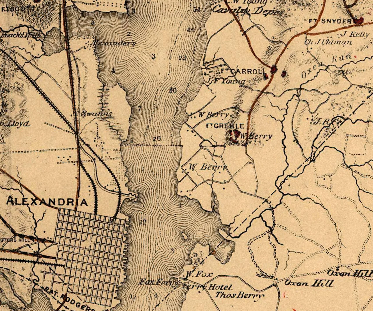

Fort Greble
First Lieutenant John Trout Greble was 27 years old when he was killed at the Battle of Big Bethel on June 10, 1861, becoming the first West Point graduate to die in the Civil War. He was an artilleryman, killed by a Confederate musket ball while serving his guns on the Virginia Peninsula. Six months later, when General John Gross Barnard finished a new earthwork on Congress Heights overlooking the junction of the Anacostia and Potomac rivers, he gave the fort Greble's name. The Berry family had owned this ground before the war and called the bluffs Congress Heights because you could see the Capitol from the top. The fort that bore Greble's name held that view for four years. It never fired a shot at an enemy. Today it holds a community baseball field instead.
The Eastern Branch Line
In the panic following the First Battle of Bull Run in July 1861, the Union scrambled to ring Washington with earthworks. Most of the early forts went up on the Virginia side, defending the bridges and the direct overland approach. George McClellan, taking command of the Military Division of the Potomac on July 26, found the District of Columbia still vulnerable. Brigadier General John Gross Barnard, the chief engineer of the Washington defenses, ordered new forts built on the Maryland side as well - specifically on Congress Heights, the high ground east of the Anacostia. The job of these forts was not to repel a charging army. The Confederate command was unlikely to mount an infantry assault here. The danger was that someone could slip a battery across the river and lob shells into the Washington Navy Yard and the U.S. Arsenal at Greenleaf Point. The Eastern Branch line existed to make that impossible. Construction on Fort Greble began in late September 1861. Barnard reported it completed and armed on December 10.
Seventeen Guns and a Mosquito Problem
The fort had a perimeter of 327 yards and emplacements for seventeen guns. A fall 1862 inspection called it large and powerful, well provided with magazines and bombproofs - though the same report recommended new gun platforms and better protection for the crews. Speed in construction had cost some refinement. In 1864 the engineer William C. Gunnell asked permission to demolish the wooden shanties that served as company quarters so the ammunition could finally be moved into proper earthen magazines. The bluff sat above swampy bottomland drained by both rivers. Mosquitoes plagued the garrison every summer. Malaria put men on the sick list. Communication with neighboring forts had to be relayed through Washington headquarters until 1864, when the Army strung telegraph wire between the works and tried, with mixed success, to establish flag-signaling stations. By May 1864 the garrison consisted of one company of the 7th Unattached Heavy Artillery of Massachusetts under Captain George S. Worcester - 125 men working a mix of 32-pounder barbette guns, 12-pounder field howitzers, an 8-inch siege howitzer, two mortars, and a 30-pounder Parrott rifle.
The Boredom Behind the Walls
Life at Fort Greble was the same life that Civil War garrisons lived everywhere across the Washington perimeter - reveille before sunrise, morning muster, drill, gunnery practice, drill again, meals, more drill, taps at nine. Sundays brought inspection and church and a few free hours in the afternoon for letters and bathing. Greble sat at the far end of the Eastern Branch line, isolated even from its neighbors. Supply wagons came once a week. Furloughs to Washington across the bridge or to Uniontown nearby were rare. The Commission on the Defenses of Washington in 1862 wrote what proved to be a prophetic assessment: an enemy will not attempt to enter Washington from this direction. No Confederate force ever brought Fort Greble under fire in the four years of war. Its guns were tested in practice. Its crews drilled themselves into competence at firing weapons they would never aim at a real target. They were judged drilled some at artillery and infantry by Inspector General Albion P. Howe in 1864 - which sounds modest until you read his report on the neighboring forts Wagner and Ricketts, judged not efficient.
From Magazine to Ball Field
After Lee surrendered at Appomattox in April 1865, the Army began classifying the Washington forts. First-class works would remain active. Second-class works would be mothballed. Third-class works would be abandoned. Fort Greble was designated second-class and chosen as a temporary storage depot for the guns and ammunition pulled from the third-class forts. By 1867 the army wrote to the Chief of Ordnance asking how much longer they actually needed it. In 1866 the U.S. Army Signal Corps, an organization founded during the war, began using Fort Greble as a training ground. Two years later General Albert J. Myer, the Army's chief signal officer, moved his signaling school onto the site to teach electric telegraphy and visual signaling. Myer would later be commemorated as the namesake of Fort Myer near Arlington. He stayed at Fort Greble only until January 1869, when he moved the school to Fort Whipple in Virginia. After that the Greble land returned to private hands. In the twentieth century, planners proposed connecting the old Washington forts via a 23-mile parkway called Fort Circle Drive. Budget concerns killed the plan. The forts that did become parks were never linked. Today the bluff is home to the Fort Greble Recreation Center, a community building serving a southeast Washington neighborhood, with a lighted baseball field where the powder magazines once stood. The Capitol is still visible from the high ground. Nobody is bombarding it from here.
From the Air
Fort Greble Recreation Center sits at roughly 38.83 degrees N, 77.01 degrees W, on Congress Heights in southeast Washington, D.C., overlooking the confluence of the Anacostia and Potomac rivers. The bluff rises about 120 feet above the water. This is inside the Washington Special Flight Rules Area and Class B - flight planning, ADS-B, and Potomac TRACON clearance are required. P-56 over the Capitol is two miles north. Reagan National (KDCA) is three miles northwest. Andrews JBA (KADW) is six miles east-southeast. Plan very carefully.
Nearby Stories
- Crownsville Hospital Center 3.5 km away
- Battle of Thoroughfare Gap 7.4 km away
- Battle of Unison 8.6 km away
- Mallows Bay-Potomac River National Marine Sanctuary 9.1 km away
- Murders of Katherine and Sheila Lyon 9.9 km away
- Germanna 15 km away
- Capital Gazette Shooting 27 km away
- St. Mary's City, Maryland 39 km away