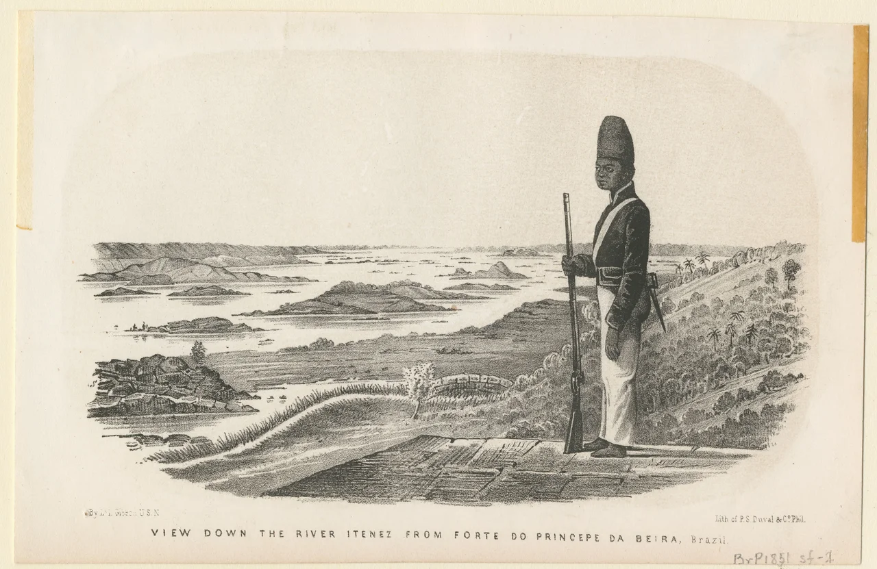

Forte Príncipe da Beira
Picture a Portuguese garrison hauling cut stone and ironwork up a jungle river in the 1770s, building a fortress the size of a small town in a place that took weeks to reach from the coast. The Guaporé River winds through some of the most isolated terrain in South America, and on its bank, near where it joins the Mamoré, the Portuguese Empire laid down a kilometer of walls in the shape of a star. They called it Forte Príncipe da Beira, after the heir to the Portuguese throne, and they built it not to win a war but to draw a line nobody could ignore.
A Line in the Wilderness
By the second half of the eighteenth century, the Portuguese and Spanish empires were pressing against each other across the heart of the continent, and treaties depended on who actually held the ground. The Spanish controlled the lands to the southwest. The Portuguese answered with stone. Constructed between 1776 and 1783, Forte Príncipe da Beira became one of only two forts the Portuguese ever built in the deep interior of Brazil, a deliberate statement of possession planted where the empire's reach was thinnest. Its purpose was as much diplomatic as military, a permanent argument that this remote stretch of the Amazon belonged to Lisbon. Building it here was an act of extraordinary logistical will. Everything that could not be cut or fired from local clay and timber had to travel hundreds of miles up rivers, through rapids and rainforest, to a site where the nearest sizable Portuguese settlement was a distant rumor. The fort was named for the Prince of Beira, the title borne by the heir to the Portuguese crown, binding this far-flung outpost to the dynasty it was meant to glorify.
Geometry Against the Jungle
The fort follows the principles of Vauban, the French military engineer whose star-shaped designs reshaped European fortification. Four bastions anchor the corners of a roughly square plan, each one originally bristling with fourteen cannons, the whole encircled by a moat and walls that stand ten meters high and run nearly a kilometer around. Inside lie the bones of a small garrison world: a chapel, soldiers' quarters, a prison, and the various utility buildings a self-contained outpost required. It is a startling thing to find in the rainforest, this precise European geometry imposed on the wild bend of a tropical river, ambition rendered in masonry.
Abandonment and Endurance
The fort's military life ended in 1889, and for a long stretch the jungle had it largely to itself. Of the bastions' original complement of cannons, only a single piece still remains in place, a lone survivor pointing out across the water. Yet the structure endured where so much else in the region returned to forest. The walls held. The bastions kept their shape. What was built to outlast a diplomatic dispute outlasted the empire that raised it, standing through more than a century of heat, rain, and neglect on a riverbank far from any road that mattered.
A Garrison Returns
Today the fortress is no longer alone. The Brazilian Army maintains a small garrison of soldiers stationed beside it near the town of Costa Marques, in the Vale do Guaporé of Rondônia, so the place that once anchored a contested frontier again has uniformed people keeping watch. Visitors who make the long journey find a museum, the great star of walls, and the river sliding past as it has for centuries. The Guaporé still marks the border between Brazil and Bolivia here, which means the fort continues, in a quiet way, to do the very thing it was built for: to stand at the edge and hold the line.
From the Air
Forte Príncipe da Beira sits at 12.43 degrees south, 64.42 degrees west, on the right bank of the Guaporé River in Rondônia, Brazil, near the town of Costa Marques. The river itself is the dominant navigational feature, marking the Brazil-Bolivia border, with the fort's star-shaped footprint and surrounding cleared ground distinguishing it from the dense forest beyond. A viewing altitude of 2,500 to 4,000 feet AGL best reveals the geometry of the bastions and the kilometer-long perimeter against the green. The nearest airfields lie across the border in Bolivia and downriver in Brazil; Guajará-Mirim (SBGM) to the northwest is the most useful Brazilian reference, with Costa Marques offering a closer local strip. Expect strong convective activity and afternoon storms in the wet season; dry-season mornings give the clearest light over the water.
Nearby Stories
- San Joaquín 46 km away
- Serra da Cutia National Park 53 km away
- Guapore Biological Reserve 119 km away
- Isla Suarez 152 km away
- Aerocon Flight 25 189 km away
- San Ignacio de Moxos 268 km away
- Bom Futuro National Forest 300 km away
- Akuntsú language 328 km away