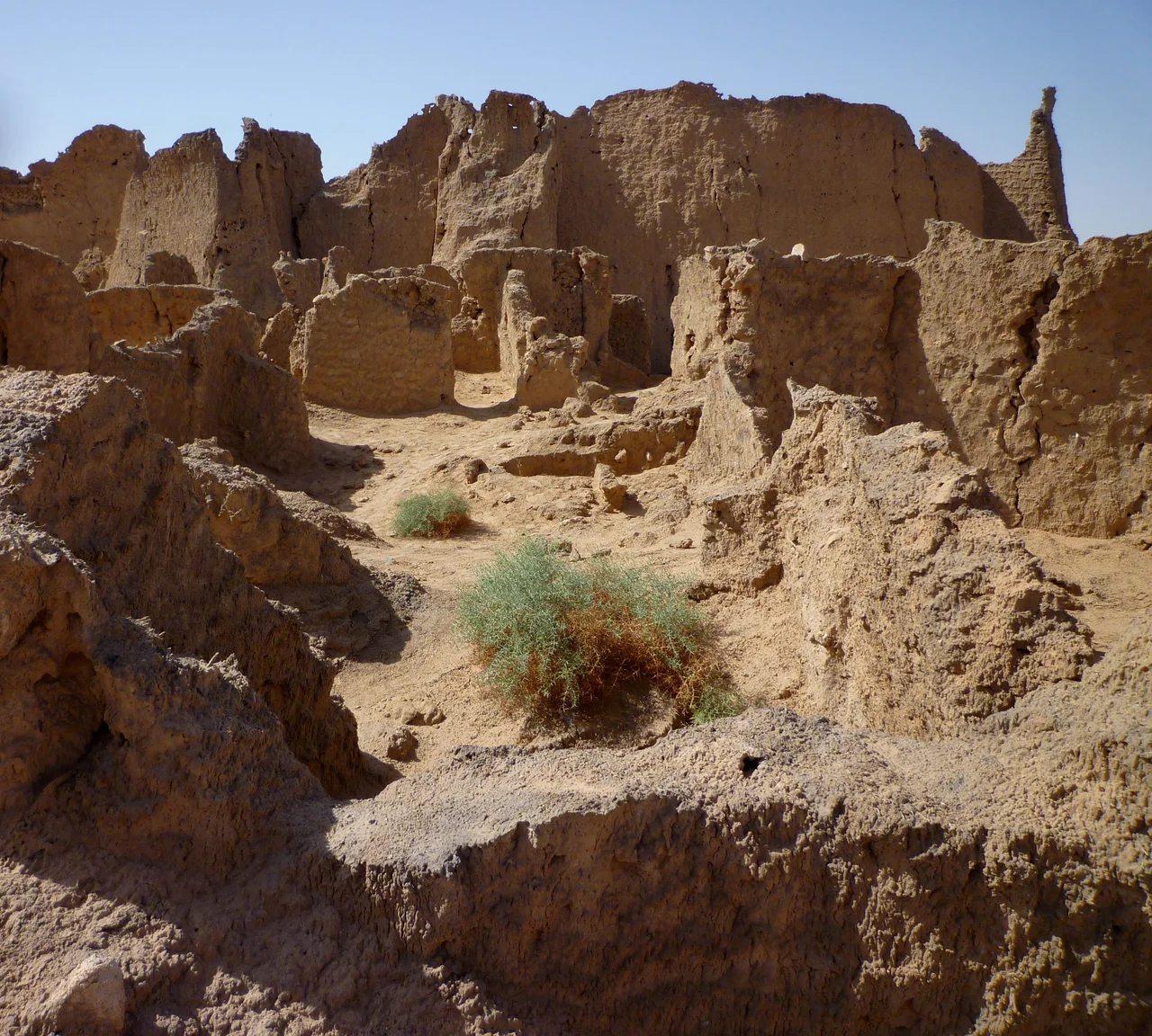
_-_Ruinen_der_antiken_Stadt_Garma_02.jpg)
Garamantes
Herodotus called them "a very great nation," and then, like much of the classical world, more or less dismissed them as desert raiders on the fringe of the map. For centuries that judgement stuck. The Garamantes were filed under barbarian: chariot-riding slavers from the empty heart of the Sahara, footnotes to Rome. Then archaeologists started digging in Libya's Fezzan and found something the Romans never bothered to record. The Garamantes had built cities. They had built them in one of the driest places on Earth, with no river to lean on, by reaching underground and pulling up water that had fallen as rain during the last ice age.
Water From the Deep Past
The Garamantian achievement rests on a single brilliant idea: the foggara. Across the Fezzan, beginning in the last centuries BC, they dug gently sloping tunnels into the water table beneath the limestone, then ran them for kilometers toward their fields, tapping vertical access shafts at intervals like a row of stitched buttonholes across the desert. Gravity did the rest, drawing groundwater to the surface with almost no loss to evaporation. The scale is staggering. Surveys led by archaeologist David Mattingly traced a network totalling hundreds of kilometers of underground channels, individual tunnels running one to three kilometers each, all of it cut by hand. The water they raised was fossil water, sealed underground for millennia and not replenished. They were, in effect, mining a buried sea.
The First Cities of the Sand
That water built a society no one expected to find. The Garamantes developed the first urban civilization centered in a major desert without a river to sustain it. Their capital, Garama, held around four thousand people, with another six thousand in surrounding villages. They farmed dates, grain, and grapes; they traded across the Sahara, linking the Mediterranean to sub-Saharan Africa; and they grew populous and settled enough that, tellingly, their skeletons show no signs of the constant warfare or punishing labor outsiders assumed desert life demanded. Studies of their bones suggest an agricultural people, not a nation of warriors. The Sahara, which Rome saw as a barrier, the Garamantes had turned into a homeland.
A People of Many Origins
The Garamantes were not one bloodline but a meeting place. They likely drew on Berber and Toubou ancestry and Saharan pastoralist roots, and the cemeteries of the Fezzan tell of a society woven from across the region. One grave holds a young woman from sub-Saharan Africa, buried with a lip ornament linked to Sahelian peoples far to the south, yet laid to rest with full Garamantian funeral rites, fully part of the community. Their world had its cruelties; like many ancient states, the Garamantes were tied to slavery, and Roman merchants bought captives that crossed the Sahara through their hands. But the archaeology resists the old caricature of mere raiders. These were farmers, traders, and engineers whose reach stretched far beyond their oases.
Rome at the Gates
Rome and the Garamantes circled each other for generations. Garamantian war bands struck across the imperial frontier and slipped back into the dunes, beyond the reach of legions trained for different ground. The Romans pushed back: Pliny records that Cornelius Balbus seized fifteen Garamantian settlements in 19 BC, and around 202 AD the emperor Septimius Severus, himself North African born, drove deep into the Sahara and took Garama itself. Yet conquest never held. The desert defended its people better than any wall.
The Well Runs Dry
What Rome could not do, the water did. Fossil water is finite, and over centuries of relentless extraction the underground level the foggaras depended on began to fall. As the table dropped below the reach of the tunnels, the system that made the cities possible slowly failed. By the late 7th century AD the Garamantian kingdom had faded. There is a hard lesson buried in the sand: a civilization can be undone not by enemies but by the quiet exhaustion of the one resource it cannot replace. The Garamantes drank from an ice age, and the ice age eventually ran out.
From the Air
The Garamantian heartland centers on the Wadi al-Ajal in Libya's Fezzan, around 26.5 degrees North, 13.0 degrees East, with the capital site of Garama at modern Germa. From altitude the landscape is a long east-west valley pinned between the dark Messak plateau to the south and the pale dunes of the Ubari Sand Sea to the north; the faint pockmarked lines of ancient foggara shafts are still visible from the air in places. The nearest airfields are Sabha (HLLS) about 150 km east and Ubari (HLUB) to the west. Expect extreme isolation, no terrain lighting, and frequent dust haze. Clear winter daylight offers the best visibility over the valley.
Nearby Stories
- Gaberoun 20 km away
- Wadi Mathendous 50 km away
- Uan Muhuggiag 260 km away
- Takarkori 290 km away
- In Amenas Hostage Crisis 343 km away
- Africa (Roman Province) 565 km away
- Killing of Muammar Gaddafi 610 km away
- Great Man-Made River 829 km away