
Geography of Mauritania
From orbit, one feature stops the eye: a bullseye nearly fifty kilometers across, etched into the desert as if by a compass the size of a country. Space Shuttle crews used the Richat Structure, the so-called Eye of the Sahara, as a landmark for navigating the featureless tan expanse below. That expanse is Mauritania, a country roughly the size of Egypt yet lying almost entirely below 1,000 meters, making it the largest nation on Earth to sit so close to sea level. Here three great realms collide: the Sahara, the Sahel, and the Atlantic.
The Eye of the Sahara
For decades the Richat Structure fooled the experts. Its near-perfect circularity, almost 50 kilometers in diameter, suggested a meteorite had slammed into the desert. But the evidence for impact never appeared, the melted rocks and shocked minerals simply weren't there. Geologists now read it as a symmetrical uplift, a circular anticline where layers of rock domed upward and were then planed flat by erosion. Resistant bands of Paleozoic quartzite stand proud as concentric ridges, the harder rock outlasting the soft, so that wind and time have carved a target into the Earth. It is one of the planet's most striking accidents of geology, and it lies in north-central Mauritania for anyone flying over to see.
A Country of Sand and Scarps
Sand covers roughly 40 percent of Mauritania, and it is not all the same sand. Fixed dunes hold coarse, fawn-colored grains in place; mobile dunes carry fine, dustlike reddish sand on the wind, growing larger and more restless toward the north. Across the country run alternating plains of clay, called regs, and seas of dune, called ergs. A line of southwest-facing scarps bisects the interior, separating sandstone plateaus, and at the foot of these cliffs, spring-fed oases break the monotony with green. The highest of the plateaus is the Adrar, rising to 500 meters; the country's true summit is Kediet ej Jill near Zouirat, an iron-rich peak of 915 meters whose ore helps anchor the national economy.
Three Worlds in One Land
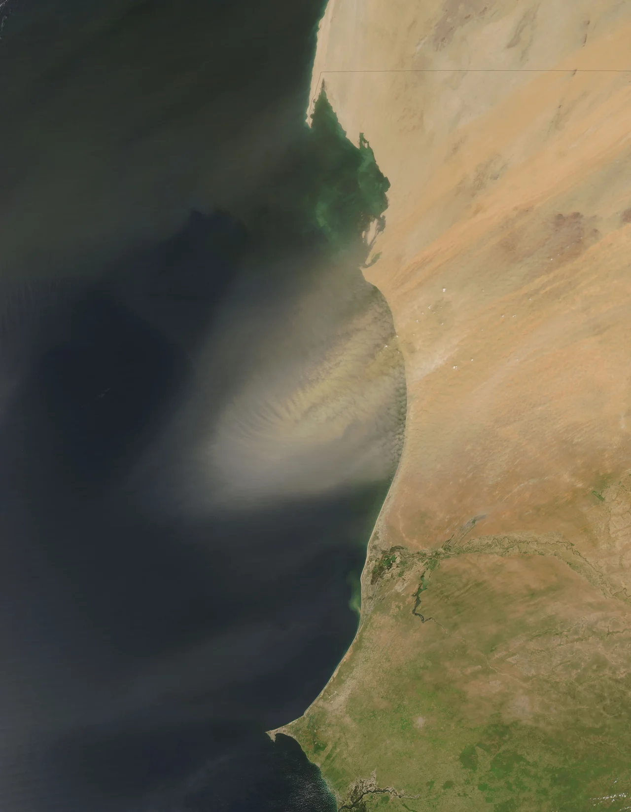
The northern two-thirds of Mauritania belong to the Saharan Zone, where a year, or several, can pass without rain, and the dry harmattan wind raises blinding sandstorms. Mornings here can begin near freezing and climb past 49 degrees Celsius by afternoon. South of that lies the Sahelian Zone, a belt of steppe and savanna where herders move cattle, sheep, and goats between seasonal pastures, and where occasional baobabs dot the grasslands. The harmattan ceaselessly stirs the dunes, and the El Djouf, an aptly named Empty Quarter of great sand seas, sprawls toward the northeast and merges into the wider Sahara.
The River and the Sea
Against all this dryness runs a single ribbon of permanent water. The Senegal River, the only perennial river between southern Morocco and central Senegal, traces the country's southern edge, flooding each year to feed the narrow, fertile valley that produces most of Mauritania's crops. To the west, some 754 kilometers of Atlantic coast are cooled by ocean trade winds off the Canary Islands. Here the desert and the sea meet at Dakhlet Nouadhibou, one of the largest natural harbors on Africa's west coast, where battering surf and shifting sandbanks have made and unmade fortunes since the Portuguese built their first sub-Saharan outpost at Arguin in 1445.
The Advancing Desert
Mauritania's geography is not fixed; it is on the move, and the direction is south. Since the prolonged drought that set in during the 1960s, the desert has advanced, pushed along by overgrazing, deforestation, and the stripping of ground cover around wells. The line marking the minimum rainfall for herding shifted roughly 100 kilometers south, past Nouakchott itself, and in the 1980s the dunes crept toward the sea at an estimated six kilometers a year. They reached the capital, threatening to bury wells, villages, and roads. In response, Mauritania planted a quarter of a million palm trees as a living barrier and dammed the Senegal River to reclaim cultivable land, a country digging in against the sand.
From the Air
Mauritania spans roughly 20 degrees N, centered near 12 degrees W, covering 1,030,700 square kilometers of mostly low, flat terrain. The Richat Structure, the Eye of the Sahara, sits near 21 degrees N, 11.4 degrees W and is the single most recognizable feature from altitude. Major airports include Atar (GQPA) in the Adrar and Nouakchott-Oumtounsy International (GQNO) on the coast. From cruising altitude, watch for the concentric rings of the Richat, the dark iron peaks near Zouirat, the green thread of the Senegal River along the southern border, and the Atlantic surf line to the west. Harmattan dust can sharply reduce visibility; clearest views come outside the dry-season dust season.
Nearby Stories
- Aouelloul crater 3.5 km away
- The Chinguetti Meteorite 34 km away
- Chinguetti 36 km away
- Tagant Region 127 km away
- Ksar el Barka 144 km away
- Tidjikja 156 km away
- Erg Amatlich 162 km away