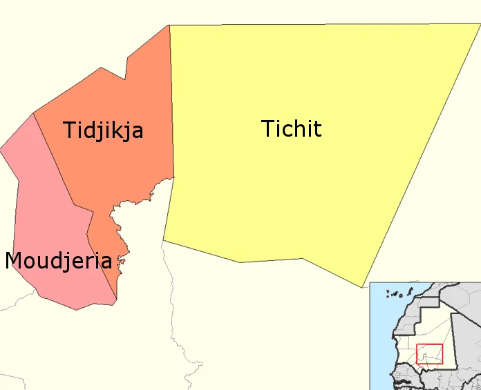

Tagant Region
The rain is leaving, and it has been leaving for a long time. In the 1960s, the Tagant plateau caught close to 250 millimeters of it a year - enough to green the wadis, fill the wells, and keep the herds moving across the high stone country of south-central Mauritania. Then the Sahara began to walk south. By the time the great droughts of the 1970s and 1980s arrived, the rains had thinned and the nomads who had crossed this plateau for centuries began drifting toward the towns. Tagant is named for the plateau it sits on, and that plateau is a study in what the desert gives and what it takes back.
The Shape of the Land
Tagant rises in the dry middle of Mauritania, a country that is mostly desert with a thin ribbon of green pressed against the Atlantic. The plateau averages around 460 meters above the sea, and across it the dunes are restless - shifting sand that piles into temporary ranges and then moves on. Days here can climb toward 38 degrees Celsius; the same nights, in the right season, drop all the way to freezing. Where groundwater surfaces, oases break the monotony with date palms and small fields. Everywhere else, the land keeps its own austere counsel. To the south lies the Aoukar basin, a great depression that once lent its name to this whole region before Tagant took over.
A People in Motion
For most of its history, Tagant belonged to people who did not stay put. The herders moved with the water and the grazing, reading the plateau the way a sailor reads weather. That way of life depended on rain, and as the rain withdrew, the calculus changed. The droughts of the 1970s and early 1980s pushed families off the open country and into urban centers, a migration that reshaped the region within a single generation. A few sedentary cultivators farmed the better-watered south, but across most of Tagant, settling down was never the plan - it was what the drought forced. Today the region holds around 80,000 people, fewer than it counted just a few years earlier, the population still ebbing with the conditions.
Three Towns on the Plateau
Administratively, Tagant divides into three departments, each anchored by a town that has outlasted empires and droughts alike. Tidjikja, the capital, is a date-palm oasis and old caravan crossroads. Tichit, off to the east, is a medieval trading town whose stone houses have been slowly reclaimed by sand. Moudjeria sits to the southwest. The framework that organizes them is French in origin - communes grouped into a moughataa, governed by an official called a hakem - layered over a society far older than any colonial map. It is a place where the modern state is present but spread thin, its services reaching only a fraction of the scattered settlements.
From the Air
Tagant region centers near 18.55 degrees N, 11.43 degrees W, on a plateau averaging about 460 meters elevation. From altitude, look for the dark tabular massif of the plateau breaking the surrounding sand sheets, with green oasis clusters marking towns like Tidjikja. The nearest major airport is Nouakchott (GQNN) on the coast to the west; Nouadhibou (GQPP) lies to the northwest. Clear desert skies make for long visibility, though harmattan dust can wash the horizon to haze.
Nearby Stories
- Ksar el Barka 32 km away
- Aoudaghost 108 km away
- Geography of Mauritania 133 km away
- Tichit 149 km away
- Maaden El-Irvane 204 km away
- Aoukar 210 km away
- Brakna region 248 km away
- Tenoumer Crater 460 km away