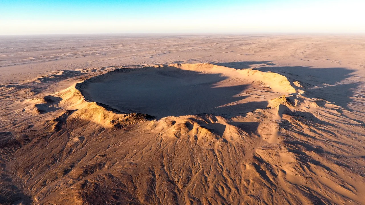

Tenoumer Crater
From above, it looks too perfect to be natural - a ring nearly two kilometers across, drawn into the desert with the precision of a compass. Tenoumer sits alone in the western Sahara of Mauritania, far from any road, its rim rising about 100 meters above the flat surrounding plain. For years geologists argued over what made it. The answer, when it came, was violent: something fell out of the sky and struck the Earth hard enough to melt solid rock.
The Argument Over the Circle
Tenoumer's near-perfect geometry was a puzzle. Scattered around its rim, researchers found basalt and rhyodacite - volcanic rocks - and for a time a volcanic origin seemed plausible. A crater this round could be the throat of an extinct volcano. But the evidence kept pointing elsewhere. Blocks of the region's ancient basement rock lay flung outside the crater, displaced by some enormous force. The supposed "lava" turned out to be impact melt: rock that had been instantaneously liquefied not by heat rising from below, but by the colossal energy of something arriving from above. The volcano theory collapsed. Tenoumer is an impact crater, gouged into the desert by a falling body from space.
Older Than It Looks
Dating the crater has been its own kind of argument. An early estimate placed the impact at 21,400 years ago - give or take nearly 10,000 - which would make it a strikingly recent wound, a thing that happened while humans were already painting cave walls. More recent work, published in 2016, pushed the age far deeper into the past, to roughly 1.57 million years. The discrepancy reflects how hard it is to read time written in shattered stone. Either way, Tenoumer is geologically young, its rim still sharp, its bowl still legible - a scar that erosion has not yet had time to soften and erase.
A Wound in Ancient Stone
What the impactor struck was not young rock. Tenoumer punched through gneiss and granite belonging to a Precambrian peneplain - a surface worn nearly flat over hundreds of millions of years, then thinly veiled by far more recent Pliocene sediments. In an instant, that long-settled landscape was rearranged. Today the crater's rim stands roughly 100 meters above the surrounding plain, but its floor is not the original blast crater you might imagine. Sediment has poured in over the millennia, filling the bowl with a thick layer of debris and sand, so that the visible crater is the upper portion of a deeper, buried structure.
The Loneliest Landmark
Few places on Earth are harder to reach. Tenoumer lies in Mauritania's Tiris Zemmour region, roughly 200 kilometers from the iron-mining town of Zouerat - and that last stretch means hours of off-road driving across open Sahara in a four-wheel drive. There is no settlement at the crater, no marker, no path. Yet for those who make the journey, the reward is to stand on the rim of an event - to walk a circle drawn by physics on a scale the mind struggles to hold. The same desert dryness that makes Tenoumer so remote is also why it survives so clearly: there is little here to wear it away.
From the Air
Tenoumer Crater lies at 22.92°N, 10.41°W in Mauritania's Tiris Zemmour region, deep in the western Sahara. The crater is about 1.9 km in diameter with a rim standing roughly 100 meters above the surrounding plain - a striking, near-circular ring that stands out sharply from cruising altitude against the flat, pale desert. The nearest town is Zouerat, roughly 200 km west; the nearest airport for access is Atar (GQPA), with onward off-road travel required. Desert air typically offers excellent visibility; watch for dust haze and harmattan winds. The crater is most dramatic under low-angle morning or evening sun, when the rim casts a shadow that defines the full circle.
Nearby Stories
- Empire of Great Fulo 76 km away
- Tourine Ambush 113 km away
- Tiris Zemmour 124 km away
- Tifariti 329 km away
- El Djouf 356 km away
- Bir Lehlou 381 km away
- Costa Teguise 695 km away