
Geography of the Isle of Man
Here is a fact unique on the planet: every square metre of the Isle of Man, every blade of grass, every length of shoreline, every cubic kilometre of airspace, every metre of seabed out to the territorial limit, is designated as a UNESCO Biosphere Reserve. The entire jurisdiction. No other sovereign or self-governing area on Earth carries that designation in its totality. The Manx government applied in 2016 and was approved the same year, and the result is a small lump of folded Ordovician rock in the Irish Sea that punches several weight classes above its size when it comes to nature conservation.
The Shape of a Small Island
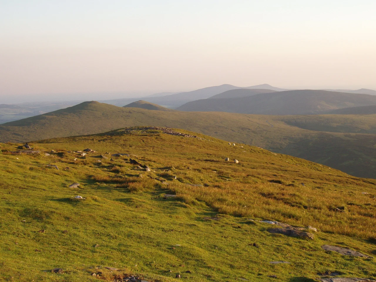
The Isle of Man covers 572 square kilometres, slightly more than three times the area of Washington, D.C., slightly more than a third of Hertfordshire, slightly smaller than Saint Lucia. Two mountainous spines run roughly north-south, divided by a central valley that links Douglas on the east coast with Peel on the west, the easiest route across for both travellers and prevailing weather. Snaefell, the highest point, reaches 620 metres above sea level and tops the northern uplands. The northern plain itself is flat and low, built from glacial tills and marine sediments left behind by retreating ice. The south is more dramatically hilly, with deep valleys and rocky coves. None of the island sits below sea level, but the coastline runs 160 kilometres, and the Raad ny Foillan footpath, the Way of the Gull created in 1986, traces 164 kilometres of it on foot.
Rocks and Rain
The majority of the island is built from heavily faulted and folded sedimentary rocks of the Ordovician period, some of the oldest in the British Isles. A belt of younger Silurian rocks runs along the west coast between Niarbyl and Peel, with small Devonian sandstones near Peel itself. Carboniferous rocks underlie part of the northern plain but never break the surface there, though they do outcrop in the south between Castletown, Silverdale, and Port St Mary. The island carries significant deposits of copper, lead, silver, zinc, iron, and plumbago, the graphite-and-clay mix that gives pencil leads their name, plus quarries of black marble, limestone, slate, and granite. Mining and quarrying are modern affairs; before the 18th century there was almost no exploitation of mineral wealth here. The climate is temperate, with cool summers and mild winters, and the rain falls hardest on Snaefell, where annual averages reach 1,900 millimetres. Lower ground gets around 800. The highest temperature recorded at Ronaldsway weather station is 28.9 Celsius, in July 1983; the lowest was recorded in December 1961.
An Island Under Many Protections
Beneath the umbrella Biosphere designation sits a remarkable matrix of more specific protections. Twenty-five Areas of Special Scientific Importance, with another previously designated and rescinded for Ramsey Estuary, cover meadows, headlands, glens, peatlands, and airfields. Ten Marine Nature Reserves protect more than 10% of the island's territorial waters, established in two waves: Ramsey Bay in 2011 and nine more in 2018, including Douglas Bay itself. Four Eelgrass Conservation Zones safeguard beds of Zostera marina, a slow-growing seagrass whose meadows store carbon and shelter juvenile fish. In 2024 the IUCN's Marine Mammal Protected Areas Task Force designated 17,610 square kilometres of the central Irish Sea, about half of Manx territorial waters, as an Important Marine Mammal Area for cetaceans and seals. Add Ballaugh Curraghs as a Ramsar wetland, five Important Bird Areas covering coast, hills, and the offshore Calf of Man, the Manx Wildlife Trust's 32 reserves, and the Manx National Heritage estates spread across 15 of the 17 parishes, and the island's nature conservation map becomes one of the most densely overlapping in Europe.
Where the People Live
Almost everyone lives near the sea. With a population of just under 85,000, the island's population is heavily clustered along the coast: Douglas with around 27,000, then a band of smaller settlements at Onchan, Ramsey in the north, Peel on the west, and Castletown, Port Erin, and Port St Mary across the south. The interior remains thinly populated, a patchwork of farms, heath, and the high moorland of the central hills. Heath itself is so important that the Heath Burning Act 2003 individually lists protected areas by name: Bradda, Bienn y Phott, Ballaugh Mountain, Cronk ny Arrey Laa, Snaefell, South Barrule, and 25 others. The Calf of Man, the tiny islet off the southern tip, is managed jointly by the Manx Wildlife Trust and Manx National Heritage and serves as a bird observatory. Climate change is showing up here as everywhere: high winds and floods have grown more frequent, summer droughts more common, snowfalls less. The temperate climate that has shaped the island for centuries is shifting, and the Biosphere designation now has the slow, difficult task of watching that shift in real time.
From the Air
The Isle of Man sits in the centre of the Irish Sea, between Great Britain and Ireland, centred roughly at 54.25 degrees north, 4.5 degrees west. From altitude the island is unmistakable: kite-shaped, oriented roughly southwest to northeast, with the prominent peak of Snaefell at 620 metres marking the northern uplands. The Calf of Man sits off the southern tip. Nearest airport: Isle of Man Airport at Ronaldsway (ICAO: EGNS) on the south coast. The central valley between Douglas and Peel is the easiest visual corridor across the island. Manx weather is notoriously variable; sea fog can hide the entire coastline within minutes.
Nearby Stories
- St Bees Lighthouse 15 km away
- Celtic Array 22 km away
- Kirkmaiden 23 km away
- Isle of Whithorn 23 km away
- Seascale Lifeboat Station 31 km away
- German submarine U-1024 36 km away
- SS Georgetown Victory 40 km away
- Blackpool Illuminations 56 km away