_-_Ruinen_der_antiken_Stadt_Garma_02.jpg)
Germa
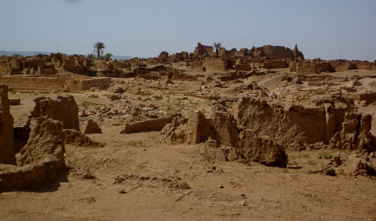
It has gone by many names: Jarma, Jerma, Djarma, Djourma, Germa. Two thousand years ago it had only one that mattered, Garama, and it was the beating heart of a kingdom that the rest of the ancient world barely knew existed. The ruins stand today in the Wadi al-Ajal, a strip of green and grey hemmed between a black plateau and an ocean of sand in southern Libya. Walk among the low mud-brick walls and it is hard to imagine ten thousand people once lived here. But they did, in a city raised in a place that should not have been able to feed a village.
Capital of a Desert Kingdom
Garama was the capital of the Garamantes, the remarkable people who farmed the Fezzan by mining fossil water through underground tunnels called foggaras. At its height the city itself held around four thousand inhabitants, with another six thousand living in villages spread within a few kilometers, all of them sustained by water drawn from beneath the sand. Garamantian power peaked in the second and third centuries AD. This was no remote camp but a genuine urban center, complete with monumental buildings, dense housing, and a trade reach that ran across the Sahara, connecting the Mediterranean coast to the kingdoms of the Sahel.
Rome's Reluctant Rival
From Garama, war bands rode out to raid Rome's African frontier, the Limes Tripolitanus, then vanished back into the dunes where heavy legions could not follow. The Romans answered in force. In 203 AD the emperor Septimius Severus, born across the desert in Leptis Magna, marched deep into the Sahara and captured Garama outright. It was a striking feat of imperial reach, and it changed almost nothing. Severus soon abandoned the city, and the Garamantes carried on as before. The desert was a wall Rome could breach but never hold, and Garama remained its own master long after the legions turned back toward the sea.
The Long Fade
How Garama ended is a story still being argued. As the fossil water that fed the foggaras was drawn down over the centuries, the agricultural base that supported the city slowly weakened. Some accounts say the Arab general Uqba ibn Nafi conquered the place in 669 AD; others reject that, suggesting instead a negotiated peace after conflict in the region. Either way, the great Garamantian kingdom had run its course. The city did not fall in a single dramatic blow. It dried out, declined, and shrank back toward the modest oasis settlement it remained for centuries afterward.
A Crossroads in the Sand
Garama was never as isolated as its location suggests. The city sat at a hinge point of the Sahara, and its wealth came as much from movement as from farming. Caravans linked the Fezzan to the Mediterranean ports to the north and to the kingdoms of the Sahel to the south, carrying goods, ideas, and people across distances that defeated most of the ancient world. What passed through Garama included the darker commerce of the era as well: like other powers of its time, the Garamantian state was entangled in the slave trade that moved captives north toward Roman markets. The city's prosperity was built on this reach across the desert, a trading hub holding the center of a network few outsiders ever saw.
Reading the Ruins
For a long time Garama was a name in Herodotus and a smear on Roman maps, little more. That changed with the spade. Archaeologists Charles Daniels and Mohammed Ayoub opened the modern study of the site, and Professor David Mattingly's Fazzan Project carried it forward, publishing four volumes titled The Archaeology of Fazzan and, notably, releasing them as free open-access books so anyone can read what the desert gave up. Their work recast the Garamantes from barbarians into builders. The walls of old Germa, eroding quietly in the heat, turned out to be the surviving address of one of antiquity's most underestimated civilizations.
From the Air
Germa sits at 26.53 degrees North, 13.07 degrees East, in the Wadi al-Ajal valley of Libya's Fezzan. From the air the site is a thin ribbon of cultivation and ruin running east-west along the valley floor, with the dark Messak Settafet plateau rising to the south and the bright dunes of the Ubari Sand Sea to the north. The nearest airfield is Sabha (HLLS), roughly 150 km to the east, with Ubari (HLUB) closer to the west along the same valley corridor. Expect remote desert conditions, no terrain lighting, and recurring dust haze. The valley is best appreciated in clear winter daylight, when low sun rakes across the ruins and the surrounding sand.
Nearby Stories
- Gaberoun 36 km away
- Wadi Mathendous 68 km away
- Uan Muhuggiag 287 km away
- Takarkori 321 km away
- In Amenas Hostage Crisis 375 km away
- Killing of Muammar Gaddafi 568 km away
- Libyan Civil War (2011) 594 km away
- Great Man-Made River 794 km away