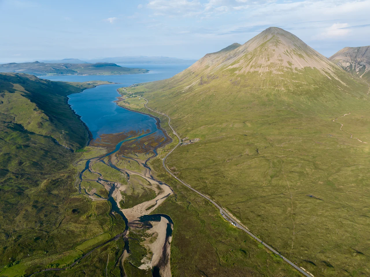

Glamaig
In 1899 a Gurkha named Harkbir Thapa walked into the bar of the Sligachan Inn, set down his drink, ran out the door, climbed Glamaig in thirty-seven minutes, ran back down, and returned to the bar. Total round trip, sea level to summit and back to where he started: fifty-five minutes. He did it barefoot. His record stood for almost a century. Olympic athletes including Chris Brasher attempted it in the 1950s and failed. The mountain that defeated them is 775 metres of red granite scree rising in an almost perfect cone above the Sligachan road, and it remains one of the cruellest short climbs in Scotland.
Two Cuillins, Different Colours
Glamaig is the northernmost of the Red Hills - the eastern Cuillin, sometimes called the Red Cuillin to distinguish them from the gabbro-black ridge to the west. The colour difference is real and visible from anywhere along Glen Sligachan. The Black Cuillin are gabbro, a dark coarse-grained igneous rock that traps light; the Red Cuillin are granite, lighter in colour and faster-weathering, which is why they shed scree in shifting brick-red rivers off their flanks. Both ranges erupted from the same Tertiary volcanic complex around 60 million years ago. Glaciation then sharpened the gabbro into ridges and rounded the granite into domes, leaving two adjacent mountain landscapes that look entirely different. Glamaig is one of only two Corbetts on Skye - peaks between 762 and 914 metres with at least 152 metres of drop on all sides.
The Cockerel and Mary's Peak
The mountain has two summits along a whaleback ridge. The eastern top is An Coileach, the Cockerel, at 673 metres. The main summit is Sgurr Mhairi, Mary's Peak, at 775 metres. From Sligachan most people head straight up the scree at the base, aiming for the summit with all the directness and none of the kindness of a line of falling water. The gradient is unrelenting, the scree slips with every step, and there is no respite until the cockerel. A gentler ascent runs from Sconser on the eastern side - longer, but with a stretch of nearly level ridge once you reach An Coileach, before the gentler final climb to Mary's Peak. From the summit, on a clear day, the Black Cuillin to the southwest looks impossibly toothed, and the Isle of Raasay seems close enough to touch.
The Glamaig Hill Race
The hill race has run from Sligachan annually since the 1980s, retracing Thapa's original line - up the scree, around the summit, back down. The distance is only seven kilometres, but the 775 metres of ascent put it in Category A, the hardest classification on the Scottish hill running circuit. Times have improved with modern shoes and training, and Thapa's record has been broken; current bests sit around 44 minutes for men. But the Gurkha's run remains legendary - not just for its time but for what it represented: a small man stepping out of a bar, into the dusk, up and back, then into the bar again. He had no special equipment, no marked route, no anti-skid technique developed for scree. He just went.
Sligachan
The Sligachan Inn at the foot of Glamaig has been a landmark since at least 1830, when it served the new military road. It became a base for Victorian climbers attempting the Cuillin and remains one of the great mountaineering pubs. From the inn's beer garden the view runs straight up Glen Sligachan toward the Black Cuillin: the gentle approach is deceptive, ending in some of the most serious mountaineering terrain in Britain. Glamaig sits at your back, the easier choice, a Corbett that punishes you for thinking it. From summit to inn the descent runs barely an hour for those willing to ride the scree. From summit to inn in fifty-five minutes round trip remains the standard Thapa set, barefoot, on a bet, with a pint waiting.
From the Air
Glamaig sits at 57.29 N, 6.13 W just east of Sligachan, summit 775 m. Recommended viewing altitude 3,000-4,500 ft AGL. The mountain's distinctive cone shape from the south and west is the easiest visual ID. The Black Cuillin ridge lies immediately southwest; the Red Hills (Glamaig's range) form a more rounded group running south to Beinn na Caillich. Nearest airports: Inverness (EGPE) ~80 nm east, Oban (EGEO) ~55 nm south. The Sligachan area is a notorious convergence zone for orographic weather coming off both Cuillin ranges; expect rapid cloud changes and significant rotor in westerlies.
Nearby Stories
- Bernera Barracks 0.3 km away
- Storr Lochs Hydro-Electric Scheme 1.9 km away
- Eigg 6 km away
- Torridon 10 km away
- Glenfinnan Railway Station 14 km away
- German submarine U-722 16 km away
- Lochmaddy 32 km away
- SS Seniority 46 km away