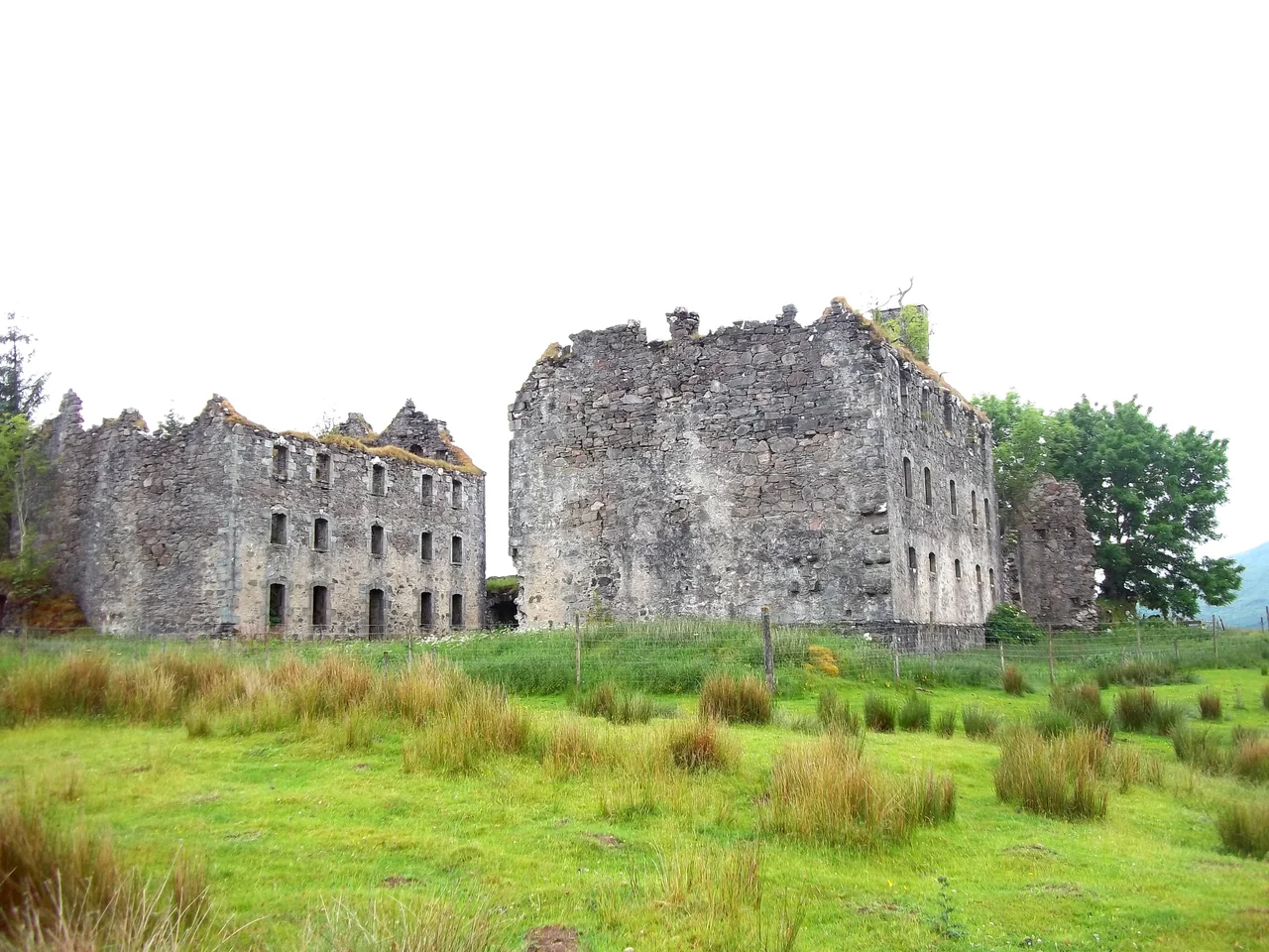

Bernera Barracks
The walls still stand square against the prevailing weather, two storeys of dressed stone with empty windows watching the Sound of Sleat. London built Bernera Barracks to hold a country it could not understand, garrisoning soldiers from Yorkshire and Surrey at the edge of a Gaelic-speaking world that often did not even acknowledge their authority. The garrison left in 1797 and the roofs fell in soon after. Two centuries on, the masonry endures the way Highland masonry tends to - slowly, stubbornly, and on its own terms.
Four Forts For A Restless Country
After the Jacobite rising of 1715 collapsed, the British government chose four sites in the Highlands to plant permanent military barracks: Ruthven near Kingussie, Kiliwhimin (later renamed Fort Augustus), Inversnaid on Loch Lomond, and Bernera at Glenelg. Ruthven's ruins and the name Fort Augustus still appear on modern maps. Glenelg's barracks went up between 1717 and 1723 under designs attributed to Andrews Jelfe and John Lambertus Romer of the Board of Ordnance, possibly building on earlier sketches by James Smith. Sir Patrick Strachan oversaw the actual construction. The strategic logic was simple: troops here could watch the Kyle Rhea narrows, where the Isle of Skye comes within half a kilometre of the mainland, and they could march to suppress any rising in the surrounding glens before it spread. The garrison was meant as a permanent reminder that London now reached this far.
Roads To Nowhere Friendly
Forts on their own are not enough; they need roads. In 1755 Major William Caulfeild engineered a military road from Fort Augustus to Bernera, a serpentine route climbing through Inchnacardoch Forest to over 1,280 feet before dropping into Glen Moriston, crossing the River Moriston near where the River Doe joins, then running north of the present A87 above Loch Cluanie. From there it descended the spine of Glen Shiel to Ratagan and crossed the Bealach Ratagain - the Ratagan Pass - before sliding down Glen More to the barracks gate. Thomas Telford's commissioners remade much of it in the 1820s. Walk parts of the route today and you can still trace the deliberate cambered roadbed, the engineered drainage, the way the surveyors chose contour over straight line. Soldiers marched it in red coats. Their officers complained constantly about the weather.
Useful For Eighty Years, Abandoned For Two Hundred
The garrison never had to repel a Jacobite assault on its own walls; the troops were used instead for patrols, escorts, and the slow grinding work of imposing London's writ on a clan society. After the final Jacobite defeat at Culloden in 1746 and the punitive legislation that followed - the proscription of tartan, the disarming of the clans, the breaking of heritable jurisdictions - the strategic case for Bernera began to fade. By 1797 the army had withdrawn entirely. The barracks were abandoned to the weather almost immediately, and the broch of Dun Telve a few miles away had already been robbed of stone in 1722, almost certainly to help build the barracks themselves - an Iron Age tower mined to build a Hanoverian one.
What Remains Above The Sound
What stands today is a quadrangle of high stone walls with empty window openings, set on a slight rise above the village of Glenelg with the Sound of Sleat glittering beyond. The roof is gone. The interior is filled with grass and nettles. Ravens nest in the gables. Sheep graze the surrounding pasture. The barracks are a scheduled monument but not a managed visitor attraction - no ticket booth, no path, no interpretation boards. Visitors who find their way here usually come for the brochs in Glen Beag and discover Bernera by accident. The ruin has the particular dignity of a building that was built to last, served its purpose imperfectly, and was then walked away from. The view across to Skye has not changed since the first sentry stood on these walls in 1723.
From the Air
Located at 57.2162 N, 5.6200 W on the West Highland coast of Scotland, immediately west of the village of Glenelg (Kirkton). The barracks appear as a rectangular roofless stone enclosure on rising ground above the Sound of Sleat, with the Isle of Skye filling the western horizon across the narrow Kyle Rhea strait. The ruin is small but distinctive against surrounding pasture. Nearest landmarks: Glenelg village to the east, the Glenelg-Kylerhea ferry slipway to the west, the brochs of Dun Telve and Dun Troddan a few kilometres south in Glen Beag. Nearest aerodrome: Inverness (EGPE) approximately 100 km east-northeast; small strip at Plockton/Skye Bridge area to the north. Terrain rises sharply inland to the Five Sisters of Kintail; sea-level approach from the west is unobstructed but tidal currents in Kyle Rhea generate notable cloud and turbulence in westerly weather. Best viewed in late afternoon light when the western face of the ruin lights up against the dark mass of Skye behind.
Nearby Stories
- High Pasture Cave 2.5 km away
- South Rona 6 km away
- Battle of Mulroy 7.5 km away
- Glenmoriston 8.2 km away
- Torridon 8.5 km away
- Glenfinnan Viaduct 8.6 km away
- Eigg 13 km away
- Conon Hydro Scheme 21 km away