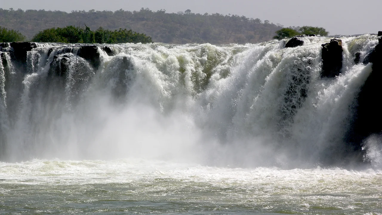

Gouina Falls
In the dry season you could almost walk it. The Sénégal River creeps over the ledge at barely a dozen cubic meters a second, and the rock shows through like the bones of the place. Then the rains come. By the height of the wet season the same falls carry more than two thousand four hundred cubic meters every second, a roaring wall of brown water five hundred meters across plunging sixteen meters into the gorge below. Locals call Gouina the Niagara of Mali, and for a few months each year the comparison earns itself.
Where the River Turns North
Gouina sits on the upper Sénégal in the Kayes Region of western Mali, downstream of the town of Bafoulabé and upstream of Diamou. Just before the falls, the river squeezes through the Talari Gorges and bends to run north toward the dry country and, eventually, the Atlantic. The setting is Sahelian: hot, broad-skied, the savanna brittle and golden through the long dry months. The falls are the kind of landmark that organizes a whole landscape. For centuries this stretch of the Sénégal was a route for trade and travel into the interior, and the broad white break of Gouina was both a marker and a barrier on the way.
A River of Two Seasons
Few waterfalls change as dramatically through the year as Gouina. The flow can swing from twelve or thirteen cubic meters per second in the dry months to roughly twenty-four hundred at the peak of the rains, a difference of nearly two hundredfold. In the dry season the cataract breaks into channels among exposed black rock, almost gentle. After the summer rains feed the Bafing and Bakoy headwaters far upstream in the highlands of Guinea, the river swells and the whole five-hundred-meter span goes white. Mist hangs over the gorge. The sound carries. It is the same river, the same ledge, transformed by the calendar.
Taming the Thunder
A waterfall this powerful was always going to attract engineers. Mali and the Senegal River Basin Development Authority spent decades studying the river's potential, and in December 2013 construction began on the 140-megawatt Gouina Hydroelectric Plant. It joined a chain of works on the Sénégal: the older Félou plant just downstream, first built in 1927 and rebuilt in 2014, and the great Manantali Dam far upstream. Gouina was inaugurated in December 2022 by Mali's prime minister, Abdoulaye Maïga, at a cost of 283 billion CFA francs, roughly 424 million euros. The dam draws power from the same drop that gives the falls their thunder, turning a seasonal spectacle into year-round electricity for a region that has long lacked it.
The Spectacle and the Trade-Off
There is a quiet tension at Gouina now, the kind that follows every dam. The falls that gave the place its name and its nickname share their ledge with the machinery that harnesses them. For the towns of the Kayes Region, the electricity matters: reliable power is scarce in this part of West Africa, and the Sénégal is one of its great untapped resources. For the traveler who has come a long way to stand at the edge of the gorge, the draw is still the water itself, the wide brown river going suddenly white, the mist rising off the rocks, the sound that fills the valley when the rains have done their work.
From the Air
Gouina Falls lies at 14.015°N, 11.103°W on the Sénégal River in the Kayes Region of western Mali, between Bafoulabé (upstream) and Diamou (downstream). The river is about 500 m wide here and the white break of the falls is a strong visual reference, especially in the wet season; the Talari Gorges lie just upstream where the river bends north. Nearest major airport is Kayes (GAKY) to the northwest. Best viewed from low to moderate altitude; clear, dry-season skies give the longest visibility, but the falls are most dramatic during the June-October rains.
Nearby Stories
- Koniakary Tata 43 km away
- Manantali Dam 59 km away
- Nioro du Sahel 150 km away
- Boucle du Baoulé National Park 180 km away
- Niagassola 263 km away
- Fugumba 321 km away
- Battle of Porédaka 364 km away
- Brakna region 400 km away